
Several news sources featured in the Daily Digest may limit the number of articles you can access without a subscription. However, gift articles and open-access links are provided when available. For more open access California water news articles, explore the main page at MavensNotebook.com.
On the calendar today …
- MEETING: California Water Plan 2028 – Advisory Committee Meeting 3 from 8:30am to 12:30pm. Agenda items include Regulatory Levers and Opportunities for Senate Bill 72 Strategies – Presentation and Facilitated Discussion, and breakout group discussions on insights and goals. Click here for the agenda. November 5 livestream: https://youtube.com/live/FlYw5BrRj6A?feature=share
- OPEN HOUSE: Final Just Transitions in the Delta from 11am to 3pm at the Jean Harvie Community Center in Walnut Grove. At the open house, the six future scenarios that we have crafted, modeled, and evaluated with ongoing engagement from Delta communities, advocates, and experts will be presented. Take part in reviewing and ranking these future scenarios to help define a more resilient future Delta that is grounded in the values and concerns of local public input. A community workshop will be held today from 10am to 4pm. For more information on the project, click here.
- FLYWAY SPEAKER NIGHTS: California: A Salmon Society? from 7pm to 8:30pm. This talk will focus on this history of salmon and people in Northern California, how that changed following European settlement and what we are doing now through science, management and outreach to help salmon populations recover and reconnect communities with their local ecosystems. Dr. Carson Jeffres is a senior researcher and field and lab director at the UC Davis Center for Watershed Sciences. A fish biologist and watershed scientist, he studies how native fish—particularly California salmon—use and benefit from healthy and restored habitats. Click here to register.
State Water Board approves water right permit for Sites Reservoir …
California’s largest reservoir in 50 years gets final approval, could break ground in June
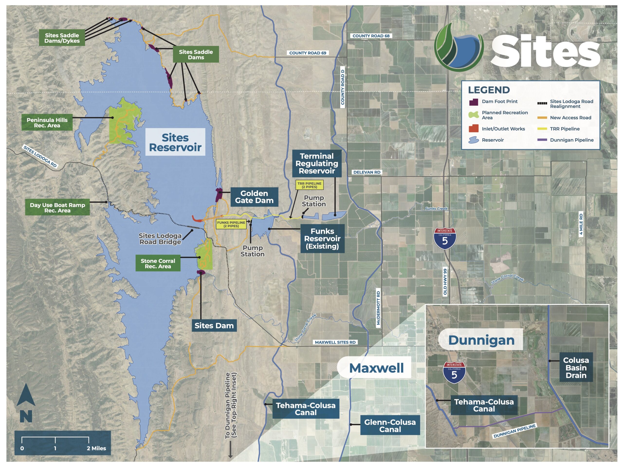
“Construction of California’s largest reservoir in half a century could begin next summer after state water regulators gave the venture the go-ahead Wednesday, a rare breakthrough for big water infrastructure. Supporters of the $6 billion Sites Reservoir, who include Gov. Gavin Newsom, have been pushing the proposal for years — some for decades — saying the water storage project 70 miles northwest of Sacramento will help the state weather chronic droughts. The reservoir would provide water for cities and farms across California, including many in the Bay Area. One of the biggest hurdles for the effort has been winning a water right, which authorizes water for the project, in this case from the Sacramento River. The problem is that most of California’s water is spoken for, and environmentalists and tribes have long protested diverting more river flows from already strained watersheds. Salmon are among the myriad wildlife struggling on the heavily used Sacramento. … ” Read more from the San Francisco Chronicle.
Amid controversy, California greenlights the state’s first large reservoir in decades
“California water regulators have approved a permit for Sites Reservoir, clearing the way for construction of the state’s first new major reservoir in decades. Plans call for two large dams about 300 feet high, as well as nine smaller ones, holding water pumped from the Sacramento River and inundating about 15,000 acres in a valley northwest of Sacramento. After a heated debate, the State Water Resources Control Board voted unanimously late Wednesday to approve the water right permit for the reservoir near the community of Maxwell. “We’re living with more extreme droughts and floods, and a growing need to store water during wet periods. Sites is built for exactly that,” Board Chair E. Joaquin Esquivel said. State officials and managers of water agencies said the $7 billion reservoir will be a critical part of California’s efforts to adapt to climate change. … ” Read more from the LA Times. | Read via Yahoo News.
California water board approves permit for Sites Reservoir project
“California’s water board on Wednesday granted a permit to the Sites Reservoir project, a 1.5 million acre-foot lake intended as an answer to the problems of a changing climate and the state’s evolving water needs. The decision by the State Water Resources Control Board was a crucial step to make the long-simmering project a reality. Officials said the reservoir in Colusa County would allow diversions of up to 986,000 acre-feet of water annually, or enough for 8.4 million people a year. The board voted unanimously to approve the permit and an accompanying decision. “This is a pretty monumental decision here,” vice chair Dorene D’Adamo said, adding: “This has been a lengthy and complex process.” Cost estimates call for billions of dollars to construct the project, with an expected operational date in 2035. … ” Read more from the Courthouse News Service.
State Water Board approves water right for Sites Reservoir
“As California responds to a changing climate, more extreme droughts and floods, and a growing need to store water during wet periods, the State Water Resources Control Board today approved a water right for a new reservoir that incorporates critical environmental safeguards to protect the state’s largest river. The Sites Reservoir Project, located about 65 miles northwest of Sacramento, is an off-stream storage project that would divert water from the Sacramento River during relatively high flows and store it for farms, cities and the environment. Sites will use new and existing infrastructure to transfer water from the river near Red Bluff and Hamilton City to a new reservoir 10 miles west of the town of Maxwell. The water right permit for the reservoir, which would be the largest surface water storage infrastructure built in California in more than 50 years, allows diversions of up to 986,000 acre-feet per year, or enough to supply about 8.4 million people annually. Today’s approval only covers diversions from the Sacramento River. Whether the project may also capture water from Funks and Stone Corral creeks, two local streams at the reservoir site, will be decided in a separate hearing that begins in January 2027. … ” Read more from the State Water Board.
STATEMENTS:
- GOVERNOR NEWSOM: California expands water storage infrastructure, largest new reservoir in more than 50 years clears final permit
- FRIENDS OF THE RIVER, et al: State Approves Controversial Sites Reservoir, Ignoring Harm to Environment and Tribes
- METROPOLITAN WATER DISTRICT: Statement on State Water Board approval of water right for Sites Reservoir
- NORTHERN CA WATER ASSOCIATION: State Water Board Approves Water Right for Sites Reservoir
In other California water news today …
The first atmospheric river of Super El Niño is coming. Here’s when it could hit
“The weather is dry for the moment, but signs across the atmosphere are painting a clear picture for when the first atmospheric river will bring rain to California. As El Niño begins to lock into the atmosphere, it will continue to set up patterns like the one we will see next week, with lower pressure just offshore and a lingering dome of high pressure across the central United States. Patterns like this that hold in place for a week or more are exceptional at squeezing out oceanic moisture in the form of atmospheric rivers – strings of the jet stream that become saturated with relentless rain. And the first of the season for Central California is taking shape for next week. … ” Read more from the Sacramento Bee.
Coastal and inland cities alike are gearing up for a historic El Niño
“In early September, Hurricane Marie battered Dana Point, along the Orange County coast. Twelve-foot-high waves breached the bluffs along the coast, damaging or destroying over a dozen homes. One of those homes was Natalie Driessen’s. As the hurricane approached, her family and friends desperately tried to reinforce the seawall with sandbags. “My entire seawall and the backyard were destroyed, and all the sand up to three feet from the house’s foundation swept away,” she says. “My foundation is still intact, but not all my neighbors were as lucky.” Hurricane Marie may be the harbinger of what’s to come, as forecasters warn that this could be one of the most severe El Niño years in recorded history. The global climate phenomenon warms the surface waters of the tropical Pacific Ocean and changes atmospheric circulation, affecting weather around the world. While the frequency of El Niño years is not necessarily increasing due to climate change, their severity is. For most or all of California, this will likely result in an unusually wet winter. … ” Read more from Western City.
How the brewing Super El Niño will benefit various regions across the country
“While the El Niño climate pattern is expected to bring more dangerous storms across parts of the West and the South this winter, it could provide important relief to regions experiencing significant to historic levels of drought. El Niño is expected to have a large influence on this winter across the U.S., with more storms expected from Southern California across the entire Southern Tier to Florida, according to NOAA’s latest seasonal forecast. NOAA expects to declare Super El Niño conditions later this year, with an 83% chance of becoming the strongest El Niño since record-keeping began in 1950. During a Super El Niño, the Pacific jet stream tends to become more extended and active, acting as a conveyor belt that directs storms farther across the southern tier of the U.S., the FOX Forecast Center said. … ” Read more from Fox Weather.
Can increased water storage reduce water price variability in California?
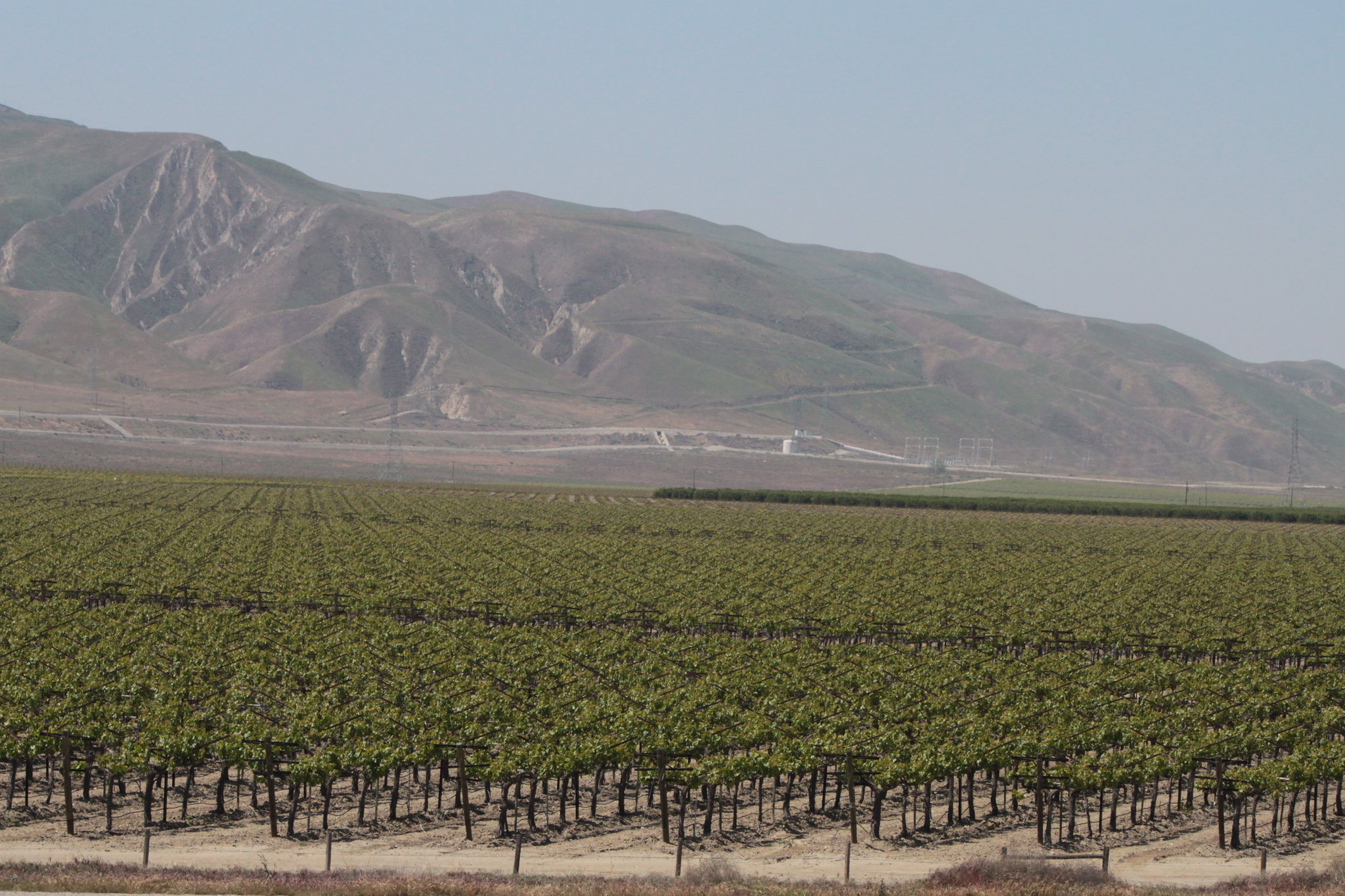 “California’s agricultural surface water prices exhibit extreme volatility over time because current water allocation systems and seasonal precipitation gaps create severe supply challenges, and this problem is only expected to get worse. This paper examines the potential for increased water storage to buffer these price spikes by carrying over excess wet-year water to mitigate dry-year scarcity. Our counterfactual analysis demonstrates that maintaining full reservoirs dramatically lowers price volatility. While expanding surface reservoirs is highly capital-intensive, utilizing excess floodwater for groundwater aquifer recharge offers a viable, cost-effective alternative to stabilize prices.” Read more from the Giannini Foundation of Agricultural Economics.
Roger Isom warns California agriculture faces growing challenges after election
“On today’s episode of the AgNet News Hour, Roger Isom, president and CEO of the Western Tree Nut Association and California Cotton Ginners and Growers Association, joined Nick Papagni for Part 1 of a two-part conversation about California’s agricultural future following the election. Isom discussed uncertainty surrounding the state’s incoming administration, declining pistachio production, international trade challenges and growing concerns over water infrastructure and agricultural regulations. With Xavier Becerra projected to become California’s next governor, Isom expressed concern about what the change in leadership could mean for farmers. He emphasized that the agricultural industry has received few indications of Becerra’s policy priorities, particularly regarding appointments to agencies overseeing water, air quality, workplace safety and pesticide regulations. … ” Read more from AgNet West.
Wildfires increased Feather River water flow
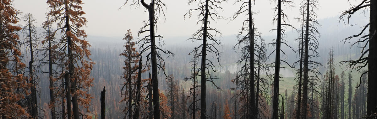 “A new study led by U.S. Geological Survey scientists estimates that the 2020 and 2021 wildfires in northern California increased the amount of water moving through the upper Feather River watershed. With fewer plants using water after the fires, more water stayed in the soil or flowed into streams. The watershed feeds Lake Oroville, which helps supply water to more than 27 million people. The fires that burned parts of Northern California in 2020 and 2021 took lives, destroyed buildings, and hurt air and water quality. A new study led by scientists at the U.S. Geological Survey California Water Science Center looks at another effect of these fires: how they changed the amount of water moving through the upper Feather River watershed. This watershed drains into Lake Oroville, a key part of the State Water Project. The North Complex, Dixie, and Sugar Fires burned more than half of it. Trees and other plants pull water from the soil and release it into the air. After the fires, there were fewer plants using water, so more water stayed in the soil or flowed into streams. The scientists measured this change by running a computer model with and without the fires’ effects on plants. … ” Read more from the USGS.
California ocean water levels break records
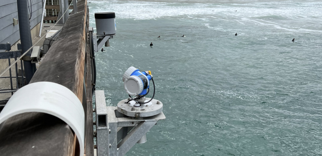
“Last week, communities along the California coast felt the effects of this year’s strong El Niño, as high water levels inundated the state’s low-lying areas. NOAA tide gauges throughout the state captured these water levels with some locations seeing their highest readings ever, with observations that date back more than 100 years. From October 24 to 30, 2026, locations on the California coast experienced heightened water levels — which are measured above Mean Higher High Water (MHHW), the average of the highest tides for that location. … These record water levels are the result of several factors coming together to impact California’s coast. The first factor is higher-than-normal astronomical tides caused by changes in the gravitational pull of the moon and sun on the ocean depending on their position relative to the Earth. A perigean spring tide occurred, when the moon was full and closest to the Earth. Pushing water levels even higher is the effect of El Niño-driven Kelvin waves. These slow-moving, large-scale, oceanic waves bring pulses of warm water eastward towards the Pacific Coast of the Americas, temporarily raising the sea level by 6-12 inches or more over several weeks as they propagate up the U.S. West Coast. … ” Continue reading from NOAA.
In regional water news and commentary today …
NORTH COAST
State grants would return 672 acres in Branscomb to the Cahto Tribe
“The creek called Dutch Charlie on federal maps has another name, Shaahnaa’ Lhook’. It means “creek with salmon.” The state now plans to help return the bottom of that creek to the Cahto Tribe. The State Coastal Conservancy filed a notice with the state Oct. 23 for what it calls the Shaahnaa’ Lhook’ Acquisition, 672 acres at 39850 Wilderness Lodge Road in Branscomb. The property sits where the creek runs into the South Fork Eel River. The Conservancy board approved a grant for the deal April 23. Under it, Trust for Public Land, a national nonprofit, would buy the land. It would then turn the land over to the Cahto Tribe of Laytonville Rancheria, according to the Conservancy’s staff report. The tribe would manage it “in perpetuity as a Cahto Tribal Protected Area,” the report says. … ” Read more from the Mendocino Voice.
SACRAMENTO VALLEY
Bringing the salmon story home to Roseville
“For many people in Northern California, salmon are associated with the Sacramento and American rivers, or perhaps the larger rivers and streams of the Sierra Nevada and North Coast. But Chinook salmon also make an extraordinary journey into the smaller creeks flowing through the communities of Placer and Sacramento counties. Each fall and winter, Chinook salmon returning from the Pacific Ocean travel more than 100 miles through the Sacramento River and American River systems before reaching the Dry Creek watershed. Their journey takes them through an increasingly urbanized landscape and into creeks that run through Roseville, Rocklin, Loomis, Antelope and Rio Linda. It is a remarkable example of the connection between communities and the watersheds that surround them. Now, that story has a new home in downtown Roseville. … ” Read more from the Northern California Water Association.
NAPA/SONOMA
Russian River communities learn from past El Niño disasters as they prepare for this winter
“Residents and officials in parts of Sonoma County are preparing for another potentially wet winter, drawing on lessons learned from past disasters as forecasts call for a strong El Niño season. In Rio Nido, reminders of one of the area’s worst weather-related disasters remain visible decades later. Warning signs and barriers still mark a hillside that collapsed during intense storms in February 1998 after heavy rainfall saturated the ground. “There are still houses that are underground up there, complete homes, probably still full of furniture and everything,” said Rio Nido resident Terry Aldrich. … ” Read more from ABC Bay Area.
BAY AREA
Rainy day in Bay Area could be preview for atmospheric river
‘A low-pressure system is bringing wet weather and the potential for thunderstorms to the Bay Area on Tuesday. On-and-off showers are expected to drop the most rain in the North Bay, with Sonoma and Marin counties expected to see half an inch and up to 0.75 inch in the coastal range. The rest of the Bay Area will get soaking rain: San Francisco, parts of the East Bay and South Bay will get up to a quarter of an inch on Tuesday, with the South Bay hills getting up to half an inch. Rachel Kennedy, a meteorologist with the National Weather Service, told SFGATE the storm door has opened, and the wet weather is arriving thanks to arctic air from the Gulf of Alaska. … ” Read more from SF Gate.
SAN JOAQUIN VALLEY
Valley flood protection still a hodgepodge, leaving bald spots and confusion
“When it comes to how prepared San Joaquin Valley communities are for potential El Niño-fueled flooding, it’s down to three things: location, location and location. In the Fresno area, for instance, the Fresno Metropolitan Flood Control District has a robust system that’s “ready to go,” according to Assistant General Manager Brent Sunamoto. The district funnels excess water through a series of storm drains and into sumps. As those systems fill, it can also move water through Fresno Irrigation District (FID) canals into FID recharge facilities. “When the basins fill up too high, we could go and flip a switch and turn a pump on and basins will pump that water into the FID canal,” Sunamoto said. … ” Read more from SJV Water.
SOUTHERN CALIFORNIA
Data center pitched for golf course at 1509 Workman Mill Rd. in City of Industry
“Struggling golf courses in the Los Angeles area have often given way to housing. Ramus Development, Inc. has different plans for the California Country Club property in the City of Industry. This week, Ramus announced plans for the LA Recreation and Technology Park (“LARTP”), which calls for reconfiguring 18 acres of the property at 1509 Workman Mill Road to incorporate a nine-hole golf course and a data center. The project will be subject to a full environmental impact report, per a statement from Ramus president Stephen Cho. Birtcher Development, LLC is leading the entitlement process for the project, which abuts the 605 Freeway corridor, and sits near the confluence of San Jose Creek and the San Gabriel River. … ” Read more from Urbanize LA.
Riverside departments preparing for ‘wet winter’ ahead of potentially historic El Niño
““The city is certainly doing everything we can on our end to make sure we are appropriately prepared for the El Niño season,” Deputy Public Works Director for Sewer Field Operations Kevin Street said in an interview with The Riverside Record. El Niño is a complex climate pattern that pushes warm water from the Pacific Ocean toward the Americas, causing disruptions to global weather conditions. Federal forecasters have said this year’s El Niño event could be historic, exceeding the strength of previous events. Daniel Swain, a climate scientist with the University of California Agriculture and Natural Resources, said in an interview with The Record that Riverside County would likely see a “very wet winter.” The region’s western metropolitan areas, he added, could see an increased likelihood of flooding as storms are predicted to roll into Southern California between November and March 2027. … ” Read more from the Riverside Record.
IMPERIAL/COACHELLA VALLEYS
California’s Pilot Knob hydropower plant secures $21m refurbishment
“Imperial Irrigation District (IID) has approved nearly US$21m to refurbish one of two generators at its Pilot Knob hydropower plant near Winterhaven, California, restoring capacity that has been unavailable for three years. The work at IID’s largest hydroelectric facility is expected to be completed in 2029. It forms part of the utility’s Powering Our Communities Together initiative, which includes plans to refurbish its 17 hydroelectric generators over the next seven years. “Pilot Knob has been part of IID’s public power system for nearly 70 years, and this investment is about making sure it remains part of our future,” said Karin Eugenio, Chairwoman of the IID Board of Directors. “By restoring equipment that has served generations of customers, we are protecting an important public asset, strengthening the reliability of our electric system and making responsible investments that will benefit our customers for decades to come.” … ” Read more from International Water and Power.
SAN DIEGO
Tijuana River sewage is impacting San Diego’s air quality
“Toxic waste dumped into the Tijuana River can travel up to 7 times farther than previously thought before evaporating into the atmosphere, significantly degrading air quality across a 20-mile radius in San Diego, according to a new study from UC Riverside. Published in Scientific Reports, the research details how this untreated sewage, which is a mix of household wastewater, industrial discharge, and urban runoff, enters the Pacific Ocean at Imperial Beach. These wastewater chemicals remain submerged in ocean currents long enough to drift northward along the San Diego coastline before venting into the atmosphere. This mechanism explains why pollution linked to the Tijuana River was found near the Scripps Institution of Oceanography pier in La Jolla, approximately 22 miles north of the river’s mouth. … ” Read more from San Diego Red.
Along the Colorado River …
Extreme flooding in the Southwest foreshadows a wild El Niño winter
 “The Southwest just got way too much of a good thing. Last weekend, a ferocious storm inundated communities and killed at least four people. Though precipitation is an essential component of Arizona’s desert climate, the state got two or three months’ worth of it in just a few days — far more than human infrastructure could handle all at once. Since September 20, an astonishing 28.84 inches of rain has fallen on Clovis, New Mexico, compared to its historical average of just 3.3 inches. “This weekend was just adding more on the rough times that those communities in Southwest Colorado and Arizona and Utah and New Mexico have been having recently,” said Russ Schumacher, director of the Colorado Climate Center at Colorado State University, who’s also the state climatologist. “I think the El Niño connection is pretty clear.” … ” Read more from Grist.
Recent rains were ‘a drop in the bucket’ for Colorado River reservoir water
“Heavy rains pounded Arizona and the Four Corners region in recent weeks, and the effects were nearly impossible to miss. Storms drenched places like Flagstaff, Winslow and Durango, Colorado, surging through rivers, across streets and into homes. Steady rain made for a soggy Halloween in the Phoenix area. Floods made it hard to reach the polls in some parts of Navajo Nation. For all of the ways those rains reshaped life in the Southwest recently, they barely made a dent in the region’s water supply crisis. “Don’t want to dim the news too much,” said Nolie Templeton, who monitors Colorado River reservoirs for the Central Arizona Project. “Very happy to have more water in the system, but it is quite literally a drop in the bucket, particularly when we’re looking at a 27 year — and counting — drought.” … ” Read more from KJZZ.
Arizona’s wet fall buys time for largest Colorado River reservoirs
“Arizona’s wet October and early November provided a nice boost for Lake Mead and Lake Powell – the two largest Colorado River reservoirs — but long-term drought conditions persist. The Lake Powell water level Tuesday was 3,533 feet, up 17 feet since it fell to its lowest level ever in mid-September. “It’s going to put off dead pool for a little bit, right? We were getting dangerously low to that issue with Lake Powell. So, this actually creates a little bit more margin,” Mike Crimmins, climate science extension specialist at the University of Arizona, told KTAR News 92.3 FM on Friday, before the state saw widespread weekend storms. … ” Read more from KTAR.
A complete ‘re-do’ of water management in the West?
“Colorado State University’s Brad Udall makes the case that the Colorado River Basin is the world’s first place where climate change is “forcing a complete re-do of water management.” The climate change component of that statement seems unassailable. Flows in the Colorado River have declined 21% this century. A river that averaged 15.2 million acre-feet in flows during the 20th century has fallen to 12.2 million acre-feet in the 21st. It has further tapered off to 10 million acre-feet in the last few years. Temperature increases of 3.3 degrees Fahrenheit since 1970 explain much of that decline. A one-degree Fahrenheit rise in temperature results in 5% loss due to increased evaporation. “Hot drought,” the phrase Udall favors, will only worsen, he says, as the process he and others call aridification will continue to worsen. Temperatures, said Udall at a recent forum, can continue to rise. “The latest science tells us that the rate of warming has almost doubled. And the fossil fuel industry is showing no signs of exit or no signs of transformation to some other business model that doesn’t involve polluting the Earth,” he said. … ” Read more from the Pagosa Daily Post.
Arizona floods damage five state fish hatcheries
“Heavy rain and flooding over the weekend of October 31 and November 1 damaged five state fish hatcheries across Arizona, leaving roads washed out, buildings flooded and several facilities closed to visitors. The worst damage occurred at Tonto Creek Hatchery, northeast of Payson, where rushing floodwaters struck a feed storage room and staff bunkhouse. Roads surrounding the hatchery were also washed out. According to a November 2 announcement from the Arizona Game and Fish Department, the area received more than two inches of rain over the weekend. Measurements from the United States Geological Survey showed that water levels on Tonto Creek near Roosevelt Lake climbed from four feet late Saturday night to 16 feet Sunday afternoon. … ” Read more from Western Water.
What we found after the Grand Canyon flood
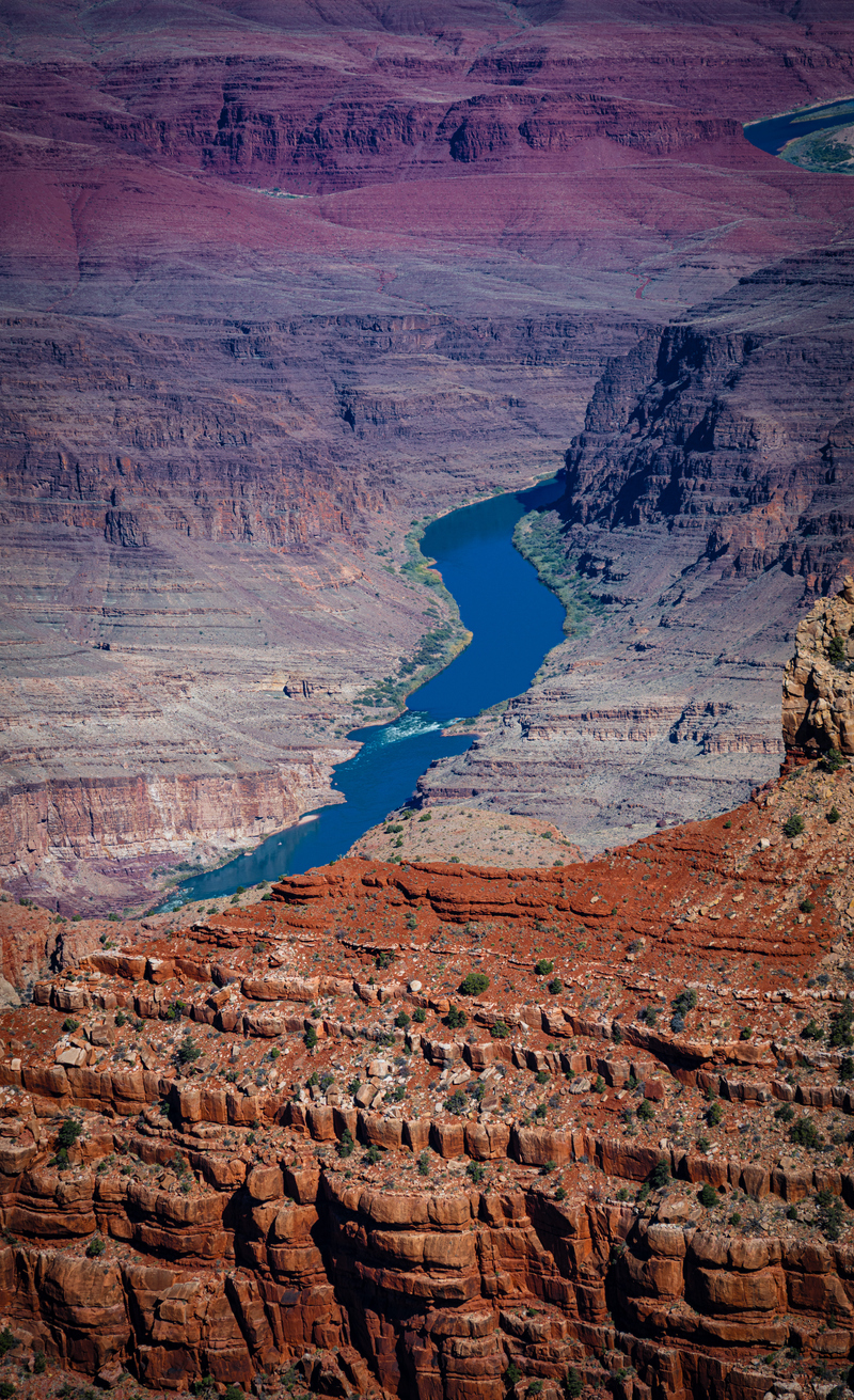
Caitlyn Burford writes, “The news broke on a Sunday morning that a catastrophic flash flood had torn through Grand Canyon National Park. As someone who works in media relations, it’s a big part of my job to make sure reporters have the information they need to cover what’s happening at our national parks and that NPCA can be a trusted source for those stories. A headline like this would have caused my phone to immediately ping. But I didn’t read the story in the news. I watched as it all played out from the bottom of the Grand Canyon. I was on vacation, my out-of-office email enthusiastically sharing that I was off-grid on a national park adventure. A friend had drawn a group permit to raft the Colorado River and row 226 river miles through the canyon over 16 days. Of the 4.4 million people who visit Grand Canyon National Park each year, only 20,000 see it from the river. I had some butterflies about the trip — the rapids, the heat, the distance from help and the many unknowns — but I knew it was a once-in-a-lifetime chance, and I wasn’t about to let my nerves get in the way. I’d spent 10 years living in Flagstaff, Arizona, hiking the canyon whenever I could, but had never seen it from the river. … ” Read more from the National Parks Conservation Association.
‘1-in-1,000-year’ extreme rainstorm: How southwest Colorado flooding compares to historic state floods
“Southwest Colorado is enduring a historic flood event after one of the most extreme rainstorms in the state’s recorded history. 9NEWS Weather Impact Team Meteorologist Chris Bianchi attributed the assessment to Colorado State climatologist Russ Schumacher, who labeled the storm “one of Colorado’s most extreme rainstorms on record,” a record spanning more than 100 years. Pagosa Springs has received nearly 15 inches of rain since Sept. 1 and Durango 13.5 inches, Bianchi said. Cortez has received 11.3 inches, Ouray 8.66 inches, and Alamosa has seen 5.82 inches since Sept. 1. The flooding is widespread rather than localized. Bianchi said the San Luis Valley and the eastern San Juan Mountains, two geographically distinct areas, are both affected. … ” Read more from Channel 9.