
Several news sources featured in the Daily Digest may limit the number of articles you can access without a subscription. However, gift articles and open-access links are provided when available. For more open access California water news articles, explore the main page at MavensNotebook.com.
On the calendar today …
- MEETING: State Water Resources Control Board beginning at 9am. The Board will consider the potential adoption of a Decision conditionally approving a water right permit for Sites Reservoir. Click here for the full agenda.
- EVENT: California Financing Coordinating Committee from 9am to 12pm. Connect with federal, state, and local agencies to discuss available bonds, grants, loans, and technical resources for local infrastructure projects. View the Fall 2026 CFCC Funding Fair Flyer. Register here.
- WEBINAR: Meeting California’s Water Challenge: Driving Conservation, Participation, and Public Trust from 10am to 11am. A webinar in partnership with Granicus. California water agencies are under pressure — from drought restrictions to rate scrutiny to rising expectations from the public. But most engagement still happens too late or reaches the wrong people. In this webinar, we will share our custom approach for California water agencies to reach more residents, understand what matters to them, and turn that insight into real participation and trust. We’ll cover how to expand your audience, learn from your community, deliver more relevant outreach, and continuously improve your results over time. Join us to see how leading agencies are driving conservation, reducing pushback, and building the kind of trust that lasts beyond a single campaign. Click here to register.
- OPEN HOUSE: Final Just Transitions in the Delta from 11am to 3pm at the Jean Harvie Community Center in Walnut Grove. At the open house, the six future scenarios that we have crafted, modeled, and evaluated with ongoing engagement from Delta communities, advocates, and experts will be presented. Take part in reviewing and ranking these future scenarios to help define a more resilient future Delta that is grounded in the values and concerns of local public input. A community workshop is scheduled for Thursday. Click here to RSVP to the Thursday workshop. For more information on the project, click here.
- LUNCH-MAR: Proof Positive: A Century of Managed Aquifer Recharge in Southern California from 12:30pm to 1:30pm. Presenter: Betsy Miller, San Bernardino Valley Water Conservation District. It’s not often that a community can look back across a century of managed recharge and quantify the value of those efforts. This talk shares how the San Bernardino Valley Water Conservation District drew on 112 years of continuous recharge data to isolate the basin-scale effects of its operations, offering a grounded point of reference for regions weighing MAR investments in their own basins. To join a Lunch-MAR Session, click here.
- MEETING: DPIIC Restoration Committee from 1pm to 3:30pm. Agenda items include 2026 Delta Restoration Forum Recap, Recommendations for Regulatory Improvements to Accelerating Restoration in the Sacramento-San Joaquin Delta and the Suisun Marsh, Satellite Observation of Flooding in the Yolo and Sutter Bypasses, and Existing, New, and Needed Restoration Funding for the Sacramento-San Joaquin Delta and Suisun Marsh. Click here for the full agenda and remote access instructions.
- MEETING: California Water Plan 2028 – Advisory Committee Meeting 3 from 1pm to 5pm in Visalia. Agenda items include CWP 2028 Planning, Technical Analysis, and Recommendations – How Does It All Connect? – Presentation and Facilitated Discussion, and breakout group discussions on insights and goals. Click here for the agenda. November 4 livestream: https://youtube.com/live/TU5IptPPFeI?feature=share
In California water news today …
Water Board promises Klamath/Trinity River water hearing after protests and testimony from Tribal communities at Bay Delta Plan hearing
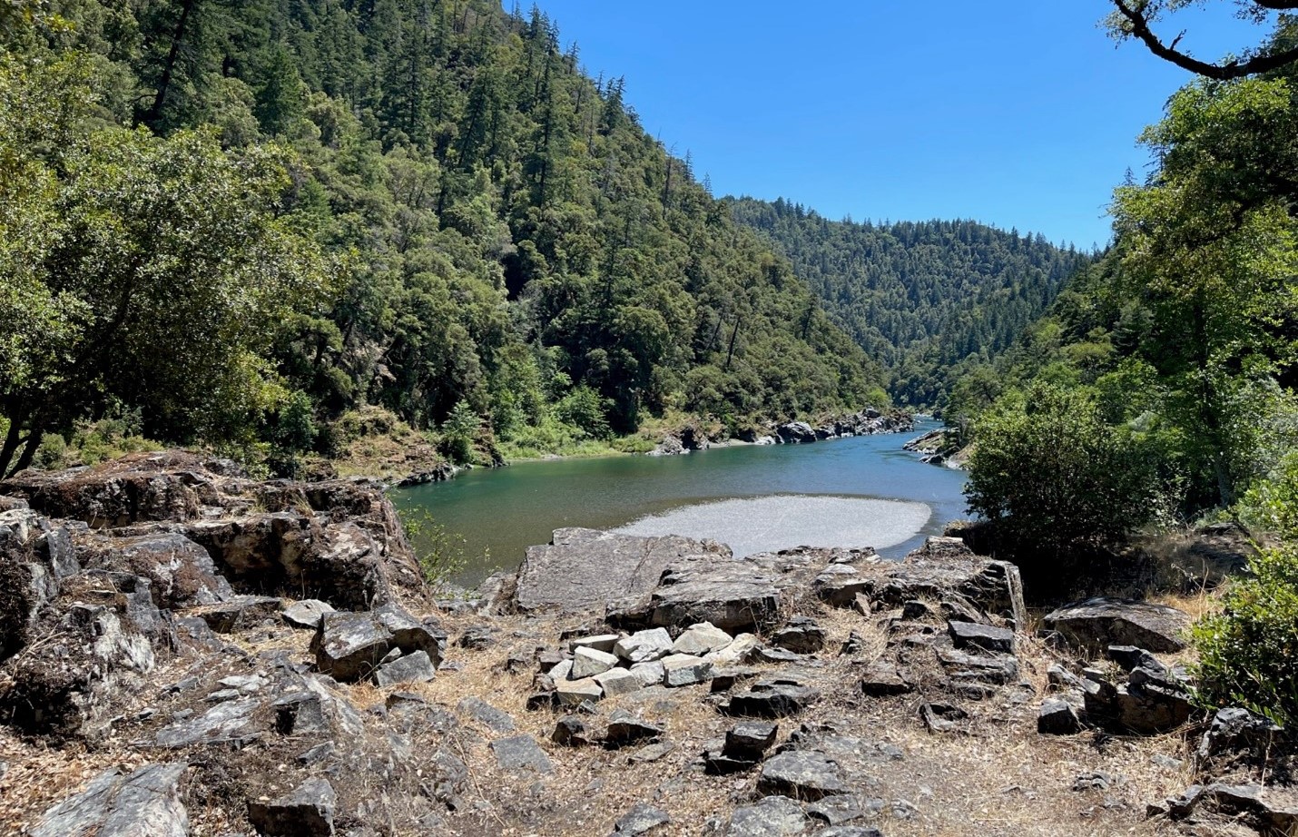
“After hours of debate during an October 29th hearing, the State Water Resources Control Board committed to public scoping hearings on Trinity River water quality and flow issues as part of its Bay Delta Plan Update. The decision followed a fierce debate among board members and testimony from dozens of tribal members who stated that the Bay-Delta process had failed to address potential major impacts on the Klamath-Trinity River system. Most of the Trinity River, the Klamath’s largest tributary, is diverted to the Bay-Delta for use by powerful agribusiness interests. Despite the fact that local tribes and rural communities depend on adequate Trinity flows for survival, the state has very few laws regulating excessive diversions. Commenters said new reservoirs and diversion projects threaten not just Trinity River releases, but also releases necessary for abating Klamath River fish kills. … ” Continue reading this press release.
SEE ALSO: Klamath tribes push California for Trinity River protections, from KDRV
El Niño could be a disaster for California — but maybe not for winegrowers
“When word of a historically powerful El Niño winter reached Gregg Hibbits in San Luis Obispo earlier this year, the longtime winegrower’s initial reaction was straightforward: “That’s great news.” Storms swept in by the recurring climate pattern are expected to drench California with rain from December through March. Although the rainy winter portends widespread flooding and power outages — prompting Gov. Gavin Newsom to declare a state of emergency last month — it’s a forecast that the state’s strained wine industry would typically celebrate. Heavy rains in winter, when grapevines are dormant, can replenish water sources, flush out soil and nourish vines’ deeply buried roots. “I mean, we’re trained to love rainfall,” Hibbits said. “If you grow up in the industry, you love all the things that rainfall brings.” … ” Read more from the San Francisco Chronicle. | Read via Yahoo News.
Developers eye golf courses for data center projects
“To counter the data center backlash that’s become an animating political force across the US, developers in California are suggesting an eco-friendly swap: Trade in a golf course — and its profligate water usage — for less-thirsty computer servers. In the City of Industry, a municipality in the suburban San Gabriel Valley region of Southern California, the owners of the 18-hole California Country Club have submitted plans to add a 99 megawatt data center to the 124-acre site. The project, called the Los Angeles Recreation and Technology Park (LARTP), would also include a large green space and a smaller nine-hole course. By leveraging the private links for compute, LA-based Ramus Development says the new tech redevelopment will reduce overall water usage on the site. … ” Read more from Bloomberg.
California faces an uncertain Colorado River future
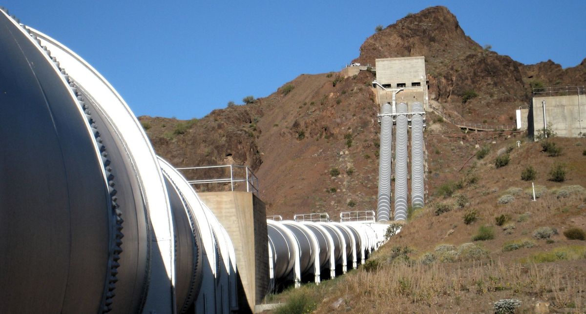
“The Colorado River may not be the first river Californians think of, but it is vital to Southern California’s water supply and farms in the state’s southeastern corner. At the California Water Commission’s October meeting, Jessica Neuwerth, executive director of the Colorado River Board of California, outlined the state’s stake in the river, the challenges facing its management, and the decisions that will shape California’s water future. Established by statute in 1937, the Colorado River Board of California is a small state agency charged with protecting California’s rights and interests in Colorado River resources. … A central responsibility of the Colorado River Board is representing California in interstate and federal discussions. The board chair serves as the governor’s representative in the Colorado River governance structure, which includes one representative from each basin state. The board and its chair coordinate California’s varied interests and priorities, then represent them in meetings and negotiations with other basin states and the federal government. The current chair is John B. Hamby of the Imperial Irrigation District. … ” Read the full article at Maven’s Notebook.
Dayna Ghirardelli discusses Sonoma County water challenges and the future of family farming
“On today’s episode of the AgNet News Hour, Dayna Ghirardelli, Executive Director of the Sonoma County Farm Bureau, joined Nick Papagni to discuss California’s ongoing water challenges, the struggling wine grape industry and growing concerns about the future of family farming. Ghirardelli also addressed agricultural regulations, emerging technology and the importance of strengthening public support for California agriculture. One of the biggest concerns facing Sonoma County farmers is the future of the Potter Valley Project, where Pacific Gas and Electric is pursuing the decommissioning of hydroelectric infrastructure. Ghirardelli explained that the Sonoma County Farm Bureau opposes removing dams at a time when California needs additional water storage. She emphasized the importance of maintaining water diversions into the Russian River, which support agricultural operations and surrounding communities. … ” Read more from AgNet West.
Desalination costs limit its potential for Western farm irrigation
“Ocean desalination could help expand water supplies for Western communities and industry, but the high cost makes it an unlikely solution for large-scale agricultural irrigation. California estimates put the cost of new seawater desalination at 3,400 to 3,700 dollars per acre-foot. That’s more than twice the roughly 1,444 dollars in average gross farm revenue generated per acre-foot of irrigation water applied. Even at 3,000 dollars per acre-foot, desalinated water could add thousands of dollars per acre in costs for crops such as lettuce, strawberries, and almonds. … ” Read more from KMJ Now.
Brood year 2026 Sacramento River winter-run salmon prognosis
Tom Cannon writes, “Conditions in the Central Valley and Bay-Delta have been tough this fall for brood year 2026 winter-run and fall-run Chinook salmon. Warm late-spring water temperatures and warm releases from Shasta Dam forced winter-run to spawn later in summer (Figure 1). That led to late emergence of fry in October into water with lethal water temperatures after Shasta’s cold-water pool was exhausted. High volume releases from Shasta Reservoir in summer 2026 led to an earlier depletion of Shasta’s cold-water pool than in 2020, a drier year (Figure 2). This further stressed the winter-run spawn. Late emergence of fry has not only reduced their numbers, but has also delayed their downstream movement toward the Bay-Delta compared to 2025. … ” Read more from the California Fisheries blog.
Even Sierra Nevada backcountry isn’t spared from microplastic pollution, finds skiing scientist
“When toxicologist Aleksandra Karapetrova was looking for a Ph.D. topic, she turned to a skill few lab researchers bring to environmental science: backcountry skiing. Knowing the sport could take her far beyond the well-trodden paths of previous atmospheric studies, she skied deep into the Sierra Nevada mountain range. I was able to go farther than most,” said Karapetrova, a toxicologist affiliated with the University of California, Riverside, currently working at California’s Office of Environmental Health Hazard Assessment. Karapetrova and colleagues set out to measure how much microplastic pollution falls on the Sierra Nevada during snowstorms. Sampling fresh snowfall, snow pit layers, and dry air fallout across seven locations in the Sierra Nevada in California, they detected microplastics in fresh snow at all locations, including the most isolated backcountry wilderness areas, according to the findings published in Environmental Science and Technology. … ” Read more from The New Lede.
Celebrating 50 years of the State Coastal Conservancy
“You can’t travel more than 30 minutes in any direction in the San Francisco Bay Area without seeing the impact of the California State Coastal Conservancy, if you know where to look. Take a weekend drive past the Sonoma Baylands or Suisun Marsh, through San Geronimo Valley or Coyote Valley, over a wildlife crossing on Highway 17, and around Fitch Mountain or Mount Diablo. Look out the airplane’s window as your flight descends into the Oakland airport or SFO and you’ll see the South Bay Salt Pond Restoration Project. Take your kids on a bike ride anywhere on the 350 miles of the San Francisco Bay Trail. Slip into a kayak and launch from one of 47 Bay Area Water Trail trailheads. Go for a walk, ride a bike, or ride a horse on the 400 miles of the Bay Area Ridge Trail. … ” Read more from Bay Nature.
California’s plastic law will cut far less single-use plastic than expected
“CalRecycle has picked the number that decides how much plastic California has to cut under the state’s 2022 landmark plastic law, and it is low. It’s just one-third of what the state estimated in a 2024 report, and 20% lower than an initial number the industry announced in June. The benchmark number, known as the source reduction baseline, is supposed to reflect how much single-use plastic was produced, distributed and sold in the state during 2023. Future reduction targets under the state’s single-use plastic law, or Senate Bill 54, are based on it. By 2032, plastic producers and distributors are required to cut the amount of single-use plastic sold in the state by 25%. In 2024, the state estimated that Californians were sold 2.9 million tons of single-use plastic. Yet on Monday, CalRecycle adopted the industry’s latest number, 1.03 million tons — 20% lower than its June estimate of 1.29 million tons, and a third of the state’s estimate. … ” Read more from the LA Times. | Read via Yahoo News.
Environmentalists successfully block California’s first carbon capture project

“A Superior Court judge ruled Tuesday that Kern County’s approval of California’s first carbon capture and storage project violated the state’s bedrock environmental law, the California Environmental Quality Act. The ruling is a win for local environmental justice and conservation groups, including the Sierra Club and the Center for Biological Diversity, who argued the county had left “multiple environmental, public health and safety issues” unaddressed when it approved the landmark project. “For years, Kern County residents have raised serious concerns about increased pollution and the safety of millions of tons of CO2 stored beneath their community,” Ileana Navarro of the Central California Environmental Justice Network said in a written statement. “We are so grateful that the court recognized what Kern County failed to see and gave community concerns the serious consideration they deserve.” … ” Read more from the Courthouse News Service.
In regional water news and commentary today …
NORTH COAST
Fort Bragg’s old Mill Pond dam heads into a possibly record El Niño
“Mendocino Railway owes the state its answers on how to clean up Fort Bragg’s Mill Pond by Tuesday, Nov. 17. One week later, the first of this winter’s king tides reaches Soldier Bay, at the foot of the pond’s old dam. Forecasters expect a strong El Niño. The ocean off the coast is already running high. And the state Department of Toxic Substances Control has sent the railway’s cleanup study back, asking, among other things, how the dam and the beach in front of it will hold up. On the map, it’s called Pond 8. In town it’s the Mill Pond. It covers about 7.3 acres and holds about 106,000 cubic yards of sediment contaminated with dioxins, according to a 2019 cleanup study. The highest reading was 243 parts per trillion, measured as toxic equivalents. The state’s draft cleanup goal is 53 parts per trillion. Holding it back is a dam with a crib wall of old redwood timbers facing the sea. … ” Read more from the Mendocino Voice.
SIERRA NEVADA
Mount Rose announces Friday opening, the first among Tahoe’s ski resorts
“Ski season is officially here. Mount Rose Ski Tahoe plans to open on Friday, which would make it the first ski resort on the West Coast to open for the season. The ski resort reported 8 to 10 inches of snow over the weekend, on top of a base already primed by snowmaking. In the Eastern Sierra, Mammoth Mountain isn’t far behind. After the weekend storm cleared out, the ski resort reported that it received 9 to 15 inches of snow on Nov. 1. Mammoth’s opening day is scheduled for Nov. 13. … ” Read more SF Gate.
Tahoe Conservancy to host public meetings on Marsh South Restoration Project
“The California Tahoe Conservancy (Conservancy) invites community members to the next round of public meetings on the Marsh South Restoration Project on November 18 and 19, 2026. At the two meetings, the Conservancy will engage the public about the proposed restoration project in the southern part of méšuk málɨm, formerly known as the Upper Truckee Marsh, in South Lake Tahoe. Proposed project elements include significant river and wetland restoration downstream of U.S. Highway 50, including the site of the former Motel 6. To facilitate the restoration, the Conservancy also proposes to modify the South Tahoe Bikeway and river access. méšuk málɨm is the name the Washoe Tribe of Nevada and California uses for the area around the confluence of the Upper Truckee River and Trout Creek, and which applies to the 600-acre marsh where the Upper Truckee River meets Lake Tahoe. … ” Read more from the Tahoe Daily Tribune.
Proposed $4.1M settlement targets PCE groundwater plume in South Lake Tahoe
“The Lahontan Regional Water Quality Control Board has proposed a $4.1 million settlement with the former and current owners of a South Lake Tahoe, California, property to address tetrachloroethylene (PCE) contamination affecting municipal drinking water supplies. The proposed agreement would require Seven Springs Limited Partnership and Fox Capital Management Corporation to fund treatment, monitoring and other improvements for Lukins Brothers Water Company and Tahoe Keys Water Company. The settlement is intended to protect drinking water supplies affected by a groundwater plume originating from dry-cleaning activities at the property between 1972 and 1979. The PCE plume extends from the junction of State Route 89 and U.S. Route 50 toward the Tahoe Keys and has contaminated wells used by the two water providers. Some affected wells have been treated while others have been closed to protect drinking water supplies. … ” Read more from Water World.
BAY AREA
Bay Area gets another coastal flood advisory as tides run unusually high
“A coastal flood advisory is in effect along San Francisco Bay from 6 a.m. Wednesday until 1 p.m. Monday as El Niño-warmed coastal waters push tides much higher than normal. Flooding is most likely in low-lying coastal areas, like San Francisco’s Embarcadero, shorelines near Highway 101 in Marin County, and estuaries in the East Bay. Up to 1.6 feet of water could cover typically dry areas, peaking Friday through Sunday in the mid- to late morning. Tides are expected to peak about a half-foot lower than last week’s tides, which set a record for October. Seas off the California coast are shattering temperature records for this time of year due to the bulge of warm water El Niño pushes in from the tropics. As water warms, it expands and pushes tides higher. … ” Read more from the San Francisco Chronicle. | Read via Yahoo News.
CENTRAL COAST
Rising tides and shifting habitats: Modeling the future of Morro Bay’s tidal marsh
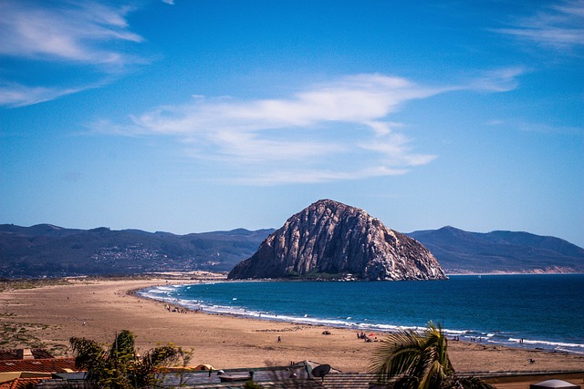 “The Morro Bay estuary supports a rich network of marshes, eelgrass beds, mudflats, and dunes that provide essential habitat while also supporting fisheries, recreation, and protection of coastal communities. Rising seas pose a growing threat to the estuary with projections of more than three feet of sea level rise (SLR) by 2100. To better understand the risk of SLR, the Estuary Program partnered with the U.S. Geological Survey (USGS) on a two-year habitat vulnerability study. The Estuary Program and USGS collected robust field data and developed a hydrodynamic model, WARMER-Coast, to assess how marshes and adjacent habitats may respond to various sea level rise rates and sediment scenarios. The study aimed to estimate future SLR rates, identify areas and timing of predicted habitat change, and evaluate potential management actions to support habitat resilience. In addition to a formal report, Estuary Program and project partners created an interactive StoryMap communication tool in both English and Spanish to summarize the results. … ” Read more from the Morro Bay National Estuary Program.
Ventura County voters decide on a water bond this election
“Besides local races, state races and propositions, some Ventura County voters are voting on whether or not to approve a $350 million water bond this election. Known as Measure D, the United Water Conservation District is asking county voters within its service area to approve the bond to help fund three capital improvements projects it says are required. The bond, if passed, would cost property owners in the district’s service area approximately $24 per $100,000 of assessed value annually. United Water says the bond would run 30 years, from 2028 through 2057. It would help fund improvements to the Santa Felicia Dam, Freeman Diversion, and Extraction Barrier and Brackish Water Treatment. … ” Read more from Spectrum News.
IMPERIAL/COACHELLA VALLEYS
IID approves $21 Million overhaul at District’s largest hydroelectric plant
“Nearly 70 years after it began generating electricity with Colorado River water, the Imperial Irrigation District (IID) is investing nearly $21 million to restore generating capacity at its largest hydroelectric plant. The IID Board of Directors approved the refurbishment of one of two generators at the Pilot Knob Hydroelectric Plant near Winterhaven. The generator has been out of service for three years, with repairs expected to be completed in 2029. “Pilot Knob has been part of IID’s public power system for nearly 70 years, and this investment is about making sure it remains part of our future,” said Karin Eugenio, Chairwoman of the IID Board of Directors. “By restoring equipment that has served generations of customers, we are protecting an important public asset, strengthening the reliability of our electric system and making responsible investments that will benefit our customers for decades to come.” … ” Read more from the Imperial Irrigation District.
SAN DIEGO
Tijuana River waste is polluting San Diego’s air
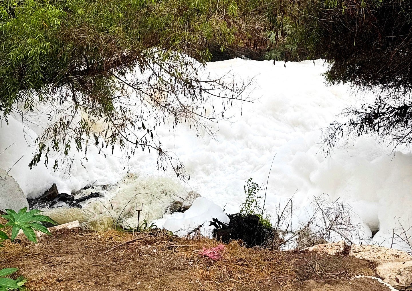
“Waste dumped into the Tijuana River can travel seven times farther than expected before becoming airborne and affecting San Diego’s air, at least 20 miles from its source, according to UC Riverside research. The river carries a complex mixture of untreated sewage from toilets, industrial waste, and urban runoff into the Pacific Ocean at Imperial Beach. The study, published in Scientific Reports, found that wastewater chemicals can remain in the ocean long enough to then travel north along the San Diego coast before escaping into the atmosphere. The finding helps explain why researchers detected Tijuana River-linked pollution in the air near the Scripps Institution of Oceanography pier in La Jolla, roughly 22 miles from the river mouth. “It was already known that compounds from this waste could enter the air, but we didn’t realize until now how far it could travel underwater before emerging,” said atmospheric scientist and study lead author Karolina Cysneiros de Carvalho. … ” Read more from UC Riverside.
Along the Colorado River …
Flood-weary Southwest to get a break from major storms through mid-November
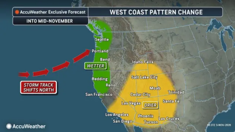 “Rounds of heavy rain have triggered flooding across parts of the southwestern United States since late September, but a drier stretch will give flood-weary residents a break into mid-November. Slow-moving storms have repeatedly drawn in tropical moisture from as far away as Hawaii and southern Mexico, fueling heavy rain and flooding. The most recent atmospheric river drenched the region last weekend, causing rivers to surge to historic levels. Parts of Southern California, New Mexico, Colorado and western and central Texas have received two to 10 times their historical average rainfall from late September through early November. … ” Read more from AccuWeather.
El Niño has destroyed an iconic natural landmark that stood for millions of years
“The American Southwest is currently in the grip of a series of historic flooding events, with at least one analyst, Colorado State University climatologist Russ Schumacher, labeling the widespread weather system a once-in-a-thousand-year occurrence. Earlier this week, floodwaters attributed to what’s forecast to be the strongest El Niño on record forced residents of Pagosa Springs, Colorado, to evacuate as they carried entire buildings away. And over the last few weeks, similar scenes have played out across towns in Utah, Arizona and New Mexico. Dry desert landscapes, too, have been pummeled by rain, causing at least two of the region’s most iconic rock formations to collapse. On Oct. 30, the owner of a tour guide company leading a group out to the Alien Throne — an otherworldly rock spire known as a hoodoo that’s located on Navajo Nation land in northwestern New Mexico — reported that the structure had toppled. … ” Read more from SF Gate.
Arizona’s wet fall buys time for largest Colorado River reservoirs
“Arizona’s wet October and early November provided a nice boost for Lake Mead and Lake Powell – the two largest Colorado River reservoirs — but long-term drought conditions persist. The Lake Powell water level Tuesday was 3,533 feet, up 17 feet since it fell to its lowest level ever in mid-September. “It’s going to put off dead pool for a little bit, right? We were getting dangerously low to that issue with Lake Powell. So, this actually creates a little bit more margin,” Mike Crimmins, climate science extension specialist at the University of Arizona, told KTAR News 92.3 FM on Friday, before the state saw widespread weekend storms. … ” Read more from KTAR.
How this Colorado River disaster can be averted
“Colorado State University’s Brad Udall makes the case that the Colorado River Basin is the world’s first place where climate change is “forcing a complete redo of water management.” The climate change component of that statement seems unassailable. Flows in the Colorado River have declined 21% this century. A river that averaged 15.2 million acre-feet in flows during the 20th century has fallen to 12.2 million acre-feet in the 21st. It has further tapered off to 10 million acre-feet in the last few years. Temperature increases of 3.3 degrees Fahrenheit since 1970 explain much of that decline. A one- degree Fahrenheit rise in temperature results in 5% loss due to increased evaporation. “Hot drought,” the phrase Udall favors, will only worsen, he says, as the process he and others call aridification will continue to worsen. Temperatures, said Udall at a recent forum, can continue to rise. … ” Read more from Big Pivots.
“Our Marina Is Gone!” Lake Powell surges but drawdowns continue at Flaming Gorge
“October was a banner month for Lake Powell, a key Colorado River reservoir straddling the Utah-Arizona state line, as rainstorms sent billions of gallons into the pool behind Glen Canyon Dam. What that means for ongoing drawdowns from Flaming Gorge Reservoir on the Wyoming-Utah border is uncertain. Between Oct. 21 and Oct. 28, the reservoir’s contents increased by 537,540 acre-feet, or roughly 175 billion gallons, raising its level by nine to 10 feet, according to reservoir data. The surge was primarily driven by flooding along the San Juan River in the Four Corners region. All told, Lake Powell gained about 600,000 acre-feet from its September low through late October. … ” Read more from Cowboy Sate Daily.
Colorado losing ground in fight to clean up record number of “orphaned” oil and gas wells
“A record 161 orphan oil and gas wells were plugged in Colorado last year, but wells are being added faster than they can be sealed and state and local officials are worried about an impending surge in abandoned sites. “The number of orphan wells stands today at 994 … the largest number of orphan wells we’ve ever had,” Jeffrey Moore, manager of Aurora’s energy and environment division, told the state commission overseeing orphan well funding in September. “On average we’ve added 300 orphan wells per year over the past three years,” Moore said. So, while plugging jumped 69% year-over-year to 161 for fiscal 2026, the program is getting almost twice the number of new abandoned wells annually. There are another 1,215 wells that have already been identified as likely candidates for being orphaned, according to Colorado Energy and Carbon Management Commission, or ECMC, which regulates the industry and runs the orphan well program. “We are losing ground,” Moore said. “It is going to take more funding.” … ” Read more from the Colorado Sun.
El Niño fuels record November snowpack in southwest Colorado, highest since 2005
“A parade of El Niño-fueled storms has boosted southwest Colorado’s snowpack. The 9NEWS Weather Impact Team said Colorado’s statewide snowpack stands at 125% of average for November 3, the highest level for this point in the winter season since 2022, driven largely by storms in the southern part of the state. 9NEWS Weather Impact Team meteorologist Chris Bianchi said in the San Juan Mountains in southwest Colorado, snowpack is the highest recorded on November 3 since 2005. … ” Read more from Channel 9.
In national water news today …
US loses a football field of forest every 2 minutes
“A new satellite tracking system finds that the United States has lost 350,000 acres of forest land per year—a rate of approximately one football field every two minutes—which is the equivalent of 2.3 billion metric tons of carbon dioxide emissions through the release of stored CO2 in the forests and lost potential carbon storage. Researchers at Clark University in Massachusetts announced the initial findings of the U.S. Forest Monitor tool Thursday, tracking “persistent” forest loss in the lower 48 states and showing 9.8 million acres of forest land was lost to development or agriculture from 1990 to 2017. Lead author Christopher Williams said the tool establishes an important historical baseline for tracking land use changes across the country and shows the need for more consistent monitoring of forest loss nationwide. “When we think about forest loss and conversion, our minds often go to the Amazon or other tropical locations,” Williams said in an interview with Inside Climate News. “What this study shows is that forest loss is something that’s happening in the United States as well, and in our own backyards, and that it deserves our attention.” … ” Read more from Inside Climate News.