Several news sources featured in the Daily Digest may limit the number of articles you can access without a subscription. However, gift articles and open-access links are provided when available. For more open access California water news articles, explore the main page at MavensNotebook.com.
On the calendar today …
- MEETING: State Board of Food and Agriculture from 10pm to 1pm. Agenda items include Updates from the Small-Scale Producer and BIPOC Producer Advisory Committees; Defining small farms; and California Small Farm Definition Considerations. Click here for the agenda and remote access instructions.
- WEBINAR: CRIT Personhood for the Colorado River: Will It Make a Difference? from 11am to 12:30pm. This WRRC Water Webinar, with introductory remarks by Amelia Flores, Chairwoman, Colorado River Indian Tribes, will discuss why the CRIT Tribal Council took action to declare that the Colorado River is entitled to protection under Tribal law and what is hoped to be accomplished by this action both inside and outside of the reservation boundaries. Click here to register.
- OPEN HOUSE: Final Just Transitions in the Delta from 11am to 3pm at the Jean Harvie Community Center in Walnut Grove. At the open house, the six future scenarios that we have crafted, modeled, and evaluated with ongoing engagement from Delta communities, advocates, and experts will be presented. Take part in reviewing and ranking these future scenarios to help define a more resilient future Delta that is grounded in the values and concerns of local public input. A community workshop is scheduled for Thursday. For more information on the project, click here. Click here to RSVP to the Thursday workshop.
In California water news today …
How ARkStorm could threaten California this winter
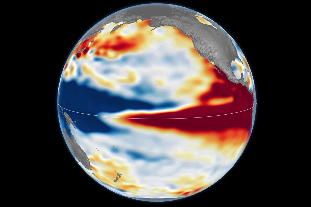 “California could face an increased risk of heavy rainfall and flooding this winter as a strengthening El Niño raises the likelihood of wetter-than-average conditions across parts of the state. The developing weather pattern has renewed attention on the possibility of an extreme storm system known as an ARkStorm, a hypothetical disaster that could bring catastrophic flooding to California. ARkStorm, short for Atmospheric River 1,000, is a hypothetical scenario developed to examine the impact of an exceptionally severe series of atmospheric river storms in California. The scenario was developed by experts from federal and state agencies, universities and research institutions, including NOAA, the U.S Geological Survey (USGS), Scripps Institution of Oceanography and FEMA. Their aim was to create a scientifically plausible hypothetical storm scenario to help emergency services, resource managers and the public understand the potential scale and consequences of an extreme flooding event. … ” Read more from Newsweek.
SEE ALSO: Video: Disaster ‘larger than any in world history’ could hit California, from USA Today
Water forecasting gaps persist as state prepares for El Niño
“In May 2023, the California State Auditor reported that the Department of Water Resources’ water forecasts do not adequately account for climate change and its reasons for some reservoir releases were unclear. The State Auditor recommended that DWR ensure its water supply forecasts more accurately account for the “observed effects of climate change” and that the department continue to implement its plan to adopt an updated water supply forecasting model and updated procedures. As of August 12, 2026, the State Auditor’s office released a report titled, “Recommendations Not Fully Implemented After One Year,” finding that DWR had partially implemented the recommendation to update its forecasting model. … ” Read more from Valley Ag Voice.
El Niño helps break marine records for entire California coast
“New data from the National Oceanic and Atmospheric Administration shows how abnormally warm California’s ocean waters have become in recent months. From Southern California to the Central Coast and the Bay Area, sea surface temperatures are running about 4 degrees Celsius above average. Even a few degrees difference can cause major changes to weather, sea level and marine life. The cause for the overheated ocean is partly due to a plume of warm water that’s traveling up the coast thanks to El Niño. The weather phenomenon is a part of a regular pattern that develops in the central and eastern tropical Pacific Ocean, when weak trade winds are linked to above-average ocean water temperatures. The warm water can lead to changing weather patterns in California, including a wet winter for much of the state. The warmer water also causes sea levels to rise. … ” Read more from SF Gate.
California’s State Water Board adopts Bay-Delta Plan as Reclamation threatens funding exit
“California’s State Water Resources Control Board adopted an updated Bay-Delta Plan for the San Francisco Bay/Sacramento-San Joaquin Delta, the watershed that supplies water to nearly 30 million Californians. Water users covered by voluntary agreements can meet its standards through them, while other rights holders fall under a regulatory route based mainly on higher river flows. The board’s decision concludes a multi-year process that included four iterations of draft language and more than 200 days of public comment. It covers the Sacramento River, the Delta’s eastside tributaries and the Delta itself, while the Lower San Joaquin River portion of the watershed was updated separately in 2018. The voluntary pathway incorporates the Healthy Rivers and Landscapes (HRL) programme, set out in a 2022 memorandum of understanding under which participating water users dedicate part of their water rights to instream flows and create habitat over an eight-year period. … ” Read more from Smart Water Magazine.
When the well runs dry: As groundwater overpumping forces farms to go fallow across the Central Valley, the future of land use hangs in the balance
“A few years back, Denise Kinabrew’s farm well ran dry. It wasn’t a complete surprise—after all, Californians have faced worsening droughts for years—but she feared for her valuable muscat grapes. “I ended up having to hook my garden hoses together to run my domestic well,” she says. “I had no other way.” Kinabrew, a third-generation farmer in Madera County who produces raisins, connected to a nearby irrigation canal to water the rest of her 20 acres, sparing the well she uses for drinking water from further strain. But the scramble underscored a fear shared by many farmers and rural residents in the region: What happens when the water stops flowing? The San Joaquin Valley is at the heart of California’s agricultural belt, and it is among the most productive farming regions in the world. Roughly 6 million acres here produce a large share of America’s fruit, vegetables and nuts. Today, farms and orchards depend heavily on water pumped from aquifers deep underground. Decades of agricultural expansion and increased planting of perennial crops have boosted water demand, while climate-change impacts—including reduced snowpack, intense droughts and greater swings between wet and dry years—have made surface water less reliable. … ” Read more from The Nature Conservancy.
What are depleted aquifers? Understanding the basics
“California depends on more than rain and rivers for its water. A lot of it comes from aquifers underground, and how we manage them affects everything from farming to the state’s access to drinking water. At Sustainable Conservation, we work with farmers and water managers on practices like groundwater recharge and cover cropping that help put water back where it belongs. This article covers the basics of aquifer depletion: what it is, why it happens, its effects, and common solutions. … ” Read more from Sustainable Conservation.
Securing the future of California dairy forage production is critical to protecting rural communities
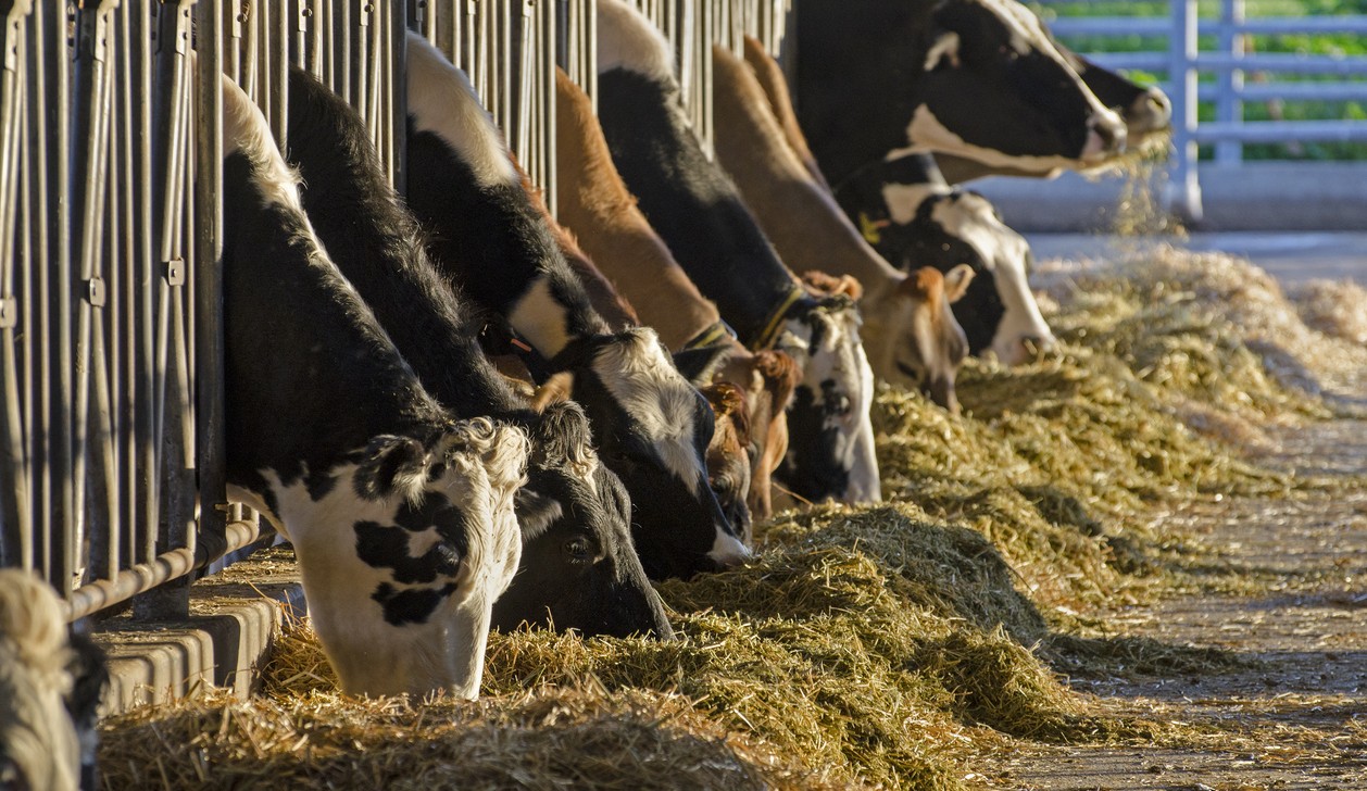 “For dairy farm families, animal feed is a critical part of their work to ensure optimal cow care, produce more nutritious milk using fewer resources, and make sure their farms remain economically sustainable. Animal feed comprises about 60 percent of a California dairy farm’s operational costs. Dairy farmers and their nutritionists work hard to ensure cows receive balanced meals each and every day. Forage production is an increasingly challenging yet critically important part of a California dairy farm’s resiliency. California dairy cow rations include a mixture of crops grown at the dairy (primarily corn and cereal silages), imported grains, and locally available byproducts from other crops. There are many reasons why California dairy farmers produce their own silage, which is a fermented form of plants that is high in moisture and nutrition. To make silage, the entire plant (stalk, husk, and kernels) is harvested while still green, chopped into pieces, and stored in airtight conditions. Minimizing transportation of the high-moisture feed is critical to both feed quality and farm economics. Importantly, growing feed on nearby fields is how dairies recycle manure nutrients and water. … ” Read more from Valley Ag Voice.
California leads in ag bankruptcy filings
“The National Agricultural Law Center, in partnership with the National Association of State Departments of Agriculture, launched a new project called, “Data on Economic and Bankruptcy Trends in Agriculture (DEBT) Project,” to analyze a more complete picture of agricultural financial stress in the U.S. The project compiled agricultural bankruptcy filings under Chapter 11 and Chapter 12 by using bankruptcy dockets from the U.S. Courts’ electronic records system — Public Access to Court Electronic Records or PACER. Chapter 12 filings are designed for family farmers and family fishermen with provisions tailored to agricultural operations. While Chapter 11 filings cover a broader business reorganization chapter, they may be used by agricultural businesses that do not qualify for Chapter 12 or whose circumstances make Chapter 11 more appropriate. … ” Read more from Valley Ag Voice.
KQED Forum: Why is water so expensive in California?
 “San Jose has the most expensive water in the country, according to a new report from Food & Water Watch. The report finds that, nationwide, household water bills have increased by an average of 62% over the last decade, and California is home to more than half of the 25 most expensive water systems in the country. So what’s driving up the cost of our household drinking water and is there a better way to pay for this essential service? We’ll hear from water policy experts about the hidden costs behind your water bill, how everything from climate change to agricultural policy is shaping rates, and what it would take to make water more affordable for Californians.” Listen at KQED (show airs at 9am).
CDFW’s Natural Community Conservation Planning Program awards seven proposals under the 2026 Local Assistance Grant solicitation
“California’s Department of Fish and Wildlife, Natural Community Conservation Planning (NCCP) Program has awarded seven proposals for the Fiscal Year 2026 Local Assistance Grant (LAG) solicitation. LAG grants provide state funds to assist local public and non-profit entities to implement high-priority tasks for NCCPs throughout California. Totaling $576,000, CDFW fully funded six proposals across the state and partially funded a seventh. … ” Read more from the Department of Fish and Wildlife.
Solano County planners set to discuss rezone on California Forever land
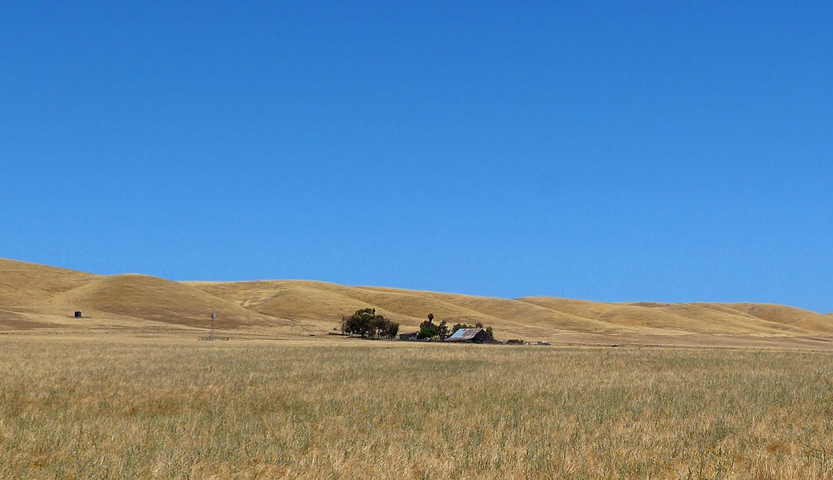 “The Solano County Planning Commission on Thursday will consider making a recommendation on a proposed zoning change affecting 1,312 acres of land east of Collinsville that California Forever has proposed using for shipbuilding. The commission is scheduled to hold a public hearing at 6 p.m. Thursday in the Board of Supervisors Chambers in the Solano County Government Center, 675 Texas St., Fairfield. It will consider making a recommendation to the Solano County Board of Supervisors on a proposal to change the property’s zoning from Exclusive Agriculture to Industrial-Water Dependent. The proposed change would bring the property’s zoning into alignment with the county’s 2008 General Plan, which designated the area for water-dependent industrial development along the Sacramento River. However, the zoning change would not approve a shipbuilding facility or any other specific development, according to a staff report prepared by the county Department of Resource Management. … ” Read more from the Vacaville Reporter.
Economic impacts of climate change: National trends and California solutions
“The financial costs of climate change are showing up in grocery prices, water bills, insurance markets, and disaster recovery budgets. For many households and businesses, the pressure is already measurable. At Sustainable Conservation, we look at these challenges practically. Protecting California’s land and water is what keeps water supplies reliable and communities economically stable. The notion that environmental protection comes at the expense of business feasibility is outdated, and that economic resilience is inherently linked to natural resource conservation. This article discusses what that looks like in economic terms, starting with the national macroeconomic insight, then narrowing into California’s specific agricultural and water challenges. We’ll also discuss collaborative, science-backed solutions that are already protecting both working land and the bottom line. … ” Read more from Sustainable Conservation.
Sites Reservoir … yes or no?
Tomorrow, the State Water Resources Control Board will consider whether to approve the water rights permit for the Sites Reservoir Project. Here are commentaries in favor of and in opposition to approving the permit.
PRO:
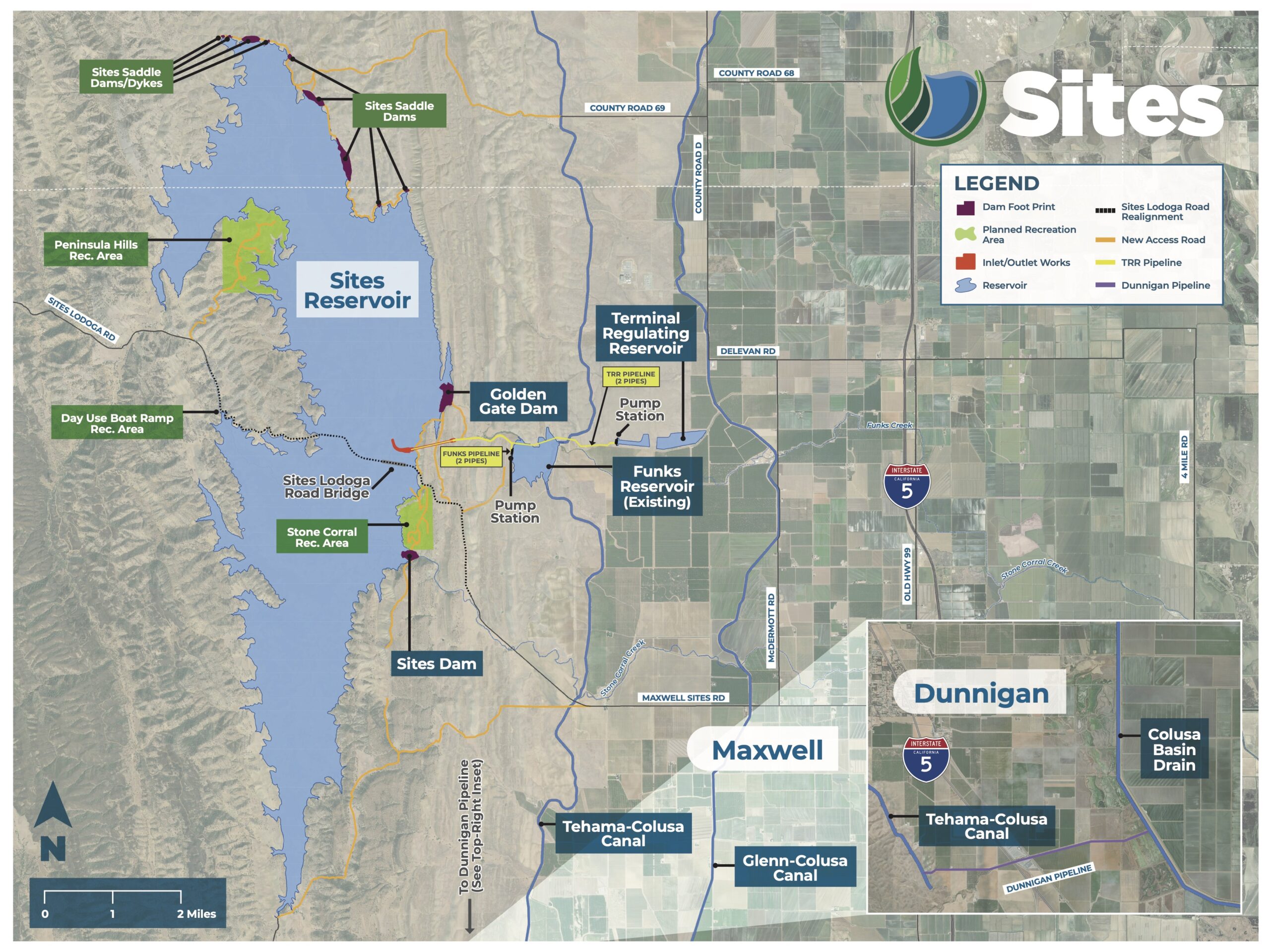
The time is now: Sites Reservoir can strengthen California’s water future
Jeff McCreary, Ducks Unlimited; Tim Johnson, California Rice Commission; and David Guy, Northern California Water Association, write, “California’s water future depends on capturing water when available and putting that water to work when communities, farms, and ecosystems need it most. Sites Reservoir embodies this approach. Combining modern infrastructure, dedicated environmental water, and collaborative management, Sites Reservoir offers an innovative investment in healthy rivers, landscapes, and communities—and a more resilient California. We encourage the State Water Board this week to approve the water right permit to move forward with Sites Reservoir—an important investment in California’s water future! In Northern California, we are all working together through a memorandum of understanding “to promote functioning ecosystems and sustainable water supplies in California’s Sacramento Valley.” Our objective is “to preserve, sustain, and promote working agricultural landscapes in the Sacramento Valley that support ecosystem function and provide landscape-scale habitat benefits for fish, bird, and wildlife populations. Our collective goal is to bring our natural and working landscapes in this region to life through the careful interaction of water, sun, and land.” … ” Continue reading this commentary.
Sites Reservoir can help sustain wetlands in the San Joaquin Valley
Ric Ortega, General Manager of Grassland Water District, writes, “For those of us responsible for delivering water to California’s remaining wetlands, Sites Reservoir offers a more dependable water supply when habitat needs it most, including in dry years when wildlife has few places to go. Although Sites would be built in the Sacramento Valley, environmental water from the project would be delivered south of the Delta, sustaining the Grassland Ecological Area wetlands and other vital links along the Pacific Flyway. Grassland Water District has worked for 73 years to protect, secure, and deliver water for wetland habitat, including 34 years working toward the environmental goals in the Central Valley Project Improvement Act (CVPIA), and 12 years to secure meaningful ecosystem benefits under California’s Proposition 1 water bond. The wetland habitat we serve in the San Joaquin Valley is internationally recognized for its importance to migratory birds. Securing CVPIA refuge water supplies remains a challenge for wetlands south of the Delta, and refuge water supply is a dedicated public benefit of the Sites project. … ” Continue reading this commentary.
CON:
The Sites Reservoir is a bad deal for Californians
Keiko Mertz, Friends of the River, writes, “There’s only one day remaining for the State to divert from its collision course on one of the most consequential and expensive water decisions to be made in our state in decades. On November 4, the State Water Resources Control Board will vote on whether to grant the proposed Sites Reservoir a water right permit, and if so, what rules should apply to the project. In March of this year, after more than two years of hearings, expert testimony, briefings, and over 1,600 pieces of evidence, the State Water Board issued a draft permit, which acknowledged that Sites Reservoir as proposed would cause unreasonable harm to water quality and the environment. To mitigate those harms, the Board included additional protections in the draft permit. Sites backers then complained to Governor Newsom and other officials that protecting water quality and the environment would make the project infeasible – that is to say, not worth the cost to its proponents. Those leaders in turn put their foot on the scale of the water right proceeding. The draft permit was changed to allow Sites to take more water, despite the clear evidence in the record and the urgency of the crisis for water quality and endangered species in the San Francisco Bay-Delta estuary. … ” Continue reading this commentary.
For California Indians, the Sites Reservoir project is one more story of cultural genocide
Chairman Wayne “Rick” Mitchum Jr. writes, “On November 4th, the California State Water Resources Control Board (Water Board) will make a decision that could permanently devastate sacred cultural landscapes, ancestral burial grounds, and irreplaceable cultural resources of our Tribe, the Cachil Dehe Band of Wintun Indians of the Colusa Indian Community. This decision concerns the proposed Sites Reservoir, a massive State-advanced project of water extraction and capture. The story of the Sites Reservoir is one of deception, dispossession, and destruction. For us Indians, these three acts seemingly always go hand-in-hand. This three-part story of the proposed Sites Project is one that has not been widely told to the California public. But we know it all too well. Over a hundred years ago, our ancestors were invited to share a meal by settlers under the guise of social exchange. These settlers poisoned our food and killed many of our people. This act of deception was in furtherance of the so-called “war of extermination,” as articulated by California’s first Governor Peter Burnett, to make Indian peoples extinct. The impetus of this genocidal act was the dispossession of our people from the lands, air, and waters that we have existed with since time immemorial. … ” Continue reading this commentary.
Massive new California dam project would break Sacramento River, Bay-Delta and wild salmon recovery
Yvon Chouinard, Gary Wockner and Matt Stoecker write, “Wild salmon and river health are rebounding on the Klamath River in northern California, but elsewhere across the state, recovery is struggling. California Gov. Gavin Newsom did support the Klamath River dam removals, but his administration’s actions — supporting a massive new dam and diversion from the state’s once top producing salmon rivers — further imperil our Capitol’s namesake river (the Sacramento), the crown jewel of West Coast estuaries (San Francisco Bay – Delta), and any prospects to truly recovering wild salmon and other threatened wildlife that call this unparalleled waterway home. The Sacramento River and its salmon fishery were once the second largest on the West Coast, but they are now on artificial life support due to excessive water diversions and drought. The river system sometimes runs so low and warm that, in 2021 and 2022, the state’s own fish and wildlife agency took emergency action, trucking millions of hatchery-raised juvenile salmon past the lethal, low and hot river to San Francisco Bay. In the subsequent years of 2023, 2024 and 2025, fall-run Chinook salmon numbers ran so low that the state closed the ocean commercial salmon fishing season. … ” Read more from Patagonia at LinkedIn.
In other commentary today …
California adopted a new water plan. It’s unlikely to end the state’s water wars
Dan Walters writes, “Gray Davis became governor in 1999 and one of his first acts was to decree that there would be no major changes in water policy for eight years, which he assumed would be his two terms in office. Davis, a veteran politician who had climbed the political ladder one rung at a time, was well aware of the decades-long stalemate on the fundamental issue of how water should be apportioned between farmers and flows to support fish and other wildlife. He was also notoriously averse to political conflict and didn’t want what had been dubbed “water wars” to be rekindled during his governorship. Davis was recalled five years later and the conflict continued after his departure. During Jerry Brown’s second stint as governor, from 2011 to 2019, he embraced the concept of “voluntary agreements.” If farmers would reduce diversions from the Sacramento and San Joaquin rivers and their tributaries, they could avoid the mandatory cutbacks that environmental groups and their allies favored. … ” Read more from Dan Walters.
In regional water news and commentary today …
NORTH COAST
What wild bees can tell habitat restoration crews on the Klamath River
“Wild bees are helping guide Klamath River restoration, providing pollen data that could shape planting in former reservoirs after dam removal. On a warm August morning, Brissa Garcia inspected a bee hotel, a large wooden box mounted in a wetland near the Klamath River in Northern California. As the fragrance of mint rose from the soggy ground, a few bees buzzed around circular openings on the front of the box. “Sometimes you can see them carrying in leaves, grass hairs,” said Garcia, a wildlife biologist with RES, the company charged with restoring three former reservoirs along the Klamath River in Northern California and Southern Oregon. “They could use plant hairs, mud, pollen for nesting material.” RES and the Yurok Tribe have been planting billions of seeds and thousands of trees, shrubs, and flowering plants in the reservoir footprints. One goal is to support pollinators, which rely on nectar and pollen for food. Now, wild bees are helping the restoration team tweak their palette of native plants. … ” Read more from Jefferson Public Radio.
SIERRA NEVADA
First to open on West Coast, Mt. Rose Ski Tahoe kicks-off winter season Friday, Nov. 6
“Mt. Rose Ski Tahoe will be the first ski area open on the west coast for the 2026-27 winter season thanks to early season snow and cold temperatures that have allowed for snowmaking operations to get underway. The Lakeview Express lift will start spinning at 9:00 a.m. this Friday, Nov. 6. “We’re excited to get winter started, and to again offer skiers and snowboarders another six month season. Mt Rose – Ski Tahoe can boast one of the longest ski seasons in Tahoe with operations from early November until almost May,” said Mike Pierce, Mt. Rose Ski Tahoe marketing director. “Recent snow paired with our extensive snowmaking efforts, the highest base area elevation in Tahoe at 8,260′, plus more snow in the extended forecast means early season conditions are ready to roll for the first turns of the season.” … ” Read more from the Tahoe Daily Tribune.
S.F. electric-surfboard maker fined $10,000 for breaking rules on Tahoe
“An electric-surfboard company has paid a $10,000 fine for violating Tahoe’s boating rules. Last year, Lind Art and Technology, a Swedish company with a headquarters in San Francisco, filmed surf videos on Lake Tahoe to promote its $27,000 battery-powered surfboard. The footage showed a rider carving turns on the lake’s glassy surface while cruising on the company’s signature board, which has a remote control-operated jet motor on its hull and is capable of reaching 37 mph. After spotting the videos online, the Tahoe Regional Planning Agency pursued enforcement actions against the company. The agency, which regulates boating on the lake, informed Lind that its surfer had illegally ridden in tributaries along the South Shore and violated Tahoe’s near-shore no-wake ordinance. … ” Read more from the San Francisco Chronicle.
The groundwater under South Lake Tahoe has been contaminated since the 1970’s. Now someone has to pay.
“Solvent that leaked from a coin-operated dry cleaning machine at a South Lake Tahoe laundromat before most of today’s residents were born is still drifting through the groundwater beneath the Y, and a settlement announced this week would keep the people responsible on the hook until the 2080s. The Tahoe Daily Tribune reported that the Lahontan Regional Water Quality Control Board has reached a proposed $4.1 million agreement with Seven Springs Limited Partnership and Fox Capital Management Corporation, the current and former owners of 1024 Lake Tahoe Boulevard. The deal would require them to fund treatment for municipal drinking water wells and address the pollution for 59 years. … ” Read more from Active NorCal.
SACRAMENTO VALLEY
Sacramento River floodplain in Red Bluff gets a redesign to stop juvenile salmon strandings
“Every time the Sacramento River runs high enough to spill into an old boat harbor behind the Red Bluff Elks Lodge, young salmon and steelhead slip in to feed and rest, and every time the water drops, some of them get trapped with no way back to the river. That problem is now being engineered out. Crews started work Oct. 19 on a redesign of the roughly three-acre floodplain, a known stranding site that state biologists trace to landscape changes left by the old Lake Red Bluff and the Red Bluff Diversion Dam. The plan calls for regrading about 5,000 cubic yards of material and lowering parts of the site so it connects to the river at flows of roughly 10,000 to 12,000 cubic feet per second, versus about 25,000 cfs today. That should give juvenile fish access far more often on their trip downstream, while gentler slopes let them leave when ready instead of getting stuck behind uneven ground and thick brush. … ” Read more from Active NorCal.
Is Sacramento ready for ‘Super El Niño’?
“With a so-called “Super El Niño” already intensifying, some residents are worried, and state and local officials are gearing up for what might come. The National Weather Service defines an El Niño as a phenomenon that occurs when ocean surface temperatures warm along the coasts of Ecuador and northern Peru, causing significant changes to global weather patterns. In California, El Niño correlates with higher than normal precipitation, particularly in the southern and central regions. Specifically, the NWS cautioned in early October that the current 2026-27 El Niño has a greater than 83 percent chance of causing “a historic event that would exceed the strengths of previous El Niños dating back to 1950.” Gov. Gavin Newsom has begun issuing executive orders for work to be done to shore up the coastline. … ” Read more from Comstock’s.
NAPA/SONOMA
Heavy surf expected this week at Sonoma County beaches
“Bay Area beachgoers are being warned to watch out for dangerous waves and strong ocean currents this week, with hazardous beach conditions expected through Tuesday evening and again Thursday through the weekend. In an advisory issued around 1:40 a.m. Monday, the National Weather Service said that long-period ocean swells will increase the risk of sneaker waves and strong rip currents along the Pacific Coast. The waves can sweep across the shoreline without warning, pulling people into the ocean from beaches, jetties and rocks, forecasters said. … ” Read more from NorCal Public Media.
CENTRAL COAST
El Niño is warming Monterey Bay, causing trouble for ocean life
“Ocean water temperatures in Monterey Bay are now the warmest observed in more than 30 years — clear evidence of El Niño’s arrival on the Central Coast, according to the Monterey Bay Aquarium Research Institute. Researchers said the warming is partly due to Kelvin waves, a giant underwater swell that slowly delivers El Niño-associated warm water across the Pacific Ocean. As many as three Kelvin waves have already moved up the California coast. Scientists tracking the phenomenon found a strong influx of warm water at depth, around 200 feet below the ocean’s surface, which is a “definitive signature of the arrival of El Niño,” researchers wrote in a recent post. Researchers wrote that as of Oct. 26, the temperature reached 18.18 degrees Celsius — roughly 64 degrees Fahrenheit — “surpassing the time-series record high set on November 19, 1997, during a previous El Niño event.” … ” Read more from KQED.
SAN JOAQUIN VALLEY
Lower San Joaquin River Project marks milestone in Stockton flood-risk reduction
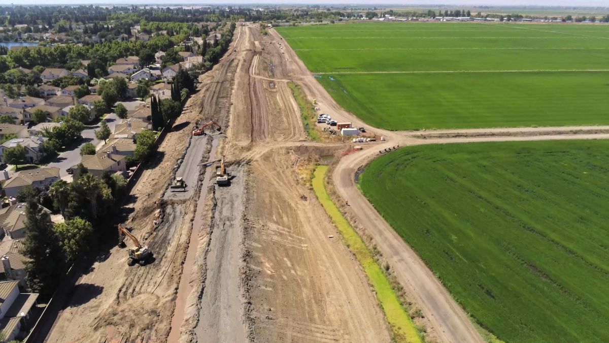
“Federal, state and local partners marked the completion of construction on Tenmile Slough Reach 30 Left Bank (TS30L) on Oct. 30, 2026, celebrating the first completed flood protection levee reach of the Lower San Joaquin River Project, a major flood-risk management effort serving north and central Stockton. The ribbon-cutting ceremony reconized the completion of approximately 1.1 miles of levee improvements along Tenmile Slough. The work addresses critical seepage and stability deficiencies and also represents an important step toward reducing flood risk for communities in the Stockton area. “Smart engineering has to be matched with smart project execution,” says Col. Robert M. McTighe, U.S. Army Corps of Engineers (USACE) Sacramento District commander. The TS30L reach was identified as one of the most at-risk portions of the existing Stockton area levee system. Although it is a dryland levee, meaning water is not normally present against it, its deficiencies presented flood risk management challenges. … ” Read more from the Army Corps of Engineers.
UC receives nearly $1.5 Million from USDA-NIFA for farm research lab in San Joaquin Valley
“The University of California Agriculture and Natural Resources has been awarded $1,479,774 by the U.S. Department of Agriculture’s National Institute of Food and Agriculture to establish a vital research lab in western Fresno County. UC ANR is matching the grant so the total project investment is nearly $3 million. The Agricultural Research and Innovation Laboratory Complex at UC West Side Research and Extension Center will allow scientists to study and diagnose problems more efficiently so farmers can get answers faster to reduce crop losses. “This award recognizes the San Joaquin Valley, and California as a whole, as a preeminent producer of so much of our country’s agricultural bounty,” said Glenda Humiston, UC vice president for agriculture and natural resources. “Our farmers are incredibly resourceful and productive, but they need cutting-edge science to help overcome a host of difficult challenges, including water scarcity, severe drought, extreme weather, soil quality issues and ever-evolving pests and plant diseases. These enhanced lab facilities at West Side REC will enable researchers to better develop and deliver solutions to our growers with greater speed, efficiency, economy and effectiveness.” … ” Read more from Valley Ag Voice.
Fish counters needed for annual population survey on the Kings River
“Volunteers are needed to assist biologists for the Kings River Fisheries Management Program’s annual fish population survey Nov. 17 through Dec. 2. Each event will take place between 9 a.m. and 3:30 p.m. Equipment and lunch will be provided to all volunteers. Volunteers must be 18 or older. The survey assesses the health of the river and its fish populations. Biologists and volunteers will use devices that send an electric shock through the water, which does not cause harm, stunning the fish in order to count and measure them. … ” Read more from SJV Water.
Kern and Tulare counties see increased ag production values in 2025
“According to the 2025 Kern County Agricultural Crop Report, the gross value of all agricultural commodities produced in Kern County increased by 12% over the 2024 crop values. In 2025, the total value of the county’s agricultural production was $8.93 billion, up from $7.96 billion in 2024. While Kern County experienced an increase in the value of its crops, the total harvested farmland dropped by 4% compared to 2024. County crop reports represent only gross values and do not account for the costs of production, marketing, transportation, or other ancillary costs. Additionally, the report does not reflect net income or loss to the producers of these commodities. The top five commodities for Kern County in 2025 were pistachios, grapes, citrus, almonds, and carrots, which accounted for over $6 billion, or 69%, of the total value. The top 20 commodities included 94% of the total value. … ” Read more from Valley Ag Voice.
EASTERN SIERRA
Without diversions, Mono would be rising
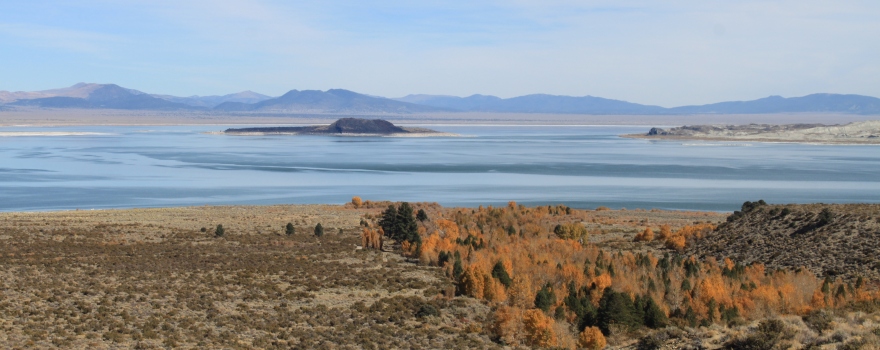 “Los Angeles has multiple sources of water, with some local sources funded specifically to offset Mono Basin diversions. Mono Lake, on the other hand, has no additional sources of water other than runoff and precipitation. When the Los Angeles Department of Water & Power (DWP) takes Mono Basin water instead of using the local sources to which it has access, it slows down Mono Lake’s rise, degrading and threatening the Mono Basin ecosystem. When Mono Lake’s level is steady, it means that inflows are balanced with evaporation. But to reach its required management level of 6,392 feet above sea level—ten feet higher than it is now—Mono Lake needs an additional 450,000 acre-feet of water. In other words, inflows must exceed evaporation by that much water to raise the lake. If spread across 20 years, that would be an additional 23,000 acre-feet per year with an average rise of about half a foot each year. … ” Read more from the Mono Lake Committee.
Mono Lake Tufa State Natural Reserve boardwalk replacement planned for spring 2027
“Construction on the State Reserve boardwalk below Mono Lake County Park began in August with a State Parks crew installing “diamond piers” that provide the foundation for the new, replacement boardwalk. The piers are small structures secured by metal posts, which eliminate the need for pouring a concrete footing in the sensitive wetland habitat. Delivery of the boardwalk materials is unfortunately delayed and State Parks is now planning to construct and install the boardwalk sections in spring 2027 with the grand reopening tentatively planned for the summer. Prior to the installation of the piers, Mono County Recreation Stewards worked to clear the boardwalk trail of invasive weeds and new willow growth since last year’s fire. This work helped to expedite State Parks’ launch of the boardwalk installation. … ” Read more from the Mono Lake Committee.
SOUTHERN CALIFORNIA
Atmospheric river could bring heavy rainfall to Southern California next week
“There’s a “slight chance” that an atmospheric river could bring heavy rainfall to Southern California next week, the National Weather Service announced Tuesday. The atmospheric river has roughly a 60% chance of taking aim at the Pacific Northwest and Northern California between Nov. 10 and 12, according to the NWS. However, there’s also a 20 to 40% chance that the rain moves into Southern California between Nov. 10 and Nov. 16. “A slight risk of heavy precipitation and high winds continues over the West Coast states and Southwest for several additional days, including portions of the Southwest recently impacted by heavy precipitation and flooding,” the NWS stated in its atmospheric river forecast. “A slight risk of heavy snow [covering] a large portion of the higher elevations across the far West and the Rockies for the same period.” … ” Read more from KTLA.
Smoke from LA fires exposed millions of people to high levels of toxic heavy metals, study says
“At the height of the Los Angeles fires in 2025, millions of residents were exposed in a 24-hour period to toxic lead levels from smoke that were 80 times higher than the typical background level, according to a new study. Researchers from the California Institute of Technology compared the chemical composition of smoke from the Eaton Fire with that of a wildfire and found that the urban plume had more lead, arsenic and halogens (which include chlorine and bromine) linked to burning vehicles, building materials and electronics. “The main, key finding is really that wildfire smoke is very different fundamentally from the urban smoke,” said Nga Lee “Sally” Ng, an author of the study published Wednesday in the journal Science Advances. With the new technology they used to measure what was in the smoke, they were able to “actually see the very detailed component of these particles that we are breathing.” … ” Read more from the LAist.
CA Fish and Wildlife allows OC Water District to keep bulldozing the Santa Ana River
“The California Department of Fish and Wildlife has agreed to alter their agreement with the Orange County Water District – soon making it legal for the water district to continue bulldozing bird habitat in the Santa Ana River. The change comes after the water district received intense backlash from public commenters and environmental activists at their Oct. 7 board of directors meeting on bulldozers being used to tear out growing plant life that is increasingly becoming a habitat for various species of protected birds. It also comes after the water district was hit with a violation from Fish and Wildlife in July after the agency illegally bulldozed a migratory bird nest in the river. The water district is currently contesting the violation. … ” Read more from the Voice of the OC.
IMPERIAL/COACHELLA VALLEYS
California city fends off data center developer’s sabotage claims
“A federal judge on Monday threw out a developer’s lawsuit, in which it claimed the city of Imperial impeded its plan for three contiguous data centers on 194 acres in southeastern California. U.S. District Judge Janis Sammartino dismissed every claim brought by Imperial Valley Computer Manufacturing, known as IVCM, against the city and its officials. The judge, however, granted the company leave to amend its complaint. The company accused the city of denying it a fair process, treating it worse than similar developers and retaliating against it. The land spans the city of Imperial, Imperial County and El Centro, near the U.S.-Mexico border. The company said the city got in the way of its plans by insisting on its own discretionary review and ignoring deadlines. … ” Read more from the Courthouse News Service.
Along the Colorado River …
Rivers hit historic levels in Southwest amid destructive floods
“The first atmospheric river to hit the Southwest this season dumped up to five times the average rain for November in parts of the region, triggering destructive flooding for the second consecutive month. Late Sunday, 15 waterways across northern Arizona and southwestern Colorado either reached or were forecast to reach major flood stage, triggering evacuations and washing out roads. That included the San Juan River in Pagosa Springs, Colorado, where a historic crest of over 22 feet was forecast Sunday night. “To put the forecast into perspective, during the devastating 1911 flood that wiped out most of what existed as the town of Pagosa at that time, the San Juan River crested at approximately 17.8 feet,” wrote the Archuleta County Sheriff’s Office. … ” Read more from the Washington Post.
SEE ALSO:
- Atmospheric river floods over 100 homes as Southwest waterways surge, from AccuWeather
- ‘Devastating’ Damage as Hard Rains and Flash Floods Batter the Southwest, from the New York Times
Is El Niño making storms and flash floods in the Southwest worse?
“A chaotic climate phenomenon is intensifying heavy rains and floods in the Southwest, experts say. A natural warming cycle called El Niño is sizzling Pacific Ocean waters, leaking moisture into the air that can fuel passing storms. Such El Niño events can happen irregularly every couple of years, but scientists say the latest iteration is particularly extreme — and it’s just getting started, with impacts expected for several more months. “We’ve had super El Niños in the past, but this is a super duper El Niño,” said meteorologist Jeff Masters of Yale Climate Connections. The phenomenon wasn’t the only cause of the severe storms and it’s difficult to attribute any single event to it. Still, scientists say this supercharged El Niño is making heavy rains more likely and intense across the Southern U.S. The effects of those storms can be felt more strongly in desert regions, where the land doesn’t absorb water as well. … ” Read more from the Associated Press.
Why Southwestern floods won’t solve a water crisis
“Floods have overwhelmed parts of the parched American Southwest in recent days and weeks, pouring water into critically low reservoirs. But the deluge did little to ease worries over the water crisis that required significant limits on usage across the Colorado River basin earlier this year. Instead, it exemplified a sort of weather whiplash that is becoming more common as the climate warms, making it harder to maintain a stable water supply for the West. Right after enduring one of its driest stretches of spring and summer on record, the Southwest is now experiencing one of its wettest autumns. “It gives us a little bit of breathing room, but we’ve just got to see how much it snows this year,” said Kathryn Sorensen, research director at the Kyl Center for Water Policy at Arizona State University. … ” Read more from the New York Times.
Heavy storms force SRP to release water in Salt River through Phoenix
“As Arizona soaked under thrashing storms during Halloween weekend, Salt River Project released excess rainwater that was filling reservoirs. Up to 403,000 gallons of water per second were sent coursing into the Salt and Verde rivers to relieve the water levels and make room for more storage. The water flowed into the normally dry Salt River and could reach the Gila River in the southwest Valley. It could be seen flowing over the Tempe Town Lake dam at times, into the riverbed. Water from the releases is up for grabs by cities, farmers and irrigation companies., and it will also help recharge the aquifers. … ” Read more from the Arizona Republic.
Queen Creek water plan is a model for other Valley cities, town’s utilities director says
““Cheap water is over.” That’s the quote from Queen Creek Utilities Director Mark Skocypec at a recent town meeting. It made it into The Washington Post, which recently profiled the town and some of its residents who are not exactly happy about a new water resource fee being debated in the East Valley town. It’s part of a plan the town has been working on to prepare for a drier future for almost a decade. The idea is to buy water from the Harquahala Valley, pump it out of the ground and transport it via canal to the fast-growing suburb. But it won’t come cheap, hence that quote from Mark Skocypec. The Town Council is voting on the new fee later this month, and I spoke with Skocypec more about Queen Creek’s long-term future water plan and why he thinks they are a model for other cities facing uncertain water futures. … ” Read more from KJZZ.