Several news sources featured in the Daily Digest may limit the number of articles you can access without a subscription. However, gift articles and open-access links are provided when available. For more open access California water news articles, explore the main page at MavensNotebook.com.
In California water news today …
A major shift in the atmosphere clears the way for El Niño to pound Southern California
“Scientists and forecasters say a powerful subtropical jet stream has developed between Hawaii and California, creating an atmospheric conveyor belt that will help deliver El Niño-charged storms to the West Coast this winter. The warm-water El Niño phenomenon is releasing extraordinary amounts of moisture into the atmosphere, which frequently translates into stronger storms and bigger surf. The storms can be especially vicious if they coincide with seasonally large high tides, which are referred to as king tides. “This is a signature outcome of El Niño, and we are already starting to feel some of its effects,” said Phil Gonsalves, a forecaster at the National Weather Service. “We’ve received about twice as much rainfall as we typically get in October.” … ” Read more from the San Diego Union-Tribune.
What the El Niño worst-case scenario would look like in California
“The significant coastal flooding that hit Southern California in recent days points to what a worst-case scenario would look like in an El Niño-fueled winter with sea levels expected to rise even farther. Last week’s flooding was so bad because of two events that are expected to worsen over the next few months: a record-hot ocean raising sea levels combined with higher-than-normal tides. A third factor would be powerful storms that bring big waves. How these three factors play out — and whether they occur simultaneously — will determine how punishing this winter will be for the coast. The tides themselves were moderately high last week, but they, in combination with record ocean temperatures, were enough to push up sea levels significantly. … ” Read more from the LA Times.
The Delta in a changing climate: Findings from California’s fifth climate change assessment
 “The Sacramento–San Joaquin Delta is central to California’s water supply, agriculture, ecosystems, and cultural heritage. It provides water to more than 27 million Californians, supports a $4.6 billion agricultural economy, and provides habitat for more than 750 plant and animal species. The region is also highly vulnerable to climate change because land subsidence and its location at the confluence of California’s two largest rivers contribute to greater relative sea-level rise than in the San Francisco Bay Area. California’s Climate Change Assessments are conducted about every five years by government, academic, Tribal, and community partners. Mandated by Senate Bill 1320 and led by the Governor’s Office of Land Use and Climate Innovation, the Fifth Assessment comprises research, data, and tools designed to support climate-related decision-making. Because the statewide assessments do not typically provide a Delta-specific synthesis, the Delta Stewardship Council, Delta Protection Commission, and Delta Conservancy developed a report consolidating information on regional climate impacts and adaptation needs. It examines risks to communities, ecosystems, agriculture, and infrastructure; identifies investment and governance challenges; and supports adaptation planning. … ” Continue reading at Maven’s Notebook.
Research article: Farm ownership in the San Joaquin Valley highlights different capacities to adapt to changing groundwater regulations
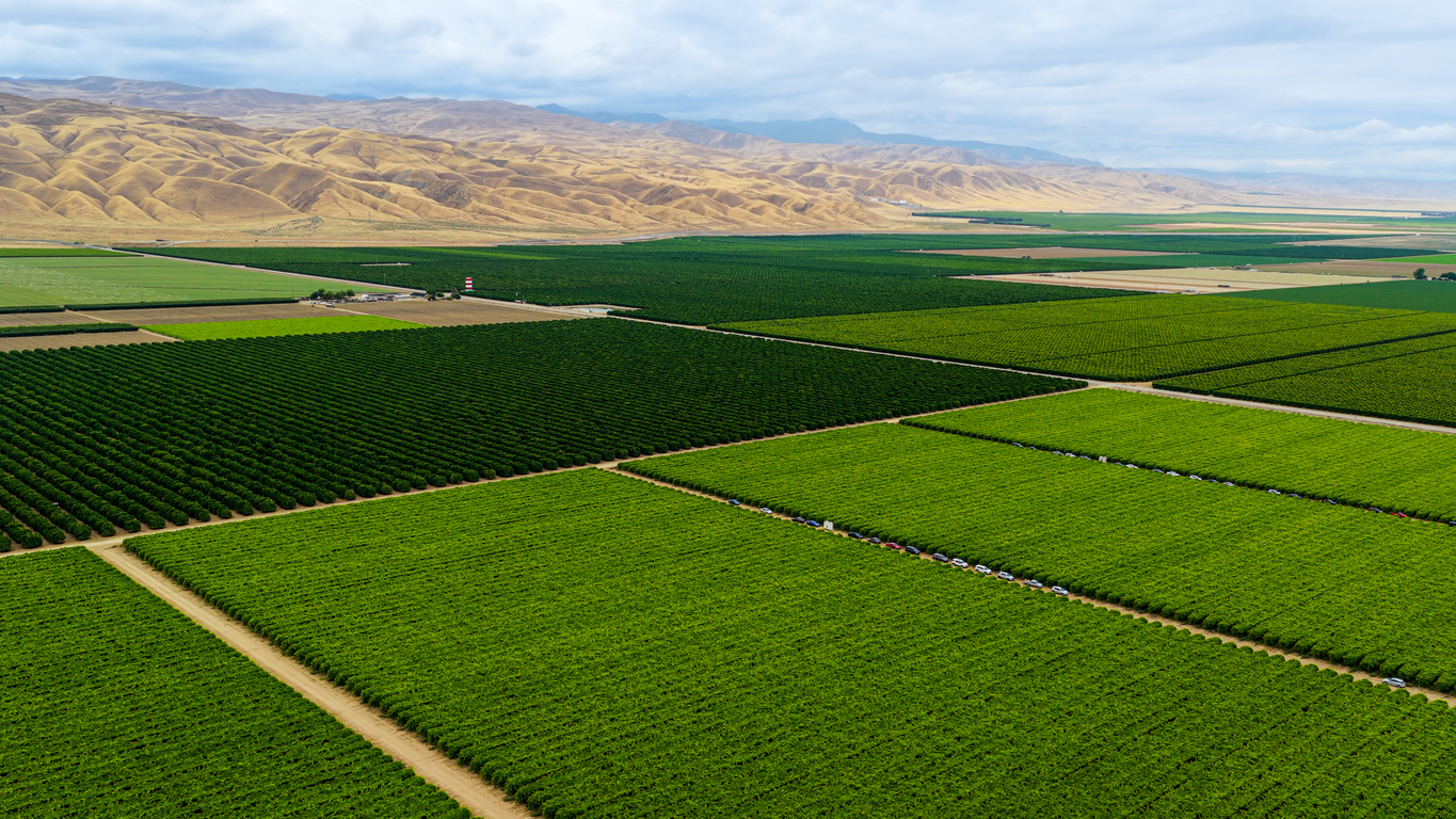 “California’s San Joaquin Valley is home to some of the nation’s most productive farmland. Yet, this agricultural productivity has been achieved through unsustainable groundwater use to support irrigation. The Sustainable Groundwater Management Act (SGMA) seeks to address the negative consequences of groundwater overdraft and requires cutbacks in pumping, most notably in 21 critically overdrafted basins, 11 of which are in the San Joaquin Valley. On the pathway towards groundwater sustainability, concern about disproportionate impacts of pumping cutbacks on smaller and less-resourced farms has prompted a closer look at water resources and vulnerability across farm size. In this paper we use county assessor records and other publicly available data to examine how characteristics such as surface water availability, crop type, and economic productivity intersect with farm size in the San Joaquin Valley. We found that small farms (less than 100 acres) make up about three-quarters of farms by count, yet only about 15% by acreage. Medium (100–499 acres) and large (500+ acres) farms had high proportions of field and grain crops, corn, and processing vegetables, while small farms grew more tree crops, vineyards, and irrigated pasture. Notably, small farms tended to be located in areas with higher-than-average surface water availability, with about 30% more deliveries per acre on average compared to areas where large farms were located. Lastly, we examined the potential local water supply impacts of providing preferential groundwater allocations to rural water systems and small farms. While smaller farms face poor inclusion in SGMA planning and implementation efforts, we identify several characteristics that may help them adapt. … ” Read this research article from UC Ag and Natural Resources.
Western water shortages spark a new interstate battle
“Downstream Missouri River states have worried for decades about receiving an insufficient flow of water from upstream dams. Now they’re worried their share of water could be further diminished by potential pipelines for dry Western states. The concern is the basis of a dispute about the U.S. House version of the federal Water Resources Development Act. A provision in the bill would require approval from all governors in Missouri River states to study or construct a project that moves water from the river or its tributaries to a non-Missouri River state. The bill has passed the House and awaits action in the Senate, where a Senate version of the legislation lacks the controversial provision. The House bill’s definition of “Missouri River states” includes not only the seven states where the river flows — Montana, North Dakota, South Dakota, Nebraska, Iowa, Kansas and Missouri — but also Colorado, Minnesota and Wyoming, which have land within the river’s 530,000-square-mile drainage basin. … ” Read more from Governing.
California’s ‘unrecognizable’ water plan may go down the drain
“Four years ago, California Gov. Gavin Newsom reached a deal with the most powerful water suppliers in the state to overhaul how cities and farms take water from the Sacramento-San Joaquin Delta, which is in “the throes of collapse,” Rachel Becker writes for Cal Matters. After years of regulatory processes, the State Water Resources Control Board has approved Newsom’s plan — but some water agencies are balking, saying the plan has become “unrecognizable.” Now, state water regulators must contend with how to move forward with the plan without the support of these major water users. … The federal government is also reporting serious concerns with the near-final draft of the plan, saying it reflects executive and regulatory overreach. The Trump administration is threatening to pull out entirely, and take $740 million in federal funding with it, which is meant to pay for habitat restoration and water purchases. … ” Read more from Planetizen.
SEE ALSO: California adopts new plan to protect Bay-Delta water, from Western Water
Blog: Who gets the water when nobody posts a price
“Is it ethical to price water? Won’t markets favor whoever has the most money? Anyone working on water markets hears some version of this early, and it bundles two worries. The first is about pricing at all: water is essential, arguably a human right, so why should it go to whoever pays most? The second is about what prices do once they exist. A market could pull water toward big agriculture, corporations, and wealthy cities, away from small farms, rural towns, and rivers, and invite speculation and hoarding along the way. Both worries are fair, and how someone answers them says a lot about whether they’ve thought hard about water or only about markets. … ” Read more from Bilen Essayas.
Snowstorms dropping microplastics on remote parts of the Sierra Nevada
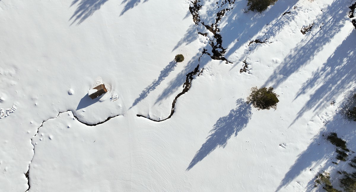
“Researchers have found that snowstorms are delivering vast numbers of tiny plastic particles to remote reaches of California’s Sierra Nevada mountains. Snowmelt is a major source of fresh water for the state. As plastic goods, synthetic fibers, and car tires wear down, they shed microplastics, which can be gathered up by the wind and become suspended in the air. When snowflakes descend, they collect some of these particles and carry them to the ground. Prior research found microplastics in snow in the Mountain West. The new study showed the contributions of individual storms. In remote parts of the Sierra Nevada, researchers found that snowfall delivered as many as 3,200 plastic particles per square meter per day. Still, the total amount of plastic is tiny — less than a tenth of an ounce per acre per day, researchers found. … ” Read more from Yale e360.
How crushed shells protect against ocean acidification
 “New research from the University of California, Davis reveals why adding crushed shells to beach sand helps protect shell-making animals — such as clams, oysters and mussels — from the detrimental effects of ocean acidification. In a study appearing in Biogeosciences, the researchers designed an experiment at the UC Davis Bodega Marine Laboratory in which they mixed crushed shells, or shell hash, into sand where baby Pacific littleneck clams burrowed and grew. They then monitored the clams’ growth and the water’s chemistry over a 90-day period. Adding shell hash, the researchers found, altered the chemistry of the water that fills the tiny spaces between sand particles, decreasing its overall acidity and creating a better environment for shell growth. “We found that, on average, clams grew larger shells when shell hash was present in their treatment,” said study first author Hannah Kempf, an environmental scientist at the California State Water Board who graduated from UC Davis with a Ph.D. in earth and planetary sciences in 2024. “Interestingly, we also found that, on a genetic level, the ‘acidification’ signal was dramatically minimized when shell hash was present.” … ” Read more from UC Davis.
San Onofre’s nuclear waste is stored on the beach: Will another community agree to take it?
“If Rep. Mike Levin’s proposal moves forward, the spent nuclear fuel stashed on the beach at San Onofre will be stored and processed at one of several potential campuses in other states. Levin, a Democratic congress member representing parts of San Diego and Orange County, discussed his plan from a point above the San Onofre Nuclear Generating Station last week. “Since I’ve been in Congress, getting this spent nuclear fuel off our coast has been one of my top priorities,” Levin said, overlooking the Pacific Ocean and the steel and concrete canisters housing nuclear fuel rods. “I have been in this fight for eight years, fighting the status quo of inaction on spent nuclear fuel.” He’s pushing to create facilities called Nuclear Lifecycle Innovation Campuses in communities that want to recycle some of the spent fuel and store remaining waste, in exchange for economic development opportunities. … ” Read more from Cal Matters.
How Prop. 45 could reshape California’s fight over data centers
“Prop. 45, billed as a pro-housing development measure, may have the unintended consequence of making it easier to build data centers, opponents say. California voters considering Proposition 45 will decide the fate of a sweeping infrastructure measure that opponents warn could render the state’s brand-new data center laws virtually toothless. That would make it far easier for developers to force unwanted facilities into local communities, potentially undermining a growing wave of bans, moratoriums, and anti-data-center resolutions at the city and county level. Data center backers insist the ballot measure will do nothing for them — even as some data center beneficiaries are spending big backing Prop. 45. … ” Read more from Jefferson Public Radio.
In commentary today …
Worried about the water impacts of data centers? Vote No on Proposition 45
Kelly Shannon McNeill, Managing Director of LA Waterkeeper, writes, “In September, a judge in Imperial County halted the state’s largest data center proposed to date because its environmental and public health impacts were not adequately analyzed. Earlier this year, voters in Monterey Park banned them outright, a first for any US city. LA County paused the development of large scale data centers in the unincorporated areas and the LA City Council is weighing zoning safeguards to protect clean air, clean water, and communities. Californians are right to ask hard questions about who pays, and who profits, when a thirsty industry moves in. The good news: Governor Newsom recently signed a package of seven bills designed to place guardrails around data center development in the Golden State. The bad news? The critical environmental and community protections established by one of those bills would be wiped out if voters approve Proposition 45 this November. The way Proposition 45 is written, it supersedes any conflicting laws on the books. … ” Read more from the LA Waterkeeper.
In regional water news and commentary today …
NORTH COAST
Seabirds and mammals pack Shelter Cove’s surf as an extraordinary ocean feast unfolds
“Wings fill the air, long bills crowd the water and breaking waves roll through a gathering of pelicans so thick that, in places, the ocean nearly disappears beneath them. As the week begins Monday, November 2, Local naturalist Kyle Keegan’s images offer a remarkable look at a feeding spectacle unfolding at Shelter Cove in Southern Humboldt County, where seabirds and marine mammals have gathered around an abundance of small fish near shore. Brown pelicans pack narrow channels between the rocks. Others spread their wings above the foam or float shoulder to shoulder in turquoise water. Beyond the crowded shallows, Keegan reports still more activity. “Brown Pelicans, Pelagic Cormorants, several species of gulls, Sea Lions and Harbor Seals can be seen feasting on the abundance of baitfish,” he wrote. … ” Check it out at the Redheaded Blackbelt.
SIERRA NEVADA
Life in the burn scar
Jane Braxton Little writes, “Dawn breaks with a piercing mechanical whine from the ridge above my house in the Plumas forest. The screech intensifies to ear-splitting squeal, then back to screech. Someone is feeding small trees and brush into a pickup-size chipper, spewing chunks and splinters onto a hillside where they are less likely to carry a blaze. I relax. This sound signifies safety. In the five years since the Dixie Fire raced up the Feather River Canyon, some 80 miles northwest of Lake Tahoe, all of us who live within its charred swath have become used to these raucous intrusions. If they startle the white-headed woodpeckers from our backyard feeders, the deer from their quiet browse, we accept the short-term disturbance for the long-term protection. … ” Read more from Bay Nature.
Lahontan Water Board secures $4.1M to protect drinking water in South Lake Tahoe
“The Lahontan Regional Water Quality Control Board announced a proposed settlement that would protect drinking water supplies in South Lake Tahoe from a toxic groundwater plume linked to a former dry-cleaning site. The proposed settlement would require Seven Springs Limited Partnership and Fox Capital Management Corporation, the former and current owners of the property, to provide treatment for municipal drinking water wells and address pollution affecting the Tahoe Valley South Subbasin for a period of 59 years. The contamination, primarily from tetrachloroethylene (PCE), originated from dry-cleaning activities at the property between 1972 and 1979 that formed a regional groundwater plume. The plume extended from the State Route 89 and U.S. Route 50 junction toward the Tahoe Keys and has contaminated wells used by two local drinking water providers. To ensure residents receive safe drinking water, the providers and the board have worked together to either treat the wells contaminated with PCE or close them. … ” Read more from the Tahoe Daily Tribune.
Hop springs eternal: Yellow-legged frogs and their path to recovery
“Above California’s Central Valley, the crisp waters of the Sierra Nevada are home to two imperiled frog species, the Sierra Nevada yellow-legged frog (SNYLF, Rana sierrae) and the mountain yellow-legged frog (MYLF, Rana muscosa). Once among the most abundant amphibians in the area, these species have experienced rapid population declines in recent years. Historically, both of these species fell under the name Rana muscosa. Not until 2007 did researchers determine that the SNYLF and MYLF were distinct species, based on differences in genetics, morphology, geography, and vocalizations. They are closely related to another California species, the foothill yellow-legged frog (FYLF, Rana boylii), found at lower elevations. Despite taxonomic differences, California’s yellow-legged frogs share a close dependence on aquatic habitats and adaptations suited to the waterways where they live. … ” Read more from FishBio.
BAY AREA
Rain is headed for the Bay Area on Election Day. Here’s when the heaviest showers hit
“Better pack an umbrella and a raincoat if you are heading to the polls Tuesday. Better yet, try to get to an early voting center or ballot drop box Monday if you can. Rain will make for a wet Election Day across the Bay Area. It looks like an on-and-off event throughout the day, with a few heightened periods of moderate to maybe even heavy showers. The wettest region will be in the North Bay, where 0.25 to 0.50 of an inch of rain is expected by Tuesday night. San Francisco, Oakland and the bayside communities will probably see around 0.25 of an inch, with closer to a tenth of an inch in San Jose and the Santa Clara Valley. … ” Read more from the San Francisco Chronicle.
Days of flooding in Marin foreshadow holiday surge
“Peter Hogg eyed the lengthy 2-foot-wide orange inflatable tube that held back the highest tide of October at the entrance to the Greenbrae Boardwalk. Hogg, an engineer and county Flood Zone 9 Advisory Board member who lives in the neighborhood, has been setting up the flood barrier for 15 years. On Wednesday, as tides reached 8 feet above sea level, a foot-deep pool blocked the boardwalk’s front steps. But the rubber tube protected a nearby mobile home park. … October tides crested higher and reached farther into low-lying areas than the prior month. The surge tested defenses and previewed impacts from even higher tides expected during Thanksgiving and Christmas weeks, according to the National Oceanic and Atmospheric Administration. … ” Read more from the Marin Independent Journal.
CENTRAL COAST
Farmers near Salinas River brace for wet winter
“Along the Salinas River, some farmers are bracing for the worst as daily headlines across California light up with threats of a strong El Niño. But in preparing for the foretold flood, some say their hands are tied with government permitting meant to protect the natural ecosystem of the river. Flood anxiety is nothing new, but with damage still fresh from destructive inundation in 2023, farmers are weighing the costs of growing alongside the river. Many are questioning how many more rounds they can take. Jynel Gularte – fifth generation in Salinas Valley agriculture – is one of those farmers and an outspoken critic of Salinas River management after high waters slammed her family’s farm in 2023. … ” Read more from the Monterey Herald.
EASTERN SIERRA
Saving Mono Lake was a California victory. But it still needs water.
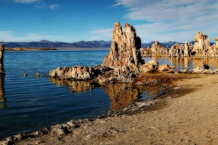 “David Gaines was a young research assistant at Stanford University when he showed up at Mono Lake in 1976 with a dozen undergraduate science students and set up camp. The group had a grant from the National Science Foundation to study the lake and its ecology. They rode 10-speed bicycles around the lake, disappearing for days to observe swarms of birds that were migrating south from the Arctic, or analyze the effects of salinity on the trillions of brine shrimp that are endemic to Mono Lake. Gaines spent the summer observing this strange and fascinating place in the Eastern Sierra with the student scientists, and he fell in love with it. Mono Lake is one of a handful of saline lakes in the Great Basin. It’s located east of Yosemite National Park, where the Sierra Nevada’s escarpment rolls away into the high desert. The lake is shaped like an amoeba with two islands, Paoha and Negit, and a scattering of islets along its shore. Fossilized springs called tufas rise out of the water. … ” Read more from SF Gate.
SOUTHERN CALIFORNIA
LA County reaches coastal flooding record in 100-year recorded history
“Los Angeles has faced more coastal flooding days in 2026 than in its recorded history over the last 100 years, according to NOAA data, since the city’s tide gauge was installed in 1923. So far in 2026, LA has experienced 12 recorded flooding days. The most in the city’s 100-year history before that was in 1983, which saw nine flooding days. Karen Kavanaugh, a NOAA oceanographer, says the agency’s current data online has not yet factored in October 2026 flooding days, so, she says, the 2026 totals are on track to far surpass previous years with high flooding counts. … ” Read more from CBS LA.
Newport Beach’s recent flooding wasn’t the first time — and likely not the last
“The seawater filling the streets, homes and businesses in recent days in Newport Beach brought back a flood of memories. Longtime Newport Beach resident Christine Donovan still remembers the El Niño-fueled flood of 1983, more than 40 years ago when she was in eighth grade, and the sight of salt water filling up the bottom of her school bus. “It’s been a long time since I’ve seen it like this,” the now-real estate broker said on a recent day, watching as the Newport Harbor flowed like a babbling creek into the streets. “We were literally driving down the Peninsula and water was rolling down the aisle in the bus.” Some say they never dreamed the flooding filling streets both from both the beach and the bay in the last month could happen. Others remember days of yesteryear, when similar scenes unfolded: water rising to car doors, soaking living rooms and garages, and always a few who take to the watery roads aboard surfboards or kayaks to bring a lighthearted take on the odd sight. … ” Read more from the OC Register.
SAN DIEGO
El Niño rains increase flood risk at Lake Hodges, home of California’s most dangerous dam
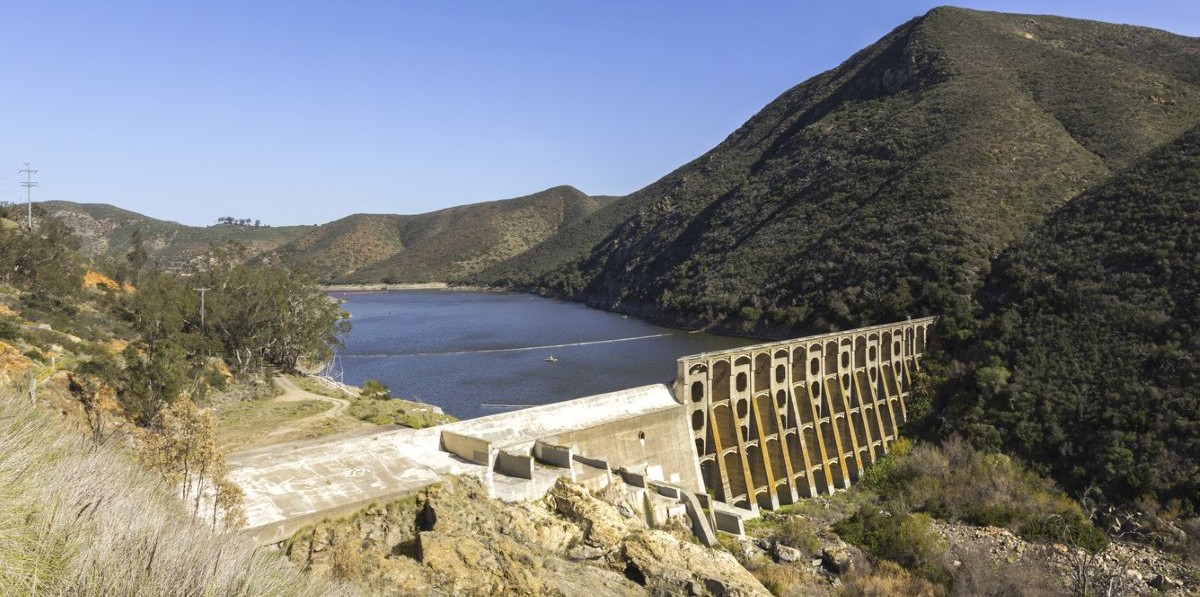
“San Diego’s Lake Hodges already has an “extremely high” flood risk. Regulators fear a dam breach would cause “considerable loss of human life” where more than 1,000 people live. But as El Niño threatens torrential rain this winter, the downstream danger could be even greater. An October state audit painted a bleak picture of California’s dams ahead of expected heavy rain this winter, and called on the Legislature to increase the state Department of Water Resources’ enforcement authority and require new emergency action plans from dam owners. The 108-year-old Lake Hodges Dam in northeastern San Diego County is the most at-risk among more than 1,200 monitored by the California Department of Water Resources’ Division of Safety of Dams. It is the only one labeled “unsatisfactory,” meaning it requires immediate or emergency action. … ” Read more from iNewsSource.
Along the Colorado River …
Arizona water agencies are in court over the Colorado River. What comes next?
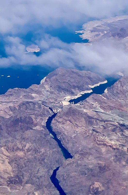 “Arizona is turning up the heat on a new federal plan for managing the Colorado River. Major cutbacks are coming for the state’s water supply. Top water officials say the cuts are unfair and illegal. Now, they’re taking that argument to court. The Arizona Department of Water Resources filed a motion to intervene in Nevada’s lawsuit against the federal government. The Central Arizona Project — which operates a 336-mile canal system that carries Colorado River Water to the Phoenix and Tucson areas — did the same less than two weeks later. The legal moves represent an escalation in a contentious, yearslong saga over how to respond to increasingly dry conditions along a river that supplies nearly 40 million people across seven Western states. Drought and climate change mean the river carries less water than it used to, but policymakers disagree on who should have to take less water out. … ” Read more from KJZZ.
On the Colorado River, will carrots or sticks make Arizonans conserve?
“In the United States, getting non-Indigenous communities to participate in environmental stewardship has often been a game of carrots versus sticks. But decades-long declines on the Colorado River related to overuse and climate drying may be reshaping cultural appetites for the management of change. In a recent interview with The Arizona Republic, former Arizona Gov. Bruce Babbitt – who guided foundational water policy in the state before implementing new directions in Colorado River management at the federal level as Bill Clinton’s Secretary of the Interior – argued that big-stick control of this vital western waterway is long overdue. “The future doesn’t have to be determined by the past,” Babbitt said. “When the pie was expanding, it was easy to slice it. The pie has now been shrinking and the states have been unable to divide it. My contention is that the federal government has unused authority here.” … ” Read more from the Sacramento Bee.
Decades-old dam explosives found in boreholes close popular Lake Powell site
“A popular recreation spot at Lake Powell is temporarily closed after crews discovered decades-old explosives left over from the construction of the Glen Canyon Dam. The National Park Service closed Chains Road and The Chains day-use area, located just north of the dam, out of an abundance of caution on Friday morning. Officials say detonation cords were found inside several boreholes along a nearby restricted service road that leads directly to the dam. That road is not public. A bomb squad inspected the site and confirmed the materials date back to the dam’s original construction in the 1950s and 1960s. … ” Read more from Arizona Family.