
Several news sources featured in the Daily Digest may limit the number of articles you can access without a subscription. However, gift articles and open-access links are provided when available. For more open access California water news articles, explore the main page at MavensNotebook.com.
On the calendar today …
- WEBINAR: Tribal Sovereignty in the Colorado River Basin & Beyond from 12pm to 1pm. The 30 Tribal Nations in the Colorado River Basin are sovereigns. What does that mean? Roughly two years in the making, a recently released, collaboratively authored policy brief from the Water & Tribes Initiative (WTI), Tribal Sovereignty in the Colorado River Basin and Beyond, addresses this fundamental question. Framed around the WTI policy brief, this WRRC Water Webinar will offer an historical perspective on Tribal sovereignty within the United States; delve into foundational principles of modern Tribal sovereignty; and examine Tribal sovereignty in practice, both internal governance and intergovernmental relations, with special emphasis on the 30 Colorado River Basin Tribes. Animating the webinar (and policy brief) is the view that greater understanding of Tribal sovereignty is much needed across the basin community. In light of the climate crisis and its profound impacts on the basin’s hydrology (i.e., aridification), this understanding is indispensable to developing and implementing the cooperative measures required now and in the future to sustainably manage the Colorado River. Click here to register.
In California water news today …
CV-SALTS maps a path toward long-term salinity management
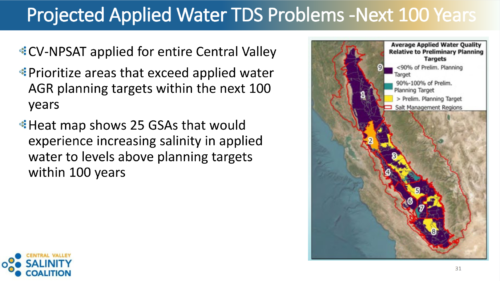 “Salinity is already affecting the Central Valley’s water supplies, agricultural lands, and communities. It has forced the retirement of hundreds of thousands of acres in the Westlands Water District and other areas. In the Tulare Lake Basin, farmers have relied on active evaporation basins and Integrated Farm Drainage Management Systems to capture and contain saline drainage water. However, these interim measures do not provide a valley-wide solution, and a long-term salinity management plan has yet to be implemented. If left unchecked, salt accumulation could impair millions of acres of productive farmland, reduce food production, and constrain the growth of Central Valley communities. At its October 6 meeting, the State Water Board received an update on efforts to address salinity through CV-SALTS, which includes separate salt and nitrate management programs. The presentation focused on the Salt Control Program, a phased effort to manage salinity impacts in surface water and groundwater. Presenters included Angela Cleaver, Central Valley Water Board program manager for the CV-SALTS Salt Control Program; Rachel Gray, executive director of the Central Valley Salinity Coalition; Tom Grovhoug, technical lead for the Salt Control Program; and David Corey, board chair of the Central Valley Salinity Coalition. … ” Read more from Maven’s Notebook.
Parts of California’s coast are vanishing 70 feet at a time
“California’s iconic seaside cliffs are rapidly crumbling into the sea, according to a new study from UC San Diego. At the Lost Coast Headlands in Humboldt County, researchers found that the cliff top eroded by 22.3 meters, or about 73 feet, per year between 2016 and 2023. Cliffs in Point Reyes National Seashore retreated by 10 meters, or just under 33 feet, per year over that timeframe, according to the study. The four California counties with the greatest amount of coastal cliff erosion measured were Humboldt, San Francisco, San Mateo and Monterey, researchers found. Adam Young, a coastal geomorphologist at the UCSD’s Scripps Institution of Oceanography and a co-author on the study, said a main cause was large landslides in Northern California. In 2024, a landslide at the Lost Coast Headlands disturbed over 1.4 million cubic yards of rock and soil, according to Scripps. “Tall coastal slopes such as those located in Big Sur in Monterey County and the King Range in Humboldt County can increase the potential for large landslides,” Young wrote in an email. … ” Read more from the San Francisco Chronicle. | Read via Yahoo News.
Trump’s cuts have exposed US to ‘cascade’ of El Niño dangers, experts warn
“Sweeping cuts to the premier US climate agency under Donald Trump have severely hampered the country’s capacity to forecast, research and respond to extreme weather events, former government officials and scientists have warned, as the US faces a cascade of hazards fueled by a potentially historic El Niño this winter. From the start of his second term, the president has taken aim at the National Oceanic and Atmospheric Administration (Noaa), slashing staff levels, canceling contracts and grants, and shutting down databases and research laboratories. The agency that has long been considered a global crown jewel in climate science and forecasting, has lost roughly 20% of its staff since January 2025. The National Weather Service, which is housed within Noaa, has also taken a hit. Weather stations have had to delay data collection and cut operating hours, with hundreds of meteorological and other technical positions still vacant across its 122 forecast offices. … ” Read more from The Guardian.
Congressman Tom McClintock discusses forest management, California water and the future of farming
“On a recent episode of the AgNet News Hour, U.S. Representative Tom McClintock, representing California’s 5th Congressional District, returned for Part 2 of his conversation with Nick Papagni. McClintock discussed federal forest management reforms, California’s water challenges and the economic pressures driving residents and businesses out of the state. The program also featured Kyle Kuechel of Syngenta AgriEdge, discussing crop protection developments and the upcoming winter produce season. McClintock highlighted legislation he helped advance to streamline forest thinning projects in the Lake Tahoe Basin. According to McClintock, the changes reduced environmental review timelines from approximately five and a half years to just a few months, allowing more acreage to receive preventative forest treatments. … ” Read more from AgNet West.
Congressmembers Carbajal, Padilla introduce bill to investigate toxic waste dumping off California coast
“New legislation introduced by Representative Salud Carbajal and Senator Alex Padilla is targeting a “forgotten history” off the Southern California coast: decades of dumping toxic industrial waste and pesticide pollution straight into the ocean. This industrial waste — including the toxic pesticide DDT, banned in the United States in 1972 for its severe environmental and health risks — was disposed of in a constellation of ocean dump sites close to the coastline, particularly near Catalina Island and in the San Pedro Basin. The Ocean Protection and DDT Reduction Act would establish a “structured federal study to assess the damage to the local marine ecosystem and develop comprehensive solutions to clean up the waste,” according to Carbajal’s office in a press release. It’s the next chapter in an alarming saga that started with UC Santa Barbara researcher David Valentine’s discovery of eerie barrels on the sea floor, surrounded by shocking amounts of DDT. … ” Read more from the Santa Barbara Independent.
Voluntary agreements: Yes or no?
As the State Water Board moves toward a vote on the Voluntary Agreements, known as the Healthy Rivers and Landscapes Program, Maven’s Notebook will publish commentaries this week examining the many sides of the proposal.
PRO
Healthy Rivers and Landscapes: A healthier future for all of California
Nicole Montna Van Vleck, President and CEO, Montna Farms, writes, “Think about the last time you enjoyed a piece of sushi or took a bite of pizza. The rice wrapped around your favorite sushi roll, the tomato sauce, the cheese, perhaps a few peppers or olives sprinkled on top of that perfect slice. Chances are, you weren’t thinking about the water, the soil, the farms or the people that helped bring those ingredients to your table. And it is highly unlikely you were thinking about the salmon swimming through Northern California’s rivers, the sandhill cranes wading through winter-flooded rice fields or the Giant Garter snakes slipping between the tule brush. But all of these vegetables, grains, people and wildlife are much more interconnected than one might imagine. California’s rivers and landscapes sustain an extraordinary range of life and activity. Water flowing through the Sacramento River Basin helps salmon and other native fish survive, nourishes wetlands along the Pacific Flyway, grows food for families across the country and provides reliable supplies for homes and businesses. The same lands that produce rice, fruits, nuts and vegetables also offer valuable habitat for wildlife. As a third-generation rice farmer in the Sacramento Valley, I’ve seen firsthand how agriculture and nature can thrive together. For nearly a century, my family has grown rice in this region, and over those generations, we’ve learned that our fields can do more than produce food for people. This land can also provide important habitat for fish and wildlife. … ” Continue reading this commentary.
CON
Why Newsom’s Voluntary Agreements Won’t Work, Part 4: The Road Not Taken (Yet)
Gary Bobker, Program Director at Friends of the River, and Eric Buescher, Managing Attorney at San Francisco Baykeeper, writes, “As discussed in the first three parts of this series, the State Water Resources Control Board’s expected decision later this week to adopt the Voluntary Agreement (VA) Program as the central feature of the update of the Bay-Delta Water Quality Control Plan would willfully ignore three uncomfortable facts. The VA Program provides far too little water and habitat to be effective; it is highly unlikely to deliver on its stated purposes; and it was developed through an exclusionary, closed-door process that ignored the interests and expertise of a diverse array of affected California communities. It doesn’t have to be this way. There was another path the Board could have taken – one that the next administration can still pursue to preserve the ecological treasures of our Central Valley rivers and the Bay-Delta estuary and manage our water resources sustainably with an eye toward a future impacted by climate change. … ” Continue reading this commentary.
Two years after Klamath Dam removal, Governor Newsom and California’s actions threaten the river’s recovery
Regina Chichizola, Managing Director, Communities United for Water Protection, writes, “Early this month, we celebrated two years since the Klamath dams came out. Klamath dam removal is an amazing success story and example of how restoration pays off, this time to the tune of 20,000+ salmon going beyond where reservoirs used to fester. Unfortunately, while these salmon were heading upstream, one of the Klamath’s largest tributaries was going dry directly below them. These salmon also may not have made it without intervention on the Trinity River, where blocks of water are regularly released to stop a fish kill, thanks to another big win, the Lower Klamath long term plan. Unfortunately, the Governor’s 1. push to divert more water from rivers, 3, manage river flows through voluntary agreements, and 2. Recent legislative vetoes threaten progress on the Klamath, which is dependent on the health of its tributaries, and the rights of Tribes. The State Water board not acting to protect our tributaries is not helping. … ” Continue reading this commentary.
Baykeeper statement: CA State Water Board poised to adopt deeply flawed Bay-Delta Plan
“This week, the California State Water Resources Control Board (Board) is holding a series of adoption hearings on its revised Bay-Delta Water Quality Control Plan. The Plan is one of the single most important pieces of state water policy, regulating water quality and volume in the Sacramento River, Mokelumne River, and other tributaries as they flow into and through the Delta, to Suisun Marsh, and San Francisco Bay. By law, the Board must adopt and regularly review the Bay-Delta Plan to ensure reasonable protection of fish, wildlife, fisheries, and other specified beneficial uses of water. The last significant update was more than 30 years ago. In that time, water quality and native fish populations have suffered major declines throughout the watershed, leaving the Bay’s ecosystem and communities that depend on healthy waterways in crisis. San Francisco Baykeeper, along with our Tribal, environmental, environmental justice, and fishing partners, have long advocated for the Board to meet its mandate with a protective, science-based update to the Plan. … ” Continue reading this statement.
In regional water news and commentary today …
NORTH COAST
Minor coastal flooding expected this week around Humboldt Bay
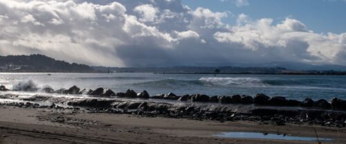
“High astronomical tides this week are likely to result in minor coastal flooding along low-lying areas around the Humboldt Bay, according to the National Weather Service’s Eureka office. “With the full moon, the highs are fairly high this week, but the difference is, with the warm ocean waters and other effects related to the El Niño, they’re running over a foot higher than the astronomical (tides) that you would sort of expect, and so they should be high enough today to cause some minor flooding in King Salmon and the Arcata Bottoms,” Meteorologist Matthew Kidwell told the Times-Standard Monday morning. Kidwell said that tides would likely be slightly higher Tuesday, and will be roughly a foot higher than would otherwise be expected thanks to El Niño. He said that the minor flooding might be a “preview” of flooding later in the year should an unusually high king tide coincide with strong southerly winds — something that happened this year and resulted in record tides and flooding in King Salmon. … ” Read more from the Eureka Times-Standard.
Cal Fire announces new heli-tank to strengthen Shelter Cove wildfire prevention
“Cal Fire and the Shelter Cove Fire Department announced the installation of a new 2,000-gallon heli-tank this week. That tank, installed at the Willow Glenn Landing Zone, will provide “an auxiliary water source for firefighting helicopters responding to wildfires in the Shelter Cove area,” according to a news release published Monday morning. “The 2,000-gallon heli-tank recently installed in Shelter Cove is a game changer when it comes to safeguarding people, property and resources,” said Battalion Chief Owen Head of the Cal Fire Humboldt–Del Norte Unit, in that news release. “Having a dependable water source readily available significantly improves our aerial firefighting capabilities and could make the difference in stopping fires while they’re still small and preventing large destructive wildfires.” The auxiliary dip site will be used by Cal Fire’s Fire Hawk helicopter, “providing another water source when coastal weather, terrain or distance limits access to traditional water sources.” … ” Read more from the Eureka Times-Standard.
Upper Trinity River nears adult fall-run chinook quota; Fishery to close this week
“The 2026 adult Chinook salmon fishing season will soon close on the Upper Trinity River. The closure comes as California Department of Fish and Wildlife (CDFW) projections indicate anglers will have met the Upper Trinity River adult fall-run Chinook salmon quota for the season as of 11:59 p.m. on Wednesday, Oct. 28. At that time, the adult Chinook salmon fishery on the Trinity River from the Old Lewiston Bridge to the Highway 299 West Bridge at Cedar Flat will be closed. This reach will remain open, however, for harvest of 2-year-old jack Chinook salmon (less than or equal to 23 inches). All adult Chinook salmon caught must be immediately released. … ” Read more from the Department of Fish and Wildlife.
SIERRA NEVADA
Plumas County receives six million dollars for wildfire recovery and resilience projects
“Plumas County received $6 million to support wildfire recovery efforts after the 2021 Dixie Fire. The money comes from a legal settlement with Pacific Gas and Electric Company and a PG&E program launched after the fire. District Attorney David Hollister led the negotiations with PG&E. He emphasized the close relationship between Plumas County and the utility. Hollister focused on recovery and cooperation rather than penalties. The settlement directs $1.5 million for public safety infrastructure in Greenville and Chester. Another $1.5 million goes to The Almanor Foundation for economic development and beautification in areas hit by the Dixie Fire. Sierra Buttes Trail Stewardship receives $1 million for rural development and recovery projects. PG&E set aside an additional $2 million for a wildfire resilience fund. This money will remove dead trees and support other fire prevention efforts, working with the Plumas County Firesafe Council. … ” Read more from Sierra News Daily.
2026 Yuba River salmon return numbers so far: Slower start, warmer water, and what it means for recovery
“At SYRCL, we track Chinook salmon returns closely because healthy populations of this keystone species are a key indicator of a thriving river ecosystem. Through SYRCL’s participation in the River Management Team (RMT), our staff receives monthly updates on the number of Chinook and steelhead adults utilizing the fish ladders at Daguerre Point Dam. This information is collected using VAKI River Watcher camera systems installed in the North and South ladders, which snap a photo every time a fish swims past it. 2026 feels like a bit more of a return to previous years in terms of salmon numbers. Excluding the record setting 2025, we’re a little behind the average year-to-date passage number going back to 2018. … ” Read more from the South Yuba River Citizens League.
The Tuolumne River’s $80 million salmon makeover keeps growing
“Salmon habitat and flood protection rarely show up on the same project list, but the latest round of restoration work planned for the Tuolumne River promises both. Three more projects are in the works to benefit Tuolumne salmon, including one that eases flood risk in west Modesto. The river’s major water diverters are getting help on them from River Partners, a nonprofit that has restored floodplains around California. Those diverters are the Modesto Irrigation District, the Turlock Irrigation District and the San Francisco Public Utilities Commission, which together committed $80 million of their own money to habitat work on the lower Tuolumne. River Partners leads the team of biologists and ecologists behind it, and the goal by 2030 is 77 acres of floodplain rearing habitat and roughly 100,000 tons of added gravel. … ” Read more from Active NorCal.
SACRAMENTO VALLEY
El Nino is here, but it’s unclear what that means for the north state
“El Niño conditions have arrived, which could have large impacts on the weather along the Pacific Coast, but how it will affect Northern California depends on a myriad of factors. Katrina Hand, a meteorologist with the National Weather Service’s Sacramento office, said the conditions are creating the potential for a “very strong El Niño.” … Generally speaking, El Niños can create wetter conditions in the southern Pacific up to Southern California while creating drier-than-normal conditions for the Pacific Northwest. That can often leave Northern California up in the air. “For Northern California, historically out of the strong El Niño years we’ve had, it has seen a mix of wet, dry and normal weather,” Hand said. “There’s not a strong correlation.” … ” Read more from the Chico Enterprise-Record.
Rio Linda residents share concerns over how money is spent during water board meeting
“From a nearly $2 million Chromium treatment plant purchase to a closed-session meeting with labor negotiators, it all happened Monday during the Rio Linda Elverta Community Water District board meeting. There was one question on the community’s mind. “Where is the money going?” Rio Linda Resident Stephanie Suela asked. “I’m a money watcher.” That was the biggest concern for locals like Suela, who says she’s been to many meetings over the years. “I have never had my bill $419 until this last time, so I don’t know what’s going on,” she continued. “A lot of people were here complaining that their bills went up another $100 or $50, so I don’t know what’s being finagled.” … ” Read more from CBS Sacramento.
Cosumnes River Preserve: A special place that cranes adore

“It’s dusk on a winter’s day. Coming from the red-rimmed horizon, a primordial trumpeting grows more distinct and louder as the silhouettes of sandhill cranes materialize in undulating waves overhead. The present time, visited by the ancient past. The ducks and geese settled on the marsh for the night and continued dabbling and preening. The ruffled water reflects the dying yellow light stenciled with the incoming flocks of cranes. Long legs pivot forward and down; wings backstroke; the cranes, bugling loudly, land gingerly on mudflats, their momentum carrying them forward one or two prancing hops. Enough light remains for passersby to just discern the pearlescent gray of their plumage and the swatch of red at their crowns. This is the Cosumnes River and its wetlands. … ” Read more from the Marin Independent Journal.
NAPA/SONOMA
A gigantic El Niño is coming. Should California winegrowers be worried?
“Winter and spring storms can bring a deluge of rain to Sonoma County, swallowing vineyards and turning low-lying areas into a network of lakes and ponds. While the sight of a flooded vineyard may be worrisome, the dormant grapevines typically remain unaffected, their roots requiring little oxygen or nutrients while growth is suspended. But what happens if the rain keeps coming? That is the question facing local winegrowers this fall after the National Oceanic and Atmospheric Administration (NOAA) issued a June 11 advisory predicting a potentially record-breaking El Niño in the coming months. El Niño is a naturally occurring climate pattern that develops when ocean temperatures in the central and eastern tropical Pacific rise above normal, influencing weather around the world. … ” Read more from the Santa Rosa Press Democrat.
Napa town famous for wine and restaurants takes drastic action to fix dirty tap water
“The wealthy Wine Country town of St. Helena may finally be solving its decadeslong brown water problem, although the taps may run even dirtier before it’s over. The city of St. Helena, home to Michelin-rated restaurants and some of Napa’s oldest wineries, started flushing 40 miles of water mains this week to address the persistent brown tap water following years of complaints from residents and businesses. St. Helena Public Works Department and contractor Hydrologics began the citywide project on Monday between Zinfandel Lane and Chaix Lane, a a city webpage for the project said. Andrew Bradley, a city spokesperson, confirmed to SFGATE that the city plans to flush out 1 to 1.5 miles of pipes per day and complete the project within 45 to 50 days. The St. Helena City Council approved more than $885,000 for the flushing project earlier this month. … ” Read more from SF Gate.
BAY AREA
Marin County lowers Lake Phoenix to lessen likelihood of winter flooding
“Marin County officials announced last week they’ll begin lowering the water at the Lake Phoenix reservoir to reduce flood risk in San Anselmo and Ross ahead of heavy winter storms. Starting Monday, officials plan on pumping out between 60 and 160 acre-feet of water — roughly 29 to 70 Olympic-size swimming pools — from the lake over the next four to six weeks, said Jessie Underhill, spokesperson for the Marin Municipal Water District. “This effort is being done in advance of the winter,” Underhill said, “to help lower the reservoir level and provide extra room which will help absorb runoff from the first storms of the season.” … ” Read more from KQED.
San Rafael flood berm project lurches forward
“Marin County supervisors have taken new steps to expedite the replacement of a deteriorating flood wall in San Rafael. The 2-mile barrier in the Santa Venetia neighborhood protects about 700 homes. The community has sought to repair or replace the structure, a timber-reinforced berm built on an earthen one, for nearly a decade. The effort has been frustrated by a lack of funds and a failure to secure right-of-way contracts. Much of the levee and berm was built on private property. On Oct. 20, supervisors approved new environmental analysis necessary for the berm replacement and authorized County Executive Derek Johnson or his designee to negotiate, approve and execute right-of-way contracts. … ” Read more from the Marin Independent Journal.
Part of San Francisco just flooded on a sunny day. Here’s what it looked like
“Seawater flooded a portion of San Francisco’s Embarcadero on Monday amid the city’s highest October tide on record — and the waterline will probably go even higher in the next few days. Flooding was most apparent south of the Ferry Building and cut off access to Pier 14. Seawater also rose through a storm drain along the Embarcadero roadway, where Port of San Francisco employees coned off the area. Tides are expected to be even higher Tuesday and Wednesday. In San Francisco, Wednesday’s high tide may be 2.1 feet above normal. King tides the weeks of Thanksgiving and Christmas will be higher and potentially a major disruption if a storm coincides. In Mill Valley on Monday, Caltrans closed an onramp to Highway 101, and KTVU reported closed roads in other parts of the city — including Miller Avenue, where a vehicle appeared to stall in floodwater. … ” Read more from the San Francisco Chronicle. | Read via Yahoo News.
CENTRAL COAST
Cal Am puts Monterey desalination cost at $825 million in CPUC filing
“California American Water (Cal Am) has put the cost of building the desalination facilities of the Monterey Peninsula Water Supply Project at US$825 million. The estimate goes to the California Public Utilities Commission (CPUC), the regulator that sets the utility’s rates, and with it the question of how much of the bill Monterey customers will pay. The company filed the application on 23 October 2026, together with a low-cost financing framework and a proposal for how the plant should be treated in rates, according to Cal Am’s statement. According to Cal Am, lengthy approval and permitting processes and continuous legal challenges since the CPUC’s 2018 authorisation have stretched the project timeline. The company says those delays exposed the plant to rising labour and construction material costs, as well as significant engineering, procurement and legal expenses. … ” Read more from Smart Water Magazine.
SAN JOAQUIN VALLEY
California’s golden mussel invasion sparks increased concerns from Stockton-area leaders
“Invasive golden mussels continue to spread through California waterways, increasing concerns about damage to water infrastructure, threats to agriculture and rising costs for boaters and communities. The issue was the focus of a public discussion Monday in Stockton, where Rep. Josh Harder and Assemblymember Rhodesia Ransom discussed efforts to contain the mussels and limit their spread. Stockton was where golden mussels were first detected in California more than two years ago. “It continues to be where we have the biggest problem with golden mussels across our state,” Harder said. … ” Read more from CBS Sacramento.
California raises mussel fee for boaters as invasive species spreads near Los Banos
“California has increased its mussel prevention fee for recreational boaters from $16 to $42 for a full two-year sticker cycle as officials work to contain invasive golden mussels already detected in waterways near Los Banos. The California State Parks Division of Boating and Waterways announced the increase October 23, with the changes taking effect October 22. Boaters purchasing a sticker in 2026 will pay $21 for the remainder of the current cycle, while those purchasing in 2027 will pay $42 for the next two-year cycle. … ” Read more from the Los Banos Enterprise.
Fifth District holds project to develop new “produced water” injection wells in pre-CEQA oil field operating since 1950’s is not statutorily or categorically exempt
“In an opinion filed on September 17, and later ordered published on October 15, 2026, the Fifth District Court of Appeal reversed a judgment granting a writ of ordinary mandamus ordering the Department of Conservation, Geologic Energy Management Division (“CalGEM”) to issue a Project Approval Letter (“PAL”) to an oil field operator. The plaintiff operator, San Joaquin Facilities Management, Inc. (“SJFM”), had sought approval from CalGEM, the state agency that regulates oil and gas extraction activities, for a project consisting of the drilling and use of up to 12 new water injection wells to dispose of “produced water” in the 11,745-acre Fruitvale Oil Field, an oil and gas field located in unincorporated Kern County and the City of Bakersfield. The Court of Appeal held the trial court erred in finding the injection well project exempt from CEQA as part of an ongoing pre-CEQA private project (CEQA Guidelines, § 15261(b)) and ordering CalGEM to approve it. San Joaquin Facilities Management, Inc. v. Department of Conservation et al. (2026) ___Cal.App.5th___. … ” Read more from Miller Starr Regalia.
SOUTHERN CALIFORNIA
With El Niño bearing down, I got a free LA County engineering assessment at home. What I learned
Erin Stone writes, “A pair of Los Angeles County engineers knocked on my door a couple of weeks ago and handed me a booklet about how to prepare for flooding and mudflows. They also told me they offer free, specific engineering advice for individual properties. I was definitely interested in this — I live in a neighborhood affected by the Eaton Fire, and the house I rent is tucked right against a steep hillside with vegetation that burned. A few days later, two engineers, as well as the county’s public information officer, showed up at my door. … ” Read more from the LAist.
Sepulveda Basin gets $22M for upgrades ahead of 2028 Olympics
“Los Angeles and state officials announced $22 million in new funding for improvements to the Sepulveda Basin over the weekend including upgrades to sports fields, wildfire prevention work and projects aimed at making the sprawling San Fernando Valley recreation area more accessible. Mayor Karen Bass joined state and local lawmakers Saturday to detail how the money will be spent: $8 million for improvements to the Balboa Sports Center, $4 million for the Hjelte Sports Fields and $6 million for transportation and mobility improvements from Lake Balboa across Victory Boulevard to the basin to improve accessibility. Another $4 million will support fire prevention and vegetation management, including $2 million for the Los Angeles Fire Department. … ” Read more from the LA Daily News.
Irvine Lake begins mass draining project for upgrades to 93-year-old reservoir
“Irvine Lake began draining this morning ahead of the El Niño and to upgrade the 93-year-old reservoir. Aside from making room for the upcoming El Niño, the water draining is part of the Irvine Ranch Water District’s $470 million Santiago Creek Dam improvement, which provides drinking and irrigation water to 900,000 customers of the 1.5 million people living in the downstream floodplain. “We need to replace the outlet tower and the spillway completely,” said John Fabris, a spokesperson for Irvine Ranch Water District. “We’re going to bring it up to state-of-the-art in terms of seismic safety.” … ” Read more from CBS News.
El Niño’s record-hot ocean waters driving coastal flooding in Southern California
“Unprecedented flooding is quickly becoming a fact of life in some Southern California coastal communities. On Monday morning, high tide brought water pouring into business districts in Newport Beach and flooded part of Pacific Coast Highway in Sunset Beach. Sea water levels reached an all-time record high in San Pedro, topping 8 feet. Conditions are expected to get worse Tuesday. What’s going on? After all, Southern California has endured El Niños before, as well as unusually high tides. The difference, scientists say, comes to how hot the ocean waters have been. Hot water takes up more room than colder water, causing sea levels to rise. This week — even without any former hurricanes in the Pacific Ocean to send swells to the California coast — maximum sea levels recorded at high tide are now nearly 2 feet higher than what would be expected from just astronomical forces that bring us high tides. … ” Read more from the LA Times. | Read via Yahoo News.
PCH to close in HB at 8 a.m. ahead of today’s peak in string of mega high tides hitting region
“Pacific Coast Highway is set to close between Warner Avenue and Anderson Street at 8 a.m. today, Oct. 27, as the string of high tides peaks around 9:45 a.m. The city of Huntington Beach announced the closure Monday after ocean water flooded the section and forced the northbound lanes to be taken offline. Today’s announced closure in both directions is until noon. “The closure will also allow city personnel, public safety agencies, and Caltrans to respond safely to conditions and complete necessary work,” city officials said. It’s like trying to figure out a puzzle. Where are the vulnerable, low-lying areas where water might spill over from the harbors and into the streets? How can crews keep the high tides from damaging homes, cars and roadways when the ocean levels rise? … ” Read more from the OC Register.
High tides flood streets, businesses in Newport Beach and Long Beach
“High tides moved into Southern California coastal communities Monday morning, flooding streets and businesses in areas that have already been battered over the past few months. The high tides, which are expected to remain through Thursday, are expected to break records, raising the threat of flooding, beach erosion and property damage. Morning tides rolled in around 9 a.m., creeping onto streets in Newport Beach and flooding some businesses. AIR7 was over the area as the water moved in, forcing cars and people to trudge through the floodwaters. The Balboa Fun Zone saw the brunt of the flooding, despite sandbags that were placed in the area ahead of the high tide. The water came in from the bay side of the peninsula, which signifies that sand berms erected on the ocean side of the peninsula kept even more water from coming in. … ” Read more from Channel 7.
SEE ALSO:
- SoCal coast hit by widespread flooding as record-breaking tides move in, from the LA Times via MSN News
- Newport Beach sees some flooding, PCH northbound in Huntington Beach closed during high tide, from the OC Register
Warm-water orcas spend past week hunting off Southern California
“Three different pods of Eastern Tropical Pacific orcas were spotted off Southern California’s coastline over the weekend, from Palos Verdes down to San Diego, a species typically found further south in warmer water climates. Newport Coastal Adventures crews came upon a pod of the killer whales rarely documented off California about a mile from Laguna Beach early Saturday morning, Oct. 24, including a large male thought to be more than 60 years old called Cuitláhuac. He is commonly seen in the warmer waters of the Gulf of California. “This is the first time I’ve seen this pod and they sure were amazing to see, very friendly toward boats as long as they were given respect,” said Mark Girardeau, a photographer for Newport Coastal Adventure, noting there were 15 confirmed orcas, but possibly 20, in the pod on Saturday. … ” Read more from the OC Register.
Big Bear Lake’s $88.6M plan to stop flushing water down to the desert
“In 1884, a group of ranchers from Redlands rode up over 5,000 feet of elevation into the mountains to their north, where they built a rock dam to collect water for agriculture. It was an ambitious feat — at the time, the reservoir was the largest artificial lake in the world — that forever reshaped the green valley that once teemed with grizzly bears. Big Bear is now in many ways defined by that lake, which provides a backdrop for the four-season tourist destination, from winter skiers and snowboarders to summer boaters and hikers. But in recent years, the lake has been plagued by drought-fueled low water levels, followed by short recovery stints after heavy winter storms, making it a prime example of the climate change-fueled whiplash that’s being experienced across California. Meanwhile, the communities that have popped up around Big Bear Lake — filled with year-round residents who keep the businesses running and the community functioning — are staring down an uncertain water future. … ” Read more from SF Gate.
SAN DIEGO
Major coastal flooding hits Mission Beach
“Major flooding hit Mission Beach on Monday morning as some of the highest tides recorded in recent memory struck San Diego’s coast — and the National Weather Service says more flooding could be on the way. The tide in La Jolla reached nearly 8 feet Monday morning, according to the National Weather Service. A coastal flood warning is in effect, with more high tides expected through Wednesday. Right where the sand berm breached Monday morning, water poured onto the sidewalk and right up to people’s front doors. Residents told me they feel this could have been avoided if the berm had been built higher. Debbilyn Kovalik got the call from neighbors Monday morning that the sand berm in Mission Beach broke, sending water from the ocean rushing onto the sidewalk and into her home. When I walked inside with her, the water sloshed beneath our feet. “It came up to here, and right in the sliding glass door, there’s water all the way through,” Kovalik said. … ” Read more from Channel 10.
Along the Colorado River …
As Arizona joins Nevada’s Colorado River lawsuit, Imperial Valley farmers watch the water war intensify
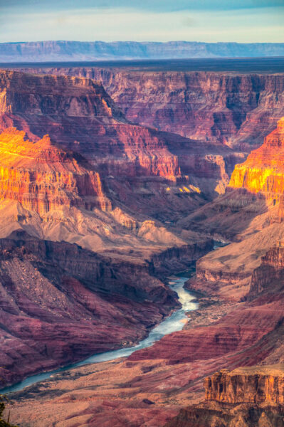
“While lawyers for Arizona and Nevada square off against the federal government in a Las Vegas federal courtroom, Imperial Valley farmers are already calculating how much less water the All-American Canal will deliver to their fields. Nevada sued the Interior Department and Bureau of Reclamation in late August, challenging the agency’s post-2026 operating guidelines for Lake Powell and Lake Mead. Last week Arizona moved to intervene as a plaintiff, arguing that the same plan — which locks in steep cuts for the Lower Basin states of Arizona, California, and Nevada — threatens its unique interests even more acutely. In its motion, Arizona told the court its interests are “unique” and that it cannot entrust them to “another State that has sued to protect its own unique, state-specific interests.” The filing, submitted by the Arizona Department of Water Resources, seeks to join Nevada’s Administrative Procedure Act challenge to the Final Environmental Impact Statement, Record of Decision, and 2027-2028 guidelines that Reclamation issued in July and August. … ” Read more from the Desert Review.
Arizona lawmaker challenges “manageable” water cut assessment
“Arizona Congressman Paul Gosar has invited U.S. Interior Secretary Doug Burgum to visit Arizona and take part in a flyover tour of the Colorado River system, arguing that the impacts of proposed federal water reductions are best understood by seeing conditions on the ground firsthand. The October 23, 2026 invitation followed comments Burgum made during an interview with KOLD News 13, where he described Arizona’s anticipated water reductions as “completely manageable.” In a letter dated October 23, 2026, Gosar disagreed with that assessment. “Respectfully, what may look manageable in a Washington briefing room looks very different on the ground in Arizona,” Gosar said in a news release issued the same day. … ” Read more from Western Water.
Did Arizona escalate a water war? Time will tell
Joanna Allhands writes, “When Arizona filed a motion to join Nevada’s Colorado River lawsuit, you could hear the collective gasp across the river basin. Here comes the water war, the headlines screamed — the point where any hope for the river’s recovery ends. But is that where we’re headed? To a future of protecting our own interests, at great cost and with little to show for it in the end? The next few weeks will be telling. Many legal experts believe a judge will allow Arizona to get involved, though that’s not official yet. Both states are asking a district court to throw out the federal government’s 10-year plan to manage the dwindling river. They contend that the plan not only fails to adequately quantify the impacts of its deepest cuts, but that it also defies a century’s worth of law, court rulings and treaties. For now, this is a lower court fight — and a rather limited one, at that. … ” Read more from the Arizona Farm Bureau.
Arizona senator proposes new commission to address Colorado River water cuts
“A state lawmaker is proposing the creation of a new commission to address the water crisis. State Senator Tim Dunn (R-LD25) announced the proposed commission in a Monday press release in which he also urged for the passage of HR 10420, legislation from Rep. Andy Biggs (R-AZ-05) that Dunn helped to craft. Dunn said that he is drafting the legislation to create the Arizona Colorado River Commission. Arizona is the only Lower Basin state in the Colorado River Basin without a state-level commission dedicated to handling the state’s water allotment. Dunn says a commission will strengthen the state’s position at the bargaining table when it comes to water rights. The Colorado River Basin has reached historically low levels, forcing the federal government to proceed with water cuts across the seven western states relying on the supply. … ” Read more from Arizona Free News.
Arizona’s San Simon Valley sinks nearly 7 feet as over 150 well applications pile up
“Arizona’s San Simon Valley is facing a new surge in groundwater drilling roughly a decade after residents first asked the state to slow agricultural expansion. State records analyzed by AZCIR show 154 applications for high-capacity wells in the San Simon Valley since 2015. A report by the Arizona Department of Water Resources’ chief hydrologist said some ground above the already overdrawn aquifer has sunk by nearly seven feet. After the jump in large-well filings, farmers in the area are once again seeking state protection for the San Simon sub-basin, according to AZCIR. State estimates put the sub-basin’s annual groundwater loss at about 50,000 acre-feet beyond what nature replaces — enough water to supply roughly 150,000 Arizona homes for a year. Once ADWR acknowledged the petition in September, farmland that had gone without irrigation for five years became temporarily off-limits to new irrigation. The petition seeks an Irrigation Non-Expansion Area, or INA, which could permanently bar irrigation on newly developed farmland in the region. … ” Read more from The Cool Down.
Phoenix water bills are some of the lowest in the U.S. Here’s what makes that possible
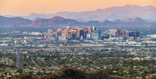
“Even though Arizona’s water supplies are down, water bills in most cities have stayed relatively low. A new study found that water rates in Arizona have increased over the past decade, but many utilities in the Phoenix area have kept costs below the national median. Of the 500 utilities included in the study, Phoenix’s water bills were the third cheapest, averaging $151.83 per year. The study was conducted by the nonprofit Food & Water Watch. Other Valley cities — Tempe, Scottsdale and Chandler — landed in the bottom fifth of those rankings. Mesa and the private utilities EPCOR and Arizona Water Company were near the middle of the pack. Gilbert and Tucson had the highest water bills of the dozen Arizona utilities included, with Gilbert’s $658.50 typical annual water bill topping that group and landing as the 121st most-expensive nationwide. … ” Read more from KJZZ.
Heavy rain boosts Colorado River in Grand Canyon to highest water level of 2026
“After an epically dry winter and a tense summer for the Colorado River, the autumn has delivered a rare boost to one of its most iconic stretches. In recent days, heavy rains pushed Colorado River flows through the Grand Canyon to their highest levels in years. The rains, which also caused flooding and destruction in communities throughout the Four Corners region, provided a crucial slug of water to the Grand Canyon’s unique ecosystems. River scientists are still gathering precise information about the exact volume of water surging through the river, but experts estimate flows reached at least 21,000 cubic feet per second. According to the U.S. Geological Survey’s measuring station above Diamond Creek, that marks the highest rate of flow since April 2023, when water managers deliberately sent a massive, sudden burst of water through the canyon. … ” Read more from KJZZ.
Utah’s urban residents rely on Colorado River water. Here’s how it gets there.
“A massive concrete wall rises 200-feet above a trickling creek where Duchesne County’s tan plateaus transform into green forested slopes. Behind it, snowmelt from the Uinta Mountains pools into a dark blue reservoir, water lapping on red rock shores. At just over 8,000 feet in elevation, the Upper Stillwater Dam marks the start of the Central Utah Project, which conveys water from the Colorado River Basin to the Great Basin where around 90% of Utahns live. “It’s the crown jewel of the Central Utah Project,” Dylan Dastrup, Stillwater area manager with the Central Utah Water Conservancy District, said as he pointed to the grey wall. The district maintains and operates the project facilities, which are owned by the federal government. From Upper Stillwater, a drop of water, which otherwise would flow to the Duchesne River, then the Green River before meeting the Colorado, begins a journey west. It does that thanks to decades of engineering and over 100 miles of tunnels, pipelines and diversions that carry the water to the state’s biggest cities. After a pit stop at Strawberry Reservoir, it cuts through the mountains and flows into pipelines that deliver water to farms, lawns and taps across the Wasatch Front. Some of that water even makes it as far as the Salt Lake City International Airport. … ” Read more from The Water Desk.
Heavy rain in southeast Utah has prompted a rise in Lake Powell’s water level. Here’s how much.
“Heavy rain that caused flooding last week in the Four Corners area of Utah, Colorado and New Mexico has had what water experts say is a beneficial side effect: A marked rise in the water level of Lake Powell. Saturday’s daily measurement of Lake Powell’s level was at 3,526.1 feet above sea level — which is 1.1 feet above the level the day before, and 7.1 feet above where the lake was two weeks ago, according to the Lake Powell Water Database. It’s also 9.5 feet above the lake’s lowest point on Sept. 15. “That’s phenomenal this time of year,” Gene Shawcroft, chair of the Colorado River Authority of Utah, said Sunday. … ” Read more from the Salt Lake Tribune.
Going up: Water level at Lake Powell rises after recent rainstorms
“Lake Powell is experiencing a sudden reversal in its water level fortunes, thanks to rainstorms that have pounded the region in the past week. The water level at the United States’ second-largest reservoir has risen to 3,529 feet, about 10 feet above its record low of 3,519 feet above sea level, which was recorded in August, the National Weather Service office in Salt Lake City reported Sunday on X. The lake’s “water levels continue to rise from all of the heavy rain across the Four Corners,” the weather service said. “A lot more water (is) moving towards Lake Powell as river flows remain very high.” The lake is mainly fed by the Colorado and San Juan rivers, according to lakepowellwaterlevel.com. The Four Corners region — the juncture of Utah, Arizona, Colorado and New Mexico — has been hit hard by heavy rains during the past several days. Severe flooding has led to evacuations and water rescues. … ” Read more from the Las Vegas Review-Journal.
Colorado won’t launch water-conservation program in 2027 without guarantee from feds
“Colorado water managers say a state-run conservation program planned for 2027 is in jeopardy as they wait on an agreement with federal officials. Before they open the application period for a new conservation program, state officials want assurance from the U.S. Bureau of Reclamation that conserved water they store in Lake Powell won’t just be released downstream for Lower Basin use. In September, the state water board approved the application review process and criteria for what state officials are calling Colorado’s near-term contribution program for 2027. The program aims to use nearly $100 million in funding from Reclamation to pay water users in the Upper Basin states (Colorado, New Mexico, Utah and Wyoming) to voluntarily cut back. But that approval depends upon whether Colorado can get credit for and have control over the stored water. State officials said repeatedly at an Oct. 21 meeting with the Colorado River Water Conservation District that they need assurance in writing from Reclamation that the pool of stored water must be “operationally neutral” — meaning it would not be factored into reservoir releases or used by the Lower Basin — before they move forward with a state-run program. … ” Read more from Aspen Journalism.
What officials know so far about major flood impacts in southwestern Colorado
“The floodwaters are beginning to recede in parts of southwestern Colorado, but the dangers haven’t washed away. Crews are just beginning to assess the damage from days of heavy rain and severe flooding, while officials warn of uncertain road conditions, potentially unsafe drinking water and overwhelmed sewage systems. In Rio Grande County, one of at least a dozen counties hit by the flooding, some sheriff’s deputies are being pulled off helping those impacted by the flooding for search and rescue efforts in the high country to help hunters stuck in the mud. “We don’t know the condition of all the roads. We have hundreds and hundreds of miles out there,” Patrick Moran, a district ranger with the Forest Service, told about 130 residents inside a South Fork church hall Monday night, with another 200 tuned in online. “We have people getting stuck and needing rescue and it is pulling resources out from the local effort here because the sheriff and her team are having to break off to assist with that,” he said. … ” Read more from the Colorado Sun.