Several news sources featured in the Daily Digest may limit the number of articles you can access without a subscription. However, gift articles and open-access links are provided when available. For more open access California water news articles, explore the main page at MavensNotebook.com.
In California water news this weekend …
Major California water plan faces ‘huge mess’ as deadline looms
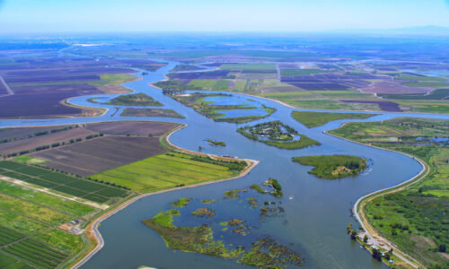
“At the urging of Gov. Gavin Newsom, California water officials have been working with a group of agencies for years on a far-reaching plan to protect the rivers that nourish the Sacramento-San Joaquin River Delta. The Newsom administration is seeking an arrangement in which urban and agricultural suppliers across the state agree to take less water from California rivers, and help restore river habitat, in exchange for more flexibility using water and meeting regulations. The goal is to halt the ecological slide of the delta, a sprawling estuary and water supply hub for nearly 30 million people. But even as the governor has made finalizing what’s called the Bay Delta Plan a priority before he leaves office in January, the state’s negotiations with the water agencies appear to have come up short. The State Water Resources Control Board is scheduled to adopt the plan this week, yet water providers up and down the state are taking issue with it, many saying it isn’t the collaborative deal they were promised. The Trump administration is also protesting. … ” Read more from the San Francisco Chronicle. | Read via Yahoo News.
Why some water experts in the middle of California are welcoming strong El Niño storms this year
“A strong El Niño weather pattern is predicted to bring an enormous amount of rain to California this winter. State agencies are gearing up for storm damage and flooding, but water officials in the Central Valley are welcoming the rain with open arms. The latest forecast from the National Oceanic and Atmospheric Administration projects El Nino will bring wetter-than-average periods in the coming months. Laura Ramos, director of the California Water Institute at Fresno State, told Central Valley Daily’s Soreath Hok that much of that water will likely not go to waste this year. The City of Fresno – a city of half a million residents – uses an average of 125 million gallons of water per day and the water comes from two main sources: surface and groundwater. Groundwater supplies are heavily fed in recent years by so-called recharge basins. … ” Read more from KVPR.
American Canyon considers scaling back stake in Sites Reservoir
“As the proposed Sites Reservoir project approaches its next design phase, American Canyon officials are considering whether to scale back the city’s planned share to better match lower water-demand forecasts. American Canyon’s $3.6 million upfront investment in the estimated $6.8 billion project gives it access to 25,000 acre-feet of water storage capacity, or 1.8% of the project, to help meet the needs of the fast-growing city. During the City Council’s Oct. 20 meeting, City Manager Jason Holley and Phil Brun, a management aide for special projects, discussed the benefits the project could bring to the city in addressing current and future water needs. “For years, we struggled with not having enough water storage and not being able to control our own destiny,” Holley said. … ” Read more from the Napa Register.
SEE ALSO: American Canyon Weighs Shrinking Its $177M Sites Reservoir Stake, from Hoodline
UCSC finds new detection technique for toxic algal blooms
“UC Santa Cruz researchers found a new technique that forecasts harmful algal blooms (HABs) up to seven weeks in advance. This new method uses copepods, zooplankton that eat toxic algae, as a part of the measuring system. Copepods produce a chemical called copepodamide, which the algae respond to by producing more toxins—in this case, a neurotoxin called domoic acid, which is a consequence of HABs in the region. Copepodamides show up about 6-7 weeks before the toxic algae and domoic acid, giving researchers time to examine whether the algae will become more toxic and alert the California Department of Public Health if necessary. “Having a month warning or even longer warning is very, very helpful for keeping humans safe, for knowing what’s going on in the ocean and for being able to respond to those conditions,” said Raphael Kudela, distinguished ocean studies professor at UCSC. … ” Read more from the Pajaronian.
California raised the price of its mussel prevention sticker
“California State Parks increased the Mussel Fee Sticker price Thursday, Oct. 22, raising the cost of a full two-year sticker cycle from $16 to $42. The fee is $21 when a sticker is first purchased in an even-numbered year and $42 when it is first purchased in an odd-numbered year. The fee is separate from vessel registration. The Division of Boating and Waterways said the higher fee will fund more inspections, decontamination, early-detection monitoring and public education to prevent invasive mussels from spreading. … ” Read more from KRCR.
SEE ALSO: California’s mussel sticker fee just went up. Here’s what boaters need to know, from the Sacramento Bee
New and expanded Marine Protected Areas headed to next stage following California Fish and Game Commission vote
 “The California Fish and Game Commission (Commission) returned to the topic of marine protected area (MPA) petitions at its October meeting, granting seven petition actions to be considered for future rulemaking. Those granted include two tribally led petition actions that propose the creation of new MPAs for Point Sal in San Luis Obispo County and Carpinteria Reef in Santa Barbara County. Twenty MPA petitions were submitted to the Commission in 2023 following the California Department of Fish and Wildlife’s (CDFW) release of its MPA Decadal Management Review; at last week’s meeting, 15 of those petitions remained to be granted or denied by the Commission. Submitted by California tribes and stakeholders, the MPA petitions included more than 80 proposed regulatory and non-regulatory changes to the MPA Network. Proposed changes included adding a tribal take exemption, renaming an MPA, creating new MPAs, expanding boundaries of existing MPAs and changes to take allowances for recreational and/or commercial fisheries in specific MPAs. … ” Read more from the Department of Fish and Wildlife.
New statewide LIDAR study identifies hotspots for California coastal cliff retreat
“The cliffs that comprise much of California’s coastline are constantly being reshaped by rain, waves, and other geologic forces. The erosion of cliffs threatens critical infrastructure such as highways, railways, homes, park lands, public access points, and more. Therefore, it is important to monitor and track change occurring along the coast. Previous cliff erosion rates were a decade old. To address this issue, researchers at UC San Diego’s Scripps Institution of Oceanography collected new airborne lidar in 2023 and developed new cutting-edge approaches to map cliff erosion and retreat. Using these approaches, they recently measured how California’s coastal cliffs changed between 2016 and 2023 and found that change was highly uneven. In some cliff retreat hotspots, the area of land loss over the seven-year period exceeded 800 dump-truck loads for every yard of shoreline. … ” Read more from Scripps.
Trump wants to strip California of coastal protections unless state meets list of demands
“In what one environmental law expert described as “a dangerous ultimatum,” the Trump administration said it would strip California of its authority to protect its coastline unless state regulators agreed to more than a dozen “corrective actions” that would benefit close allies of the White House, according to the draft findings of a controversial federal review. Citing “a pattern of jurisdictional and regulatory overreach,” the 92-page review said California coastal authorities have demonstrated “unjustified hostility and political bias against offshore drilling opportunities, oil and gas projects broadly, and SpaceX’s launch activities.” The document, which The Times obtained through a public records request, said future federal funding for the state’s coastal management program has been suspended “unless and until the identified deficiencies are satisfactorily addressed.” At the top of the list of corrective actions are demands that the California Coastal Commission meet with SpaceX and “discuss any outstanding concerns about political bias and … productive next steps moving forward.” It also directed coastal authorities to discuss “any outstanding concerns about regulatory burden and overreach” with Sable Offshore Corp., a Texas-based oil company that has sought President Trump’s influence to bypass state oversight and restart a once-dormant offshore operation off the Santa Barbara coast. … ” Read more from the LA Times. | Read via Yahoo News.
In people news this weekend …
Promotions, passings, profiles – submit people news items to maven@mavensnotebook.com.
Garry South, of Marina Del Rey, has been appointed to the California Water Commission.
South has been Principal at Garry South Consulting since 2016. He was Principal at The Garry South Group from 2005 to 2016. South was Senior Advisor at Gavin Newsom for Governor Campaign from 2008 to 2009. South was Senior Political Advisor at the Office of Governor Gray Davis from 1999 to 2003. He was Chief of Staff at the Office of Lieutenant Governor Gray Davis from 1995 to 1999. South was Communications Director in the Office of Ohio Governor Richard F. Celeste from 1987 to 1991. South was Vice President of Political Communications at the National Association of Realtors from 1982 to 1987. He was Special Assistant to the United States Secretary of Agriculture Bob Bergland from 1979 to 1981. South was Midwest Regional Finance Director at the Democratic National Committee in 1977. He was Public Information Director at the Montana Legislature in 1975. South earned a Bachelor of Arts degree in History and Political Science from the University of Montana. This position requires Senate confirmation, and compensation is $100 per diem. South is a Democrat.
Beatriz Gonzalez, of Indio, has been reappointed to the Colorado River Basin Regional Water Quality Control Board …
…where she has served since 2021. Gonzalez was the District Coordinator of Expanded Learning Programs at Coachella Valley Unified School District from 2011 to 2026. She is a member of the Desert Community College District Board of Trustees. This position requires Senate confirmation, and the compensation is $250 per diem. Gonzalez is a Democrat.
Podcasts …
AgNET NEWS HOUR: Edward Ring urges California growers to prepare for winter storms and groundwater recharge
On a recent episode of the AgNet News Hour, Edward Ring, director of water and energy policy at the California Policy Center, returned for Part 2 of his conversation with Nick Papagni. Ring discussed the possibility of a strong El Niño winter, opportunities to replenish California’s groundwater supplies and the policies he believes are threatening the future of Central Valley agriculture. With forecasters discussing the potential for increased winter precipitation, Ring emphasized that California should prepare for both the opportunities and challenges that significant rainfall could bring.
SCIENCE YOU CAN USE: Fresh thinking for freshwater species: Expanding the management decision space
Protected areas are considered an antidote to biodiversity loss, but have not protected all biodiversity equally. Freshwater biodiversity has declined globally by 84 percent since 1970—more than twice the rate of marine and terrestrial species. Legacy effects from logging, mining, livestock grazing, dams, and fish stocking have affected freshwater ecosystems across the landscape including federally-protected areas. Music courtesy of Souvenir Thread.
WATERLOOP: The chemistry eating our sewers
What’s actually eating away at the concrete inside our sewer systems? The answer takes us into a world of bacteria, sulfuric acid, and chemical reactions happening beneath our streets. In this episode, Joseph Talley of Imerys provides a deep dive into the chemistry of wastewater corrosion. He breaks down how the process starts, what it does to concrete, and why understanding those reactions matters when choosing how to repair the damage. There’s some fascinating materials science in the response, too. Talley explains how calcium aluminate linings interact with that corrosive environment, using chemistry to neutralize acid and slow the bacteria producing it.
WATER IS A MANY SPLENDOR’ED THING: Water Birthing
 The most amazing biological wonder that I have ever experienced is the birth of new life into this new world. In a world of C-sections and induced labors the pictures that we draw is many times described as painful, scary, discomforting and an exhausting experience. Elena Tonetti has been working with the birthing process called water birthing. This method is designed to bring the best out of every experience when giving birth. Water is a Many Splendor ’ed Thing brings you another water relationship that has a personally significant impact to your life. Produced by Stephen Baker, Bringing People Together to Solve Water Problems, water@operationunite.co 530-205-6388
In regional water news this weekend …
NORTH COAST
Ukiah vineyard floats 252 solar panels on its irrigation pond
“The new solar panels at Nelson Family Vineyards don’t take up any farmland. All 252 float on the irrigation pond. “There’s nothing fancy about it. It’s just a bunch of solar panels, but they’re floating. And that makes it really, really cool,” owner Tyler Nelson said Friday. “It’s kind of fun to watch, and I love the electricity bill.” The pond array is the farm’s second. Together with older panels on the winery roof, the two now cover all the power on the ranch, Nelson said. When the family first priced the project, it was expected to save about $30,000 a year, he said. It took the family about three years to finally commit. By the time it was finished, PG&E rate increases had pushed the estimated savings to about $80,000 a year. … ” Read more from the Mendocino Voice.
SIERRA NEVADA
Early snow arrived this week as California ski resorts prepare to open
“A storm moving through the Sierra Nevada this week brought snow to California ski resorts, some for the first time this season, with many places counting down the days until opening. Snow laced the tops of mountains, while rain poured at lower elevations. Elevation played a big role in this storm, and likely will continue to influence snowfall this winter, with El Niño predicted to bring warm and wet storms to the Sierra Nevada. The Eastern Sierra led the snow totals with more than 6 inches of snow at Mammoth Mountain’s summit, elevation 11,053 feet, as of Friday morning. And snow flurries were still coming down, a spokesperson for Mammoth Mountain, Mike Imes, said in an email to SFGATE. Opening day for Mammoth Mountain is set for Friday, Nov. 13, less than a month away. … ” Read more from SF Gate.
This ‘magical’ 21-mile trail on the edge of Yosemite was nearly erased by fire. It’s about to reopen
“Marching through knee-high brush at the western edge of Yosemite National Park, Bill King paused by the furrowed trunk of a ponderosa pine and gazed toward the river canyon that zigzagged through the mountain folds ahead. A once-glorious 21-mile thru-hiking trail along this remote section of the South Fork Merced River was destroyed by wildfire and storms eight years ago, and King, founder of the nonprofit Mariposa Trails, has been battling to resurrect it. After years of intensive labor — sawing through hundreds of fallen trees, lopping back shrubs and digging drainage structures — a trail crew is attempting to clear the final mile this month. If all goes according to plan, the entire route will once again be passable starting in early November. “For people who have been to Yosemite and are looking for something new — and they want a challenging trail experience — this will be a great one,” King said. … ” Read more from the San Francisco Chronicle.
NAPA/SONOMA
As North Bay braces for El Niño this winter, here’s how officials, agencies and emergency responders are preparing
“As Californians brace for an anticipated wet and stormy winter wrought by what could be a historic El Niño weather pattern, North Bay officials, utility providers and emergency responders have been working to shore up infrastructure, reduce flood risks and prepare problem areas before it’s too late. “Right now is the time to get ready,” said Jeff DuVall, director of the Sonoma County’s Department of Emergency Management. “Winter is here, and we need to prepare.” That means encouraging and helping the public to take proactive steps — DuVall said that by the middle of next week all nine of Sonoma County’s sandbag stations will be available for community use. From an agency standpoint, DuVall’s team is coordinating with Sonoma Public Infrastructure and Sonoma County Regional Parks to stockpile equipment and do extra maintenance in areas where they know the roads tend to flood. … ” Read more from the Santa Rosa Press Democrat.
BAY AREA
San Francisco declares emergency ahead of expected wet El Niño winter
“Mayor Daniel Lurie declared a local emergency in San Francisco on Friday for the powerful El Niño that is likely to pummel California with rain and coastal flooding this winter. The naturally occurring pattern happens every 2 to 7 years and is the most powerful climate influence on global weather patterns. This year’s El Niño is historically strong, and will bring extremely high tides as well as potentially very wet weather that could exacerbate tidal flooding. The first series of storms is expected to arrive the weekend of Halloween. The declaration waives city contracting requirements that can slow down its ability to get equipment needed to defend the city from floodwaters, like pumps, flood barriers and generators. “It will cut through our usual red tape so our departments can manage our critical infrastructure and that they can take action quickly,” Lurie said at a news conference at the Embarcadero. … ” Read more from the San Francisco Chronicle.
East Bay Park District agrees to take on Golden Gate Fields
“With an air of celebration, the East Bay Regional Park District board voted unanimously Wednesday to approve a $175 million deal to acquire the former Golden Gate Fields racetrack, a major step in turning the 162-acre bayside site into a public park. The transaction, which essentially seals the park district’s ownership and management of the new park, sets the stage for what is likely to be a long and lively planning process. It will shape the look, feel and offerings of what is today a shuttered racetrack complex, complete with a one-mile track, grandstand, stables, dorms, restaurant and other support facilities, and roughly 50 acres of parking lot. Golden Gate Fields, which straddles Albany and Berkeley, with about three-quarters of the property in Albany, closed in June 2024 after more than 80 years of horse racing. “This is a matter of statewide interest. It isn’t just going to serve the people that live near Golden Gate Fields, but everyone in California, people that visit California,” said state Sen. Jesse Arreguín at the meeting. Arreguín, who represents the area, led efforts to secure state funding for the park. … ” Read more from Bay Nature.
River otter spotted on San Mateo Coast is believed to be first since 1800s
“In a promising sign of wildlife recovery in the Bay Area, researchers have observed a river otter living along the San Mateo coast, the first documented sighting of the nimble, furry-coated swimmers there since the 1800s, scientists say. The animal was photographed by a motion-activated wildlife camera three times in recent months on the Cloverdale Ranch Preserve, a 5,100-acre property near Pescadero that is owned by the Midpeninsula Regional Open Space District. Once numerous across the United States, river otters — a more slender cousin of sea otters who spend their time mostly in inland streams, creeks and bays — were hunted for their dense fur in the 1800s and also experienced population declines due to development and toxic chemicals. In recent years, river otters have made a comeback across Northern California, with sightings increasingly common along the shores of San Francisco Bay, the Sacramento-San Joaquin Delta and Marin and Sonoma counties. … ” Read more from the San Jose Mercury News.
El Niño: Check this interactive map to see your San Jose neighborhood’s flood risk
“San Jose officials say the city is prepared for the extreme winter weather a “Super El Niño” could bring and has a local FEMA map available for residents to check the flood risks in their neighborhoods. The heightened urgency follows National Oceanic and Atmospheric Administration forecasts warning of a strong El Niño weather pattern expected to persist through the winter, potentially bringing record-setting storms to the region. City and water officials are actively clearing vulnerable waterways, and say the city’s early warning systems and emergency response workflows are ready. The city says most staff are trained in disaster response, and the emergency operations center can be activated within an hour if needed. … ” Read more from the San Jose Mercury News.
CENTRAL COAST
California American Water submits Monterey Desalination Project financing and cost updates to the California Public Utilities Commission
“Today, California American Water submitted an application to the California Public Utilities Commission (CPUC) updating the project cost estimates, a low-cost financing framework, and a proposal for rate treatment for the Monterey Peninsula Water Supply Project’s desalination facilities. California American Water has been working with state regulatory agencies for decades to address the Monterey Peninsula’s water supply crisis and lift the State Water Board’s cease-and-desist order, which has limited the region’s economic growth and prevented sustainable housing development. This work has reduced pumping from the Carmel River by 75 percent, to date. “California American Water remains committed to ensuring the Monterey Peninsula has a reliable water supply into the future, and we are taking steps to pursue alternative sources of financing to minimize the costs and protect affordability for our customers,” said California American Water President Sarah Leeper. “To mitigate the impacts of the project costs, our application proposes financing and ratemaking measures estimated to reduce the impact on customers by $588 million over the 40-year life of the project.” … ” Read more from California American Water.
San Luis Obispo County to study in-lieu water program
“San Luis Obispo County is studying to determine if an in-lieu fee program could be established to satisfy water conservation requirements and replace a retrofit program in order to build new construction in Los Osos. Officially called the “Los Osos Title 19 Water Conservation Program Nexus Study” the County is in the early stages of studying a potential in-lieu program wherein potential development projects could simply pay a fee to satisfy water saving requirements instead of finding a certain number of homes or businesses to retrofit with water-saving devices like low-flow toilets and showerheads. “A nexus study,” reads a report from Los Osos Community Services District General Manager, Greg Kwolek, “evaluates whether there is a reasonable relationship between a proposed fee and the public benefit provided by the project or projects funded by that fee.” … ” Read more from the Estero Bay News.
Santa Maria drilling first new water well in 30 years, utilities director says
“Santa Maria has completed drilling a new groundwater well and expects it to begin supplying water by the end of 2027, as the city works to strengthen its water supply and prepare for future demand. Shad Springer, director of the city’s Utilities Department, said drilling on Well 15 was completed in late 2025. The city split the project into two contracts to accelerate completion, with one covering drilling and the other covering equipment installation and related infrastructure. Work on the well includes installing the equipment needed to bring it online, along with pipelines to connect it to the city’s water system. … ” Read more from the Santa Maria Times.
SAN JOAQUIN VALLEY
MEETING NOTES: Kern districts discuss Bay-Delta Plan, El Niño “emergency”
“State consideration of an updated plan to manage the Sacramento-San Joaquin Delta, known as the Bay-Delta Water Quality Control Plan, prompted concern at two Kern Water district meetings. The state Water Resources Control Board will hold a hearing Oct. 28 on an update to the Bay-Delta Plan. The recommended update has been widely panned by both environmental groups and water districts. Environmental groups say the plan doesn’t mandate enough water from the state’s rivers to flow through the delta. And water districts that had participated in what became known as the Healthy River and Landscapes Program portion of the plan, say the state arbitrarily changed previously negotiated sections on flows and collaborative decision making. … ” Read more from SJV Water.
EASTERN SIERRA
Mono Lake: State Water Board hearing launch at hand
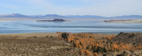 “As the end of the year approaches, so does the formal launch of the long-anticipated California State Water Resources Control Board Mono Lake hearing process. Expected to take nine or more months, the hearing is the necessary quasi-judicial procedure the Board must undertake to modify the rules governing how much water the Los Angeles Department of Water & Power (DWP) can divert from tributary streams, export from the Mono Basin, and permanently take away from Mono Lake. In March, the Board discussed Mono Lake extensively, receiving a report from the UCLA Center for Climate Science affirming that water diversions have had a significant impact delaying Mono Lake’s recovery to the Board-mandated management level of 6,392 feet above sea level. The Mono Lake Committee and a wide range of interested parties called for action to pause diversions since the lake is only halfway to 6,392 feet and a decade overdue. The discussion concluded with Board members unanimously directing staff to do the legwork needed to initiate the hearing process before the end of the year. … ” Read more from the Mono Lake Committee.
Mammoth Community Water District projects strengthen local wildfire suppression capability
“Over the past two summers, the Mammoth Community Water District (MCWD or District) has installed two new fire hydrants and a tanker fire truck filling station to bolster local wildfire-suppression capabilities and emergency-response readiness. The completed projects provide additional water access for firefighting operations in key areas of the community including: a fire hydrant in Old Mammoth near the Valentine Reserve; a new fire hydrant along the Mammoth Scenic Loop; and a tanker fire truck filling station near the District’s Lake Mary Water Treatment Facility within the Lakes Basin. MCWD continues to work with community stakeholders to identify locations where additional hydrants might be installed in the future. … ” Read more from the Sierra Wave.
SOUTHERN CALIFORNIA
Exceptionally high tides will swamp California, ‘likely to get worse before it gets better’
“Exceptionally high tides are set to hit California as early as this weekend, sending officials scrambling to prepare for another onslaught along the state’s already battered coast. The National Weather Service issued a coastal flood warning that goes into effect Sunday morning and lasts through Thursday afternoon, saying it expects “significant coastal flooding” in San Diego and Orange counties that will inundate low-lying homes, businesses and critical infrastructure, with some shoreline erosion in the morning throughout the warning period. Significant-to-moderate beach erosion is likely in Los Angeles, Ventura, Santa Barbara and San Luis Obispo counties, and “isolated damage of structures due to sea water inundation is possible,” forecasters said. A coastal flood advisory has been issued over the same time period in those four counties. … ” Read more from the LA Times. | Read via Yahoo News.
Long Beach, OC coastal towns eke out a day of bliss before ‘all-time’ high tides – and likely flooding – return
“Southern California will once again see unusually high tides beginning early Sunday morning that threaten to flood streets in Orange County, Long Beach and other areas recently embattled by giant waves. Low-lying beach areas are expected to flood, with high tides rolling in between 7.5 and 8 feet during the early morning hours Sunday, and continuing through Thursday, according to the National Weather Service. That’s about 1 to 1.5 feet higher than normal. The San Pedro beaches could see some of their highest ever waves on record between Monday and Wednesday, the NWS said. The current record at San Pedro is 7.93 feet set on Jan 10, 2005, with records going back to 1924. The NWS said that “moderate to significant beach erosion” is likely. The high tides are expected to begin at 5 a.m. Sunday and continue through 1 p.m. Thursday. … ” Read more from the LA Daily News.
Orange County races to protect beaches, homes ahead of unusually high tides
“Orange County beach communities are rushing to reinforce their shorelines ahead of unusually high tides expected next week, with Seal Beach building its seasonal sand berm a month early and extending it farther than usual to protect against potential flooding. Crews were working Friday to construct the protective barrier along the beach south of the Seal Beach Pier, where water pumps have also been positioned in anticipation of rising ocean levels. The city typically installs its seasonal berm about a month later, but the threat of elevated tides from Monday, Oct. 26, through Wednesday, Oct. 28, has prompted crews to accelerate construction, KTLA’s Orange County Bureau Chief Chip Yost reported. … ” Read more from KTLA.
Here’s why the Hoover Dam needs a wet winter
“Today we look at the Hoover Dam, which has been generating electricity for 90 years and paved the way for development in Las Vegas, Arizona and Southern California. Hoover Dam generates, on average, about 4 billion kilowatt-hours of hydroelectric power each year for use in Nevada, Arizona and California – enough to serve 1.3 million people. … Building the transmission lines to Los Angeles took three years from 1933 to 1936 and was a historic feat of engineering managed by the Los Angeles Bureau of Power and Light. When completed the lines stretched 266 miles transmitting electricity at 287,500 volts — a higher voltage than any other long-distance transmission line in the world at the time. The project had seven construction camps spaced roughly 30 miles apart. Temperatures routinely reached 135 degrees in the summer and concrete footings were poured at night to prevent fracturing or boiling. … ” Read more from the LA Daily News.
“The Happiest Place on Earth” underwater: Massive storm floods key lands at Disneyland
“Southern California is famous for its year-round sunshine, but a powerful Pacific storm recently reminded residents and tourists alike that when it rains in the Golden State, it pours. The Happiest Place on Earth was no exception. As a strong storm system moved across the region on October 21 and 22, bringing heavy rain and flood advisories to parts of Southern California, Disneyland Park experienced significant water accumulation in several areas. While Walt Disney World in Florida regularly contends with heavy rain and thunderstorms, Disneyland also has to manage the effects of severe weather when it moves through Southern California. Videos shared by X (formerly Twitter) user @DisneyScoopGuy showed standing water in portions of Frontierland, puddles in Star Wars: Galaxy’s Edge, and water accumulation in the Disneyland tram pickup area. The footage documents localized flooding, although it does not establish the cause of the pooling or the extent of any operational disruptions. … ” Read more from Inside the Magic.
Irvine Lake to be drained in preparation for El Niño and dam renovations
“Irvine Lake is set to be drained next week in preparation for the coming El Niño winter and a major overhaul of the nearly century-old Santiago Creek Dam. The planned work has drawn ire from members of the shoreline fishing community. Water levels will be reduced from about 738 feet to 720 feet on Monday, Oct. 26, according to the Irvine Ranch Water District, which manages the lake. Roughly 300 acre-feet of water will remain in the lake until next summer, when the reservoir will be emptied for construction on the dam improvement project. The district has already reduced water levels as part of “normal operations,” but the further drawdown is necessary for safety reasons, spokesperson John Fabris said. “The El Niño-related reason for drawing the water level down now is to ensure we have enough space in the reservoir to accommodate major storms and keep the downstream community safe,” Fabris said in an email. … ” Read more from the OC Register.
IMPERIAL/COACHELLA VALLEYS
Salton Sea Summit highlights tangible environmental progress, future conservation roadmap
“Environmental researchers, Tribal leaders, and government officials gathered at the fifth biannual Salton Sea Summit to evaluate ongoing ecological restoration efforts and outline long-term strategies for California’s largest lake. Hosted by the University of California, Riverside, and the Pacific Institute on Oct. 16–17 at UCR’s Palm Desert Center, this year’s summit—themed “Spotlight on Solutions”—focused on recent collaborative actions taken to address the sea’s escalating environmental and public health challenges. A primary focus of the two-day conference was the State of California’s Species Conservation Habitat (SCH) project. Speakers highlighted the initiative’s creation of habitat ponds, which have successfully supported local fish and bird populations while suppressing dust emissions from exposed, dried lakebed—a major source of air quality concerns for surrounding Imperial and Coachella Valley communities. … ” Read more from the Imperial Valley Press.
SAN DIEGO
Lawmakers gather for a roundtable discussion of the Tijuana River crisis
“The urgency of the Tijuana River sewage crisis and its impacts on residents’ health and the economy were among the topics discussed last Friday, Oct. 16, at the San Diego Foundation, where several lawmakers gathered. County Supervisor District 1 Paloma Aguirre and Assemblymember (80th District) David Alvarez organized the roundtable. At the end of the event, Alvarez said the group had “a productive conversation… and we came together to try and ensure we are all on the same page on this disaster that is occurring in South County that is impacting all San Diegans.” Aguirre reiterated that the meeting was about everyone being clear on the situation. She explained, “We had a presentation from experts in the economic field, public health field, water regulation field, as well as updates from our congressional delegation and representatives from different cities throughout the county. It was really with the goal of all of us getting on the same page of what is it that has been done, what can we do moving forward so we can have a unified voice and a unified message.” … ” Read more from the Coronado Eagle & Times.
Along the Colorado River …
As water crisis continues, backup water supply in the Colorado River basin is also drying up
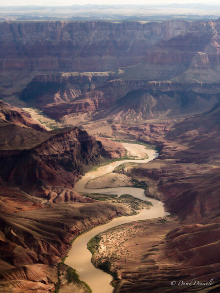 “The Southwestern US is in an ongoing megadrought that began in 2000, largely driven by overconsumption of water and climate change. Water scarcity in the region is immediately visible in the Colorado River and the reservoirs of Lake Mead and Lake Powell. As the region’s agricultural industries and human populations grow, water levels continue to fall. Currently, surface reservoirs contain just 15 months’ worth of water, based on average current consumption rates. Farmlands use up the majority of the Basin’s water supply: about 52 percent of water from the Colorado River goes to agricultural irrigation. When those rivers, lakes and reservoirs dry up, those industries – and the ~40 million people who live in the Colorado River Basin – rely on another, hidden source of water below ground. … ” Read more from Science Alert.
Crop rotation vs. fallowing: Why idle fields hurt Arizona’s desert soils and farms
“”Agriculture needs to get back to letting land lay out, or fallow,” a keyboard farmer posted on Arizona Farm Bureau’s Facebook page. The commenter went on to say it’s a type of rotation. We try to respond to comments. But in this case, we reached out to an expert for his assessment. Jeffrey C. Silvertooth, Ph.D. — a professor and Extension Specialist in Agronomy and Soil Science in the Department of Environmental Science at the University of Arizona — offered an informative response. Soil scientists teach that crop rotations are a basic and fundamentally sound agronomic practice to maintain healthy soil. The practice of crop rotation is rather literal, meaning the rotational changing of crops in a given field or set of fields. … ” Read more from the Arizona Farm Bureau.
As Colorado River battles intensify, lawmakers visit the Central Utah Project
“The golf carts drove eight miles through a dark tunnel buried 3,000 feet under the mountaintop in the Uintas. Lawmakers, local officials and staffers at the Central Utah Water Conservancy District were getting a very close look at where a significant portion of the Wasatch Front’s drinking water supply comes from. After more than an hour of driving through the tunnel, they emerged outside Upper Stillwater Dam. “Water from this reservoir is able to make it to the state Capitol and also to the airport so that far north into Salt Lake County and all across the east and west, everyone’s getting water from this,” said Dylan Dastrup the Stillwater area manager for the water district. … ” Read more from Fox 13.
In national water news this weekend …
EPA could be vastly under-reporting PFAS levels in drinking water, study finds
“US drinking water could contain double the PFAS levels currently reported by regulators, according to a new study from Texas Christian University. The study, published in Cell Reports Sustainability, used computer modeling to estimate that the latest reports from the Environmental Protection Agency (EPA) capture only 44% of the average combined concentration of 25 polyfluoroalkyl substances (PFAS) in US water systems. PFAS, also known as “forever chemicals,” are known to persist in the environment and are linked to some cancers, high cholesterol, reproductive issues and other health problems. Researchers analyzed more than 1.8 million PFAS measurement records from the EPA’s January 2026 release of monitoring data from water systems across the country. They found most individual PFAS test results in the dataset fall below the EPA’s minimum reporting levels (MRLs). These data points are often treated as zero when agencies and researchers summarize average PFAS levels in drinking water. … ” Read more from the New Lede.