A wrap-up of posts published on Maven’s Notebook this week …
Note to readers: Sign up for weekly email service and you will receive notification of this post on Friday mornings. Readers on daily email service can add weekly email service by updating their subscription preferences. Click here to sign up!
In California water news this week …
El Niño: New forecasts show high chance for California rainfall at 150%-200% of normal this winter
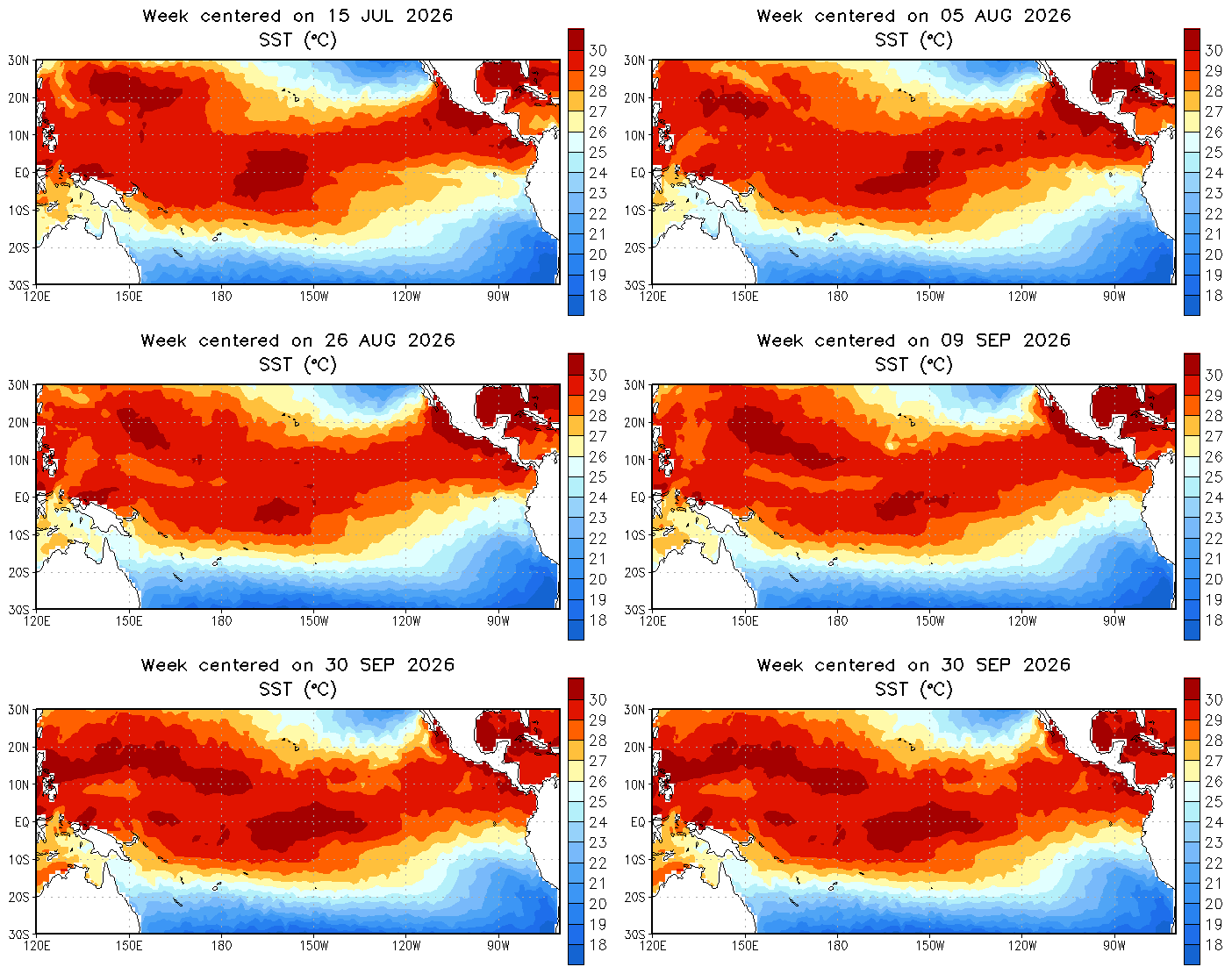 “Like a pot of water on a slow boil, El Niño conditions in the Pacific Ocean are continuing to intensify, scientists said Thursday, setting up a winter that could bring drenching rain to some parts of California — at amounts potentially double the historical average, particularly in January and February. On Thursday, scientists at NOAA, the National Oceanic and Atmospheric Administration, said there is a 100% chance of a strong El Niño being present from now through March, and an 83% probability that it will rank as the strongest in history since modern records began in 1950, up from 69% two months ago. “We are seeing a lot of warmth in the tropical Pacific, which provides ample energy for storm systems as we move through the fall and winter,” said Michael Anderson, state climatologist with the California Department of Water Resources. “Be ready for the storms and watch those forecasts.” … ” Read more from the San Jose Mercury News.
How California is bracing for a winter of floods, fires and extreme storms all at once
“Before this year, the US National Weather Service had never issued a September coastal flood advisory for the San Francisco Bay Area. In the past month, it has had to issue two. As flood water swallowed intersections and eroded beaches up and down the California coast last week, scientists and emergency managers warned that this is just an early signal of a coming tumultuous winter as an already exceptional El Niño continues to strengthen. It’s been called everything from “super” to “Godzilla”, as forecasters hammer home the message that conditions brewing in the Pacific Ocean could soon climb off the charts, and fuel extreme weather around the world. Tens of millions could face food insecurity, and global food prices could be pushed higher. Climate scientists have projected that by February, more than 450,000 people around the world could succumb to spikes in temperature linked to the strong El Niño. Yet more deaths will be caused by floods and droughts, wildfires and rain. … ” Read more from The Guardian.
NOAA: Kelvin waves, explained
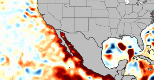
“You may be hearing a lot about Kelvin waves in the news. What are Kelvin waves, and how are they related to El Niño? We asked oceanographer Michael Jacox, from the Southwest Fisheries Science Center and NOAA Physical Sciences Laboratory, to explain the phenomenon. What is a Kelvin wave and is there currently one moving across the Pacific? Unlike the waves we’re used to seeing at the beach, Kelvin waves travel underwater, are very long, and only change sea level slightly. They often form in the western equatorial Pacific, then travel along the equator from west to east. After reaching South America, they continue as coastal trapped waves away from the equator—both north along the Central and North American coasts and south along the South American coast. As of early October, there is one making its way up the North American West Coast, and behind it there are one or two more that are still in the tropics. … ” Continue reading from NOAA.
U.S. water rates soaring, with Bay Area bills among highest in nation
“Water rates in the United States have risen more than twice as much as groceries over the past decade, and more than 1.5 times the overall rate of inflation, which has left Bay Area residents with some of the biggest water bills in the nation, according to a new report. An analysis of the country’s 500 largest community water providers, published by the consumer advocacy group Food and Water Watch on Tuesday, cites the privately held San Jose Water Company as the nation’s most expensive water retailer. The utility’s rates are more than 2.5 times the national average, the report says. Also among the 15 U.S. water providers with the highest rates are the Marin Municipal Water District, San Jose’s municipal water department and the San Francisco Public Utilities Commission. Thirteen of the 25 most expensive providers are in California, with their rates averaging more than twice the national average. … ” Read more from the San Francisco Chronicle.
CMUA releases new policy paper about water affordability from a system cost perspective
 “A new policy paper from CMUA called Understanding Water Affordability in California: A System Cost Perspective examines the key drivers that are increasing water system costs and explains why rate design alone is not enough to address the water affordability problem for households. A durable statewide affordability system will require ongoing state support, coordinated enrollment, sustained state and federal partnerships, and more, the paper finds. This report explains why affordability pressures are increasing, the challenges beyond a utility’s control that drive up water costs, why local rate-based tools are constrained, and what durable, scalable solutions could look like in California. It is a reference tool for CMUA and its member agencies to support informed engagement with state partners, including the State Water Resources Control Board, the Department of Water Resources, and the California Legislature. This CMUA policy paper is the newest in an ongoing series providing thought leadership about key topics and issues that will shape the present and future of California water and energy.” Click here to read the paper.
Protecting California’s water from cyberattacks
“In June, Iranian hackers breached California Water Service systems and claimed they could have shut down water service to thousands of customers. According to Cal Water, those claims were false, but the next month, more water sector cyberattacks targeted systems in at least 12 states across the United States. While most impacts were relatively minor, in Minnesota, the hardest-hit state, a coordinated attack hit more than 30 water systems over two days. California appears to have largely been spared in this summer’s cyberattacks on US water agencies, but the threat remains. In late August, another group threatened the US with “unexpected and critical events in the energy, water, and telecommunications industries.” Fortunately, water providers can take relatively simple cyber hygiene steps—like ensuring strong passwords and multifactor authentication to protect water security. In fact, it’s been reported that nearly all cyber security incidents could have been prevented with better cyber hygiene. That said, water agencies with small staffs and budgets can find it difficult to balance security with ease of use. … ” Read more from the PPIC.
Closing the gap: A Unified Water Plan for the San Joaquin Valley
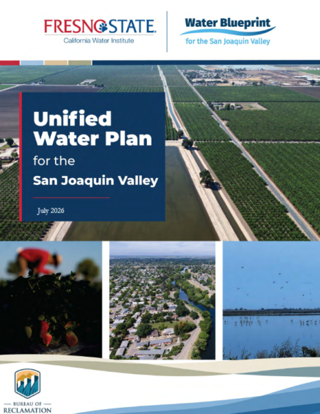 “The San Joaquin Valley faces a defining water challenge: how to secure reliable supplies, manage flood risk, and protect ecosystems across one of California’s most productive regions. The Unified Water Plan (UWP) lays out a comprehensive strategy for the eight-county Valley—San Joaquin, Stanislaus, Merced, Madera, Fresno, Kings, Tulare, and Kern—spanning the San Joaquin River and Tulare Lake hydrologic regions through 2040 and beyond. Congress directed the effort under Public Law 111-11, with funding from the U.S. Bureau of Reclamation. The California Water Institute (CWI) at Fresno State developed the plan in coordination with the Water Blueprint for the San Joaquin Valley. The plan pairs a regional strategy for water supply reliability, flood management, and ecosystem needs with a sobering conclusion: even an estimated $18 billion to $33 billion in infrastructure investments and management actions would not fully close the Valley’s projected water supply gap. … ” Read more from Maven’s Notebook.
California agencies use confidentiality agreements to keep some Bay-Delta science secret
“California state agencies have quietly been using confidentiality agreements to keep some scientific data and discussions behind the Newsom administration’s updated Bay-Delta plan a secret, raising concerns about transparency in the rule-making process. The California State Water Resources Control Board is set to vote later this month on the updated Bay-Delta plan, a massive policy proposal that aims to balance water needs for communities and agriculture while protecting fish, wildlife, and the environment in the San Francisco Bay-Sacramento-San Joaquin Delta. State officials have denied they are hiding anything and maintain the process has been transparent. The proposed update to the Bay-Delta plan heavily relies on voluntary agreements, deals negotiated between state agencies and major water users, such as farmers. The deals involve larger water users providing water and funding for environmental purposes in exchange for more certainty around their water supply. “It’s detailed, it’s science-based and outcomes-focused,” California Natural Resources Secretary Wade Crowfoot said at a hearing on the plan in January. “I want to be clear; this has always been and meant to be an inclusive process.” … ” Read more from KCRA.
Water demand and the Delta
“California is probably the most hydrologically altered state in the US, and the web of state and federal laws governing its water is just as complex. Our Mediterranean climate, which delivers warm, dry summers and cool, wet winters, coupled with the diversity in landscape and climate across the state, make it so. Most of California’s precipitation falls in the northern half of the state, while most of its population lives in the Southern half of the state. Water has been sent impressive distances across California to irrigate its vast agricultural lands and hydrate its growing cities. … The Sacramento Delta, the only inland delta in the United States, is technically backwards: where most deltas widen as they approach the sea, the wide edge of the Sacramento Delta is at the point of convergence between the two rivers, and these waters enter the estuary through a narrow channel. The dynamics of this delta are likewise unique and independent from other deltas in the United States: it is simultaneously tidal and fresh. … ” Read more from Audubon.
Draft 2026 Sustainable Groundwater Management Grant Program Guideline Amendment and Proposal Solicitation Package
“The California Department of Water Resources (DWR) is pleased to announce the release of the Draft 2026 Sustainable Groundwater Management Grant Program Guideline Amendment and Draft 2026 Proposal Solicitation Package (PSP). DWR will host two public workshops in November to provide an overview of the program, review key components of the Draft 2026 Guideline Amendment and Proposal Solicitation Package, and to accept public comments.” Read the full notice from DWR.
Metropolitan, Delta Conservancy celebrate the start of 2,800-acre wetland restoration project
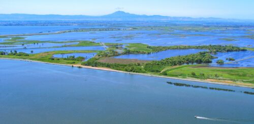
“Surrounded by the waters of the Sacramento-San Joaquin Delta, state and local leaders gathered today on Webb Tract to mark the beginning of a 2,800-acre wetland restoration project aimed at giving new life to one of the Delta’s deeply subsided islands. Supported by a $20.9 million grant from The Delta Conservancy, the project on the Metropolitan-owned Webb Tract seeks to help slow subsidence, sequester carbon and create habitat for migratory birds and other wildlife, while continuing to support the local agricultural economy. … More than a century of conventional dry-soil farming has contributed to subsidence throughout the Delta, with some areas of Webb Tract now as much as 24 feet below sea level. When peat soils are drained, they decompose and release carbon and the land surface continues to subside. If the land surface sinks too low, levees can fail and the islands could be flooded, which could affect the people who live and work on the islands, water quality, water exports, agriculture, infrastructure and habitat. … ” Read more from the Metropolitan Water District.
‘Nature-based’ solutions could save insurers and policyholders billions
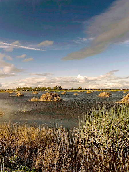
“After years trudging through marshes around San Francisco Bay studying conservation practices, coastal ecologist Megan Kelso realized that one of the largest determinants of wetland health may not be an invasive species lurking with her among the sea grasses, but decisions made miles away in the executive suites of insurance companies. Wetlands absorb massive volumes of carbon and are vital to combating climate change, Kelso said, and she saw her early field work as the most effective way to keep them healthy. It wasn’t until she started working alongside Mike Beck, director of University of California Santa Cruz’s coastal resilience program, and was offered a grant to research how insurance can promote similar habitat restoration projects, that she had her “aha” moment. “I was thinking, maybe there’s a way to align this huge sector of insurance with nature and conservation in a way that could have a bigger impact than what I was doing before,” Kelso said. … ” Read more from Inside Climate News.
A constant problem’: Abandoned mines causing sinkholes, other incidents across the country
“In California, a gold mine caved in beneath a family living room, killing a 32-year-old man and his dog. In Pennsylvania, a grandmother died when an abandoned coal mine gave way under her feet while she searched for her missing cat. And in New Jersey, an abandoned mine shaft opened up beneath a major highway, creating a sinkhole more than 40 feet wide. At the time, these may have appeared to be isolated incidents — but an ABC News investigation found that they were caused by decaying infrastructure from abandoned underground mines collapsing beneath residential streets, highways, and family homes, triggering sudden sinkholes, injuries, and, in some cases, fatal accidents. Abandoned or forgotten mines are inactive mining sites, dating back to the 19th and mid 20th centuries, that were left unsealed and unmonitored after operations ceased. “It’s pretty much everywhere and different stages of problems,” said Paul Santi, who has spent years studying the nation’s mining legacy at the Colorado School of Mines. “I think it’s one of these things that people aren’t really thinking about until it happens.” … ” Read more from ABC News.
LAO: The 2026-27 California Spending Plan: Natural Resources and Environmental Protection
 “This post begins by providing an overview of total spending for the departments overseen by the California Natural Resources Agency (CNRA) and California Environmental Protection Agency (CalEPA). Next, we discuss certain cross-cutting issues that affect departments in both agencies, including spending from the Greenhouse Gas Reduction Fund (GGRF). We then discuss individual departments that had notable budget changes within each of the two agencies. We conclude with a summary of budget allocations from Proposition 4, the climate bond approved by voters in November 2024.” Read the report from the LAO.
In commentary this week …
Observations as a new water year begins
Edward Ring, director of water and energy policy for the California Policy Center, writes, “For water users and water watchers, October 1st was New Year’s Day. It’s a good time to step back and comment on where we’re headed with water policy and water projects. There is no single variable that affects how much water is available to Californians than how we manage the Sacramento-San Joaquin Delta. Around five million acre feet per year are exported from the delta into southbound aqueducts: the federally operated Delta Mendota Canal, and the state operated California Aqueduct. Of this diverted water, in a typical year, about 1.4 million acre feet per year goes to cities, mostly on the Southern California coast, and the rest goes to farms, mostly in the San Joaquin Valley. How much water flows through the delta and out to the San Francisco Bay is also affected by how much water makes it into the delta to begin with. Farm irrigation, evaporation, percolation, and diversions for environmental purposes consume additional millions of acre feet from tributaries up and down the 43,000 square mile watershed. For the water year just ended, 14.0 million acre feet of water survived the gauntlet of diversions and poured into the San Francisco Bay. And from the delta, 2.4 million acre feet (MAF) were pumped into the California Aqueduct, and 2.1 MAF were pumped into the Delta Mendota Canal. That totals 4.5 MAF going to farms and cities in the year just ended. … ” Read more from Edward Ring.
California Sportfishing Protection Alliance and allies comment on August final draft Bay-Delta Plan
“On September 18, 2026, CSPA joined a coalition of environmental organizations, fishing organizations, and Tribal advocates in comments on the August “Final” Draft Bay-Delta Plan. The State Water Board issued the draft on August 19, 2026. At the center of the proposed August Final Draft Plan are “Voluntary Agreements.” This alternative framework substitutes small amounts of flow, and physical changes in and around rivers, for new flow requirements based on a percent of unimpaired flow into San Francisco Bay. The Voluntary Agreements will not work. The comments state: “The VAs will preserve the status quo under a new name, maintaining anemic and inadequate flows at an exorbitant cost that is highly unlikely to attain instream water quality objectives.” … ” Read more from the California Sportfishing Protection Alliance.
Securing the future of California dairy forage production is critical to protecting rural communities
“For dairy farm families, animal feed is a critical part of their work to ensure optimal cow care, produce more nutritious milk using fewer resources, and make sure their farms remain economically sustainable. Animal feed comprises about 60 percent of a California dairy farm’s operational costs. Dairy farmers and their nutritionists work hard to ensure cows receive balanced meals each and every day. Forage production is an increasingly challenging yet critically important part of a California dairy farm’s resiliency. California dairy cow rations include a mixture of crops grown at the dairy (primarily corn and cereal silages), imported grains, and locally available byproducts from other crops. There are many reasons why California dairy farmers produce their own silage, which is a fermented form of plants that is high in moisture and nutrition. To make silage, the entire plant (stalk, husk, and kernels) is harvested while still green, chopped into pieces, and stored in airtight conditions. Minimizing transportation of the high-moisture feed is critical to both feed quality and farm economics. Importantly, growing feed on nearby fields is how dairies recycle manure nutrients and water. … ” Read more from Dairy Cares.
California Sportfishing Protection Alliance and allies comment on revised draft Water Rights Permit for Sites Reservoir
“On October 5, 2026, CSPA joined allied environmental organizations, fishing organizations, a Tribe, and Tribal advocates (“NGO Parties”) in comments on the Revised Draft Water Rights Permit and Revised Draft Water Rights Decision on the proposed Sites Reservoir. The State Water Board and its Administrative Hearing Office released the revised documents on September 3, 2026. CSPA and allies oppose granting a water right for Sites. However, the State Water Board is likely to grant a permit. Therefore, the comments of NGO Parties largely focus on the flow requirements in the Revised Draft Permit. The first (March) Draft Permit included a stand-alone requirement that 55% of the unimpaired flow must be passing into and through the Delta as a precondition to diversions to Sites Reservoir. Following political pressure and opposition from the Sites Authority and others over the summer, the Revised Draft Permit removed this requirement. Instead, Revised Draft Permit requires compliance with an updated Bay-Delta Plan, which, in its current (but not yet adopted) August Draft, includes a 55% of unimpaired flow requirement for “new water supply projects.” … ” Read more from the California Sportfishing Protection Alliance.
Hydropower keeps California moving — policy needs to catch up
Bruce McLaughlin, general manager of the Power and Water Resources Pooling Authority (PWRPA), writes, “The very water system both you and I rely on, whether in your home, running a small business, or working on land that’s been in your family for generations, is the same system that stores water, moves it across the state and uses that movement to generate clean, affordable electricity in return. We have hydropower systems to thank for that. Hydropower plays a critical role in maintaining both affordable, reliable electricity, and water flow and distribution. That built-in, reliable cycle keeps electricity costs down. It’s the kind of reliability families and businesses depend on, especially as utility bills keep rising. And yet, that affordable reliability remains threatened. Why? A challenge that exists at the state level is that policies shaping California’s energy future haven’t fully caught up. Large hydropower, one of the state’s most reliable sources of clean energy, still falls outside key definitions in the Renewable Portfolio Standard — the state’s primary clean energy program, which requires utilities to procure renewable electricity to meet California’s energy goals. However, not all hydropower resources count toward those targets. … ” Read more from Capitol Weekly.
In regional water news this week …
Protecting Lake Tahoe: How the Lahontan Water Board helps keep the iconic lake blue
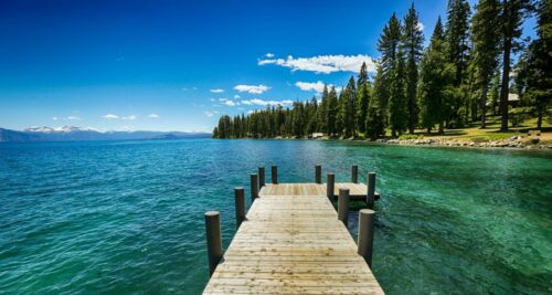 “Lake Tahoe, one of California’s – and the world’s – most dazzling natural features, attracts approximately 15 million visitors every year to its emerald waters, sandy beaches and stunning alpine terrain. Often referred to as the “Jewel of the Sierra,” the lake is not just a tourism hotspot but also a unique water resource and major freshwater research hub, with Lahontan Regional Water Quality Control Board scientists playing a key role in preserving the lake’s iconic water clarity and quality. Tahoe’s clarity is one of many reasons that make it iconic, but it’s also fragile. As the lake’s popularity has increased, its waters have become murkier. Clarity declined from a depth of 105 feet in 1967 to an all-time low at the time of only 64 feet in 1997, spurring concern in California and Nevada. …; ” Read more from the State Water Board’s Ebb and Flow.
Scientists seek new ways to protect Sierra Nevada meadows
“Sierra Nevada meadows may cover a relatively small portion of the landscape, but scientists say they play an important role in supporting wildlife, storing water and maintaining biodiversity. Researchers and conservationists recently gathered at the University of Nevada, Reno’s Lake Tahoe campus to discuss what is known about these ecosystems and what still needs to be studied. The workshop, sponsored by the Tahoe Institute for Global Sustainability, brought together researchers from different fields to identify gaps in meadow research and explore ways to improve conservation and restoration efforts. “They’re critical for wildlife, for water storage, for water quality. These are really unique and just biologically important ecosystems,” said Cody Reed, a meadow ecologist with Point Blue Conservation Science. … ” Read more from the Tahoe Daily Tribune.
Feather Falls restoration progress remains ongoing
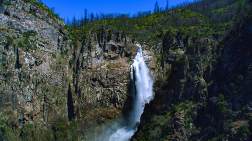
“When the North Complex tore through over 300,000 acres of land in the Plumas National Forest in 2020, the Feather Falls scenic area was devastated — three bridges, the scenic overlook and the non-motorized trail were essentially destroyed. But in the years since, several efforts have been made to support rebuilding efforts, including a recent $500,000 grant awarded by the Sierra Nevada Conservancy to the Mooretown Rancheria of the Maidu Indians of California. The grant follows a prior $350,000 grant given in 2022 to the rancheria to complete a comprehensive cultural resource survey of the area. The surveying took place while the U.S. Forest Service worked to remove hazardous trees, restore the 8-mile trail and rebuild the scenic overlook, according to SNC Representative Kristy Hoffman. With the most recent grant, which was awarded in September, the second phase of the Feather Falls Post-Fire Project project will begin. … ” Read more from the Chico Enterprise-Record.
Dangerous surf, high tides and coastal flooding forecast for Bay Area this weekend
“A trip to the beach this weekend could be a lot more dangerous than it looks. The National Weather Service issued a Beach Hazards Statement Thursday for the San Francisco Peninsula coast and coastal North Bay, warning of breaking waves up to 16 feet, sneaker waves and strong rip currents from Saturday morning through Monday afternoon. At the same time, a Coastal Flood Advisory is in effect from Friday morning through Tuesday afternoon for San Francisco, Monterey Bay and other bayshore areas. The weather service says up to 1.2 feet of water could cover low-lying areas near shorelines and tidal waterways, with flooding possible at some parks, parking lots, roads and coastal trails. The combination is unusual enough to warrant extra caution from officials. “Never turn your back on the ocean,” the weather service warned. … ” Read more from the San Francisco Chronicle.
Sierra Club sues San Francisco, claims city is fabricating its water needs
“The Sierra Club is suing the city of San Francisco’s water department, claiming officials are manipulating water data to justify bigger water grabs for the city — and causing unnecessary harm to the environment, and inflating customer rates. The suit, filed last week in San Francisco Superior Court, calls for the San Francisco Public Utilities Commission to revise its state-mandated Urban Water Management Plan to reflect more modest water needs, notably from the Tuolumne River at Yosemite National Park, where the bulk of the city’s water comes from. The Oakland-based Sierra Club and other environmental groups have long accused San Francisco of holding back too much water at its Hetch Hetchy Reservoir in Yosemite. They say the excess storage comes at the expense of struggling salmon runs and a drying foothill landscape. The Tuolumne River, because of water draws by the city and others, averages just 21% of its natural flow during peak run-off season. … ” Continue reading from the San Francisco Chronicle.
San Luis Obispo: 13-year Lawsuit with Steinbeck Vineyards Resolved
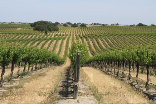 “On September 24, 2026, the Santa Clara Superior Court issued its final judgment in Steinbeck Vineyards #1, LLC, et al. v. County of San Luis Obispo, et al. (Steinbeck litigation). This judgment represents the culmination of nearly 13 years of litigation involving quiet title claims asserted by hundreds of landowner parties against several water suppliers, including the County of San Luis Obispo, City of Paso Robles, San Miguel Community Services District, Templeton Community Services District and Atascadero Mutual Water Company as well as the County Flood Control District. The County was a defendant based on its ownership and operation of water systems in Shandon and Santa Margarita, collectively serving over 800 customers. The Steinbeck litigation was heard in Santa Clara County to avoid local conflicts of interest and was conducted in six separate phases of trial due to the complex nature of the issues. … ” Read more from San Luis Obispo County.
Project to reduce groundwater pumping near Friant-Kern Canal – damaged by excessive pumping – gets underway
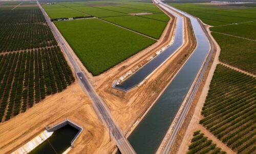 “A groundbreaking ceremony in southern Tulare County last week signaled the start of another chapter in the long and expensive effort to fix the sinking Friant-Kern Canal. Construction began on five new Friant Water Authority pump stations that will lift water out of the canal and into Tea Pot Dome Water District and Saucelito Irrigation District systems, reducing growers’ reliance on groundwater. The project is expected to cost $46 million and take two and a half years to complete. More than $500 million – so far – in local, state and federal funding has been dedicated to fixing the canal, which has sunk along a 33-mile section from about Pixley to the Kern County line due to excessive groundwater pumping. Friant is looking for up to $400 million more to start the next phase of construction. … ” Read more from SJV Water.
After October heat wave, Southern California braces for rain, flooding and high surf
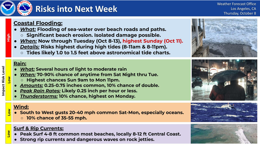 “Southern California is expected to get a reprieve from its prolonged October heat wave this weekend, but the cooldown will come with widespread rain, the possibility of flash flooding in mountain communities and another round of powerful surf threatening an already battered coastline. Moisture associated with Rachel, a tropical storm expected to weaken as it approaches northern Baja California, could bring moderate to occasionally heavy rainfall beginning late Saturday, Oct. 10, with showers potentially lingering through Tuesday, according to the National Weather Service. Although the storm’s center is most likely to remain south of Southern California, forecasters said its moisture, combined with approaching low-pressure systems, could bring rain, gusty winds and significantly cooler temperatures across the region. “The storm system right now is more likely than not to track south of the region,” said Kyle Wheeler, a meteorologist with the National Weather Service in San Diego. … ” Read more from the OC Register.
Councilmember Nazarian and city partners break ground on new project turning rainwater into local water supply
“Councilmember Adrin Nazarian, LADWP, LA Recreation and Parks, and the LA Bureau of Engineering convened in Valley Plaza Park this morning to break ground on a stormwater capture project to collect rainwater and urban runoff at seven local parks in the East San Fernando Valley. “This innovative program will be instrumental in fortifying Los Angeles’s water supply,” said Councilmember Nazarian. “This initiative enables the capture of millions of gallons of water that would otherwise flow into the ocean. Once complete, this initiative enables the capture of millions of gallons of water that would otherwise flow into the ocean, especially in times of heavy rainfall. Consequently, municipal rates can remain stable by reducing reliance on imported water sources from hundreds of miles away. I’m so glad that the East San Fernando Valley will be the first region in the city to see the benefits of this new program.” … ” Read more from LADWP.
LADWP begins refilling Santa Ynez Reservoir following completion of drinking water floating cover construction project
“The Los Angeles Department of Water and Power (LADWP) began refilling the Santa Ynez Drinking Water Reservoir yesterday. At the current fill rate of approximately 1.5 feet to 2 feet per day, the reservoir is anticipated to be back in service by the end of the year. The refilling process follows the completion of a new floating cover designed to protect drinking water quality and ensure compliance with state and federal drinking water regulations. The design and installation of the new reinforced liner and floating cover system – both required to safeguard potable storage under the EPA’s Long‑Term 2 Enhanced Surface Water Treatment Rule – began earlier this year and was fully installed in September. Throughout the floating cover replacement project and current refilling process, LADWP continues to provide uninterrupted drinking water service to Pacific Palisades customers through the Upper Stone Canyon Reservoir and the Westgate Trunk Line. … ” Read more from LADWP.
Chino Basin Program moves closer to final Prop 1 funding award
 “Proposition 1, approved by California voters in 2014, authorized $2.65 billion for public benefits associated with water storage projects, administered by the California Water Commission through the Water Storage Investment Program. Five of the eight conditionally accepted projects remain active, including the Inland Empire Utilities Agency’s Chino Basin Program, which would improve groundwater quality, support ecosystem flows, and provide emergency supplies. At the Commission’s August meeting, program manager Elizabeth Hurst updated commissioners on the project’s status, proposed public-benefit contracts, and remaining requirements for a final funding award. The Chino Basin Program is located in western San Bernardino County in Southern California and overlies the Chino Groundwater Basin. All program facilities will be constructed in the Rancho Cucamonga and Fontana portions of the Inland Empire Utilities Agency’s service area. The program will build on IEUA’s existing wastewater treatment and recycled water systems to expand regional treatment capacity and access to recycled water. … ” Read more from Maven’s Notebook.
San Diego City Council delays vote on water rates to comply with court decision
“The San Diego City Council on Tuesday punted a decision on adopting a new structure of water rates that would lower bills for apartment buildings but increase them for most single-family homes. The proposal is intended to bring the city into compliance with Proposition 218, a voter initiative from 1996 that regulates fees charged by local governments, including fees for water service. … “Public Utilities Department does not agree with the court,” said San Diego Chief Infrastructure Officer Kris McFadden. “However, we legally required to have a rate structure that the court deems valid under Proposition 218. The city must implement a unitary rate structure for our rates to be in compliance with the court ruling.” … ” Read more from KPBS.