Several news sources featured in the Daily Digest may limit the number of articles you can access without a subscription. However, gift articles and open-access links are provided when available. For more open access California water news articles, explore the main page at MavensNotebook.com.
On the calendar today …
- MEETING: South Bay Salt Ponds Restoration Project Stakeholder Forum and Public Meeting from 9am to 11am. You are invited to attend this periodic public meeting to learn about and provide feedback on the Restoration Project’s plans and work. This meeting is designed to update members of our Stakeholder Forum and members of the public about Restoration Project on-the-ground progress, work, science, and funding, and to hear your thoughts and feedback and answer your questions. The 2-hour meeting will be followed by an optional 1-hour Open House, from 11 a.m. to Noon, to allow time for more detailed questions, follow-up topics, and informal conversation. Click here for more information and to register.
- WEBINAR SERIES: Expanding Recharge and Preparing for Wet Weather from 11am to 12pm. Presenters: Mike Anderson and Mike Mierzwa, DWR The Department of Water Resources (DWR) and its State, federal, and local partners are actively preparing for a possibly wet season under very strong El Niño conditions. DWR is using the most advanced forecasting tools with partners at NOAA, Scripps, and others to prepare water managers for whatever may come in the months ahead. Mike Anderson, the State Climatologist with DWR, will present what current forecasts are telling us about the wet season ahead and Mike Mierzwa, the State Floodplain Manager also with DWR, will share guidance about how to prepare for flood conditions and document flood thresholds for advancing activities that reduce flood risk while increasing recharge under CWC Section 1242.1. Click here to register. Click here for a flyer.
- WEBINAR: Warming Ocean, Growing Risks California Prepares for Super El Niño from 12pm to 1pm. Supercharged El Niño conditions are fast developing in the Pacific Ocean and combined with an ongoing marine heatwave, may bring powerful storms, heavy surf, coastal flooding, power outages, and other threats to California’s communities, infrastructure, and ecosystems this winter. Join scientists and state leaders for an important discussion about these developing conditions, what we can expect this winter (and are already experiencing!), and how California communities are preparing. We’ll break down the science, update current projections, and discuss actions underway to prepare for storm and flood emergencies. We’ll also share practical actions that we can all take to prepare for extreme weather. Click here to register.
- MEETING: California Advisory Committee on Salmon and Steelhead Trout from 1pm to 4:30pm. Agenda items include an Overview of COEQWAL Alternative Water Futures for California; CDFW Update on Fall Creek and Trinity River Hatchery Production and Operations; CDFW Update on Landings and In-Season Adjustments for the 2026 Commercial Salmon Fishing Season; and an Update on Status of the Pacific Whiting Fishing Permit. Click here for the agenda and remote access instructions.
In California water news today …
All eyes are on this new El Niño forecast for California
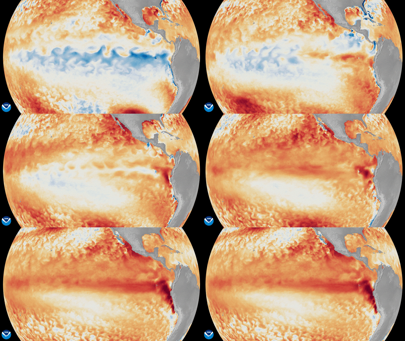
“Anticipation is mounting in California as the El Niño winter looms. El Niño now officially ranks as “very strong,” the most extreme category, according to an outlook the National Oceanic and Atmospheric Administration’s Climate Prediction Center published Thursday. The memo gives an 83% chance that El Niño will become “historic” by 2027, surpassing the strength of all events since 1950. As forecasters gain confidence in the extraordinary power of this year’s El Niño, early signs like hurricane swells are already impacting California. “It’s El Niño macho, as I call it,” Josh Willis, a senior research scientist for NASA’s Jet Propulsion Laboratory, told SFGATE. “This is a big event, it’s still growing in size, and its impact is just starting to reach out of the tropics.” … ” Read more from SF Gate.
New data: Super El Niño to bring even more rain to California, how much could we get?
“As El Niño breaks news records one week after the next, a new suite of data points to a wetter winter for the entire state of California, even wetter than previously thought. New this week, two new runs of climate model products have been released, and both point to rain and snow on the way. The National Multimodel Ensemble (NMME), which we highlighted as one of the leading signs of a wet winter earlier this week, and the European Seasonal Forecasting System 5 (SEAS5), which has been shown to be more accurate than others across the western United States. The sign is pretty unambiguous, rain is coming, and in some places quite a lot more. Most of the state, and the vast majority of populated areas, looks primed for rainfall of at least 150% of normal throughout the winter months, with some areas likely receiving double their winter average along the coast, where El Niño is already expected to raise sea levels thanks to warmer ocean temperatures and an ongoing marine heat wave. … ” Read more from the Sacramento Bee.
El Niño is very likely to be the strongest since records began 75 years ago, feds say
“El Niño has a greater than 80% chance of eclipsing all such events since 1950 as it continues to strengthen through the fall, federal forecasters said Thursday. Parts of the equatorial Pacific were more than 4 degrees Celsius above normal in September. In the patch of ocean that forecasters watch closely to track El Niño, known as Niño 3.4, the average daily surface temperature reached a record 86 degrees Fahrenheit this week. Ocean temperatures off the coast of Chile and Peru were more than 7 degrees Celsius above normal, fueling a hurricane outbreak in the east Pacific over the past few months. It’s a hallmark of an eastern-based El Niño, a pattern that can favor wetter California winters. The warmth extends well below the surface of the ocean. Some subsurface areas of the eastern Pacific are more than 10 degrees Celsius warmer than average. That reservoir of warmth can help sustain and strengthen El Niño. … ” Read more from the San Francisco Chronicle.
The National Hurricane Center just drew a forecast path into California. Is the threat legit?
“The National Hurricane Center on Wednesday morning extended the forecast cone of an ongoing tropical cyclone — Hurricane Rachel — into California. The storm won’t be a hurricane by the time it nears California this weekend, but it could still present hazards characteristic of a tropical cyclone: Heavy rain, strong winds, big waves and potential storm surge. Officially, the hurricane center forecasts the storm to make landfall about 100 miles south of San Diego around 5 a.m. Sunday, but the “cone of uncertainty” shows the possible path of the center of the storm as far north as Anaheim — a highly unusual potential incursion into California. The hurricane center notes “hazardous conditions can occur outside of the cone.” The distant hurricane is already raising the risk of dangerous rip currents for most of coastal Southern California. As it draws closer late Saturday into Sunday, Orange and San Diego counties are most likely to experience strong winds, and large, potentially damaging waves. … ” Read more from the San Francisco Chronicle. | Read via Yahoo News.
Draft 2026 Sustainable Groundwater Management Grant Program Guideline Amendment and Proposal Solicitation Package
“The California Department of Water Resources (DWR) is pleased to announce the release of the Draft 2026 Sustainable Groundwater Management Grant Program Guideline Amendment and Draft 2026 Proposal Solicitation Package (PSP). DWR will host two public workshops in November to provide an overview of the program, review key components of the Draft 2026 Guideline Amendment and Proposal Solicitation Package, and to accept public comments.” Read the full notice from DWR.
Metropolitan, Delta Conservancy celebrate the start of 2,800-acre wetland restoration project
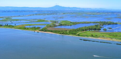
“Surrounded by the waters of the Sacramento-San Joaquin Delta, state and local leaders gathered today on Webb Tract to mark the beginning of a 2,800-acre wetland restoration project aimed at giving new life to one of the Delta’s deeply subsided islands. Supported by a $20.9 million grant from The Delta Conservancy, the project on the Metropolitan-owned Webb Tract seeks to help slow subsidence, sequester carbon and create habitat for migratory birds and other wildlife, while continuing to support the local agricultural economy. … More than a century of conventional dry-soil farming has contributed to subsidence throughout the Delta, with some areas of Webb Tract now as much as 24 feet below sea level. When peat soils are drained, they decompose and release carbon and the land surface continues to subside. If the land surface sinks too low, levees can fail and the islands could be flooded, which could affect the people who live and work on the islands, water quality, water exports, agriculture, infrastructure and habitat. … ” Read more from the Metropolitan Water District.
DELTA CONVEYANCE PROJECT: Procedural Ruling and Closing Brief Guidance (DCP)
“The surrebuttal phase of the Delta Conveyance Project (DCP) hearing on the change petitions submitted by the Department of Water Resources (DWR) concluded on September 3, 2026. As described below, the Protestants’ requests to present additional evidence are denied without prejudice. This letter also addresses Ms. Des Jardins’ motion regarding climate modeling, sets page limits and deadlines for the submission of closing briefs, and provides guidance to the parties about preparation of closing and reply briefs.” Click here to read the ruling.
Chino Basin Program moves closer to final Prop 1 funding award
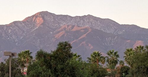 “Proposition 1, approved by California voters in 2014, authorized $2.65 billion for public benefits associated with water storage projects, administered by the California Water Commission through the Water Storage Investment Program. Five of the eight conditionally accepted projects remain active, including the Inland Empire Utilities Agency’s Chino Basin Program, which would improve groundwater quality, support ecosystem flows, and provide emergency supplies. At the Commission’s August meeting, program manager Elizabeth Hurst updated commissioners on the project’s status, proposed public-benefit contracts, and remaining requirements for a final funding award. The Chino Basin Program is located in western San Bernardino County in Southern California and overlies the Chino Groundwater Basin. All program facilities will be constructed in the Rancho Cucamonga and Fontana portions of the Inland Empire Utilities Agency’s service area. The program will build on IEUA’s existing wastewater treatment and recycled water systems to expand regional treatment capacity and access to recycled water. … ” Read more from Maven’s Notebook.
Copepodamide tracking predicts harmful algal blooms seven weeks out
“A team of marine scientists led by researchers at the University of California, Santa Cruz, has unlocked a novel approach to predicting harmful algal blooms (HABs), fundamentally shifting how oceanographers track these hazardous marine events. In a study published in the Proceedings of the National Academy of Sciences (PNAS), the researchers demonstrated that passively measuring chemical “alarm cues” produced by microscopic ocean predators—a group of polar lipids known as copepodamides—allows scientists to forecast toxic algal blooms up to seven weeks in advance. This “top-down” biological monitoring technique extends predictive lead time by more than a month compared to conventional toxin-tracking methods, giving coastal agencies and shellfish fisheries critical advance warning before toxins reach dangerous levels. … ” Read more from Eco Magazine.
Overcoming funding barriers for water efficiency with Dr. Emilio Mateo
“Dr. Emilio Mateo works on the Pacific Institute’s Catalyzing Water Efficiency Investments through Debt Financing Accelerator in partnership with WaterNow. The project team is working with the Bay Area Water Supply and Conservation Agency (BAWSCA) in Northern California and the Pueblo West Metropolitan District (PWMD) in Southern Colorado on alternative ways to fund water efficiency at a larger scale. Sumbul: You started out studying glaciers and mountain hydrology in Colorado and Peru and now you work on how utilities can increase investments in water efficiency incentives. What connects those two things for you, and what pulled you toward the financing side of water? Emilio: My background is rooted in the natural hydrology space, specifically glacier hydrology. In Peru, I focused on meltwater streams below different forms of glaciers, the water quality of that meltwater, and ultimately on the downstream impacts in communities below. My work in Colorado was a bit broader, from soil moisture in mountainous terrain to snow sublimation, to how climate data is used in various sectors and is factored in the decision-making process. … ” Read more from the Pacific Institute.
CA Water Alliance forum highlights need for state-federal partnerships
“On October 1, the California Water Alliance hosted its sixth annual Water Forum in Fresno, featuring insights from policymakers and local leaders in water, agriculture, and business. Along with remarks from Central Valley Congressman Vince Fong, the forum included an expert panel discussion on California’s water future. According to Ryan Jacobsen, moderator of the panel and CEO of the Fresno County Farm Bureau, the panelists were uniquely suited to discuss water reliability, infrastructure, policy, and practical solutions to the state’s water challenges. Panelists included Executive Director of the Water Blueprint for the San Joaquin Valley Austin Ewell, CEO of the Friant Water Authority Johnny Amaral, Founder and CEO of Weather Tools Rob Doornbos, Water Law and Public Agency Attorney Lauren Layne, and Karla Nemeth, executive director of the Association of California Water Agencies and former director of the California Department of Water Resources. Jacobsen began the discussion by asking each panelist to describe the obstacles to establishing greater water reliability in the state. According to Layne, regulations and legislation continue to hinder meaningful progress. … ” Read more from Valley Ag Voice.
Newsom apologized to tribes for historic harms, but vetoed 2 bills that would have empowered them
“Five days after signing a law formalizing a state apology for “harms and atrocities” against California’s Native peoples, Gov. Gavin Newsom vetoed two additional bills that California tribes had championed, one on water and the other on sacred sites. Tribal leaders say the vetoes leave them shut out of decisions about their ancestral waters and sacred places. One of Newsom’s vetoes struck down a measure that would have compelled state agencies to address water shortages faced by tribes. Assembly Bill 2218 by Ash Kalra, a Santa Clara County Democrat, would have established a state policy to address water-related inequities and would have required a dispute between a tribe and any state water agency over water projects in the tribe’s ancestral territory to go through a mediation process, run by the Governor’s Office of Tribal Affairs. The Karuk Tribe and the Shingle Springs Band of Miwok Indians co-sponsored the legislation. … ” Read more from Cal Matters.
California, 16 states join forces to try to save the Roadless Rule
“California and 16 other states are denouncing the Trump administration’s plan to repeal the government’s 23-year-old “Roadless Rule” and allow road-building, logging and possibly oil-drilling and mining on nearly 45 million acres of national forest land. “By supporting the drinking water supply for 25 million Americans, the Roadless Rule and the sustainable forest management practices it mandates provide critical human health and economic benefits,” the states said Tuesday in a letter asking the U.S. Department of Agriculture to withdraw the plan. California Attorney General Rob Bonta, who led the group of states along with his counterparts in Washington and Oregon, said his state is “home to some of the most pristine and diverse ecosystems in the nation. We will not stand by and allow the federal government to subject our National Forests to commercial exploitation.” … ” Read more from the San Francisco Chronicle.
See how extreme wildfires are transforming forests
“When Jonathan Coop was a child growing up in northern New Mexico, the Jemez Mountains were a playground of towering volcanic cliffs and expansive conifer forests. Hiking trails were carpeted with sweet-smelling needles. Ponderosa pine and Douglas fir kept the mountainsides shady and cool. But in 2011, the Las Conchas Fire ripped through the landscape, breaking what was then the record for largest blaze in state history. The fire was so extreme it killed nearly every conifer across thousands of acres of land. In the aftermath — made hotter and drier by human-caused warming — many species were unable to re-germinate. New plants began to colonize the empty space, including stunted oaks and invasive weeds. “Now it looks like a few little black matchsticks in landscape of shrubs and grass,” said Coop, now an ecologist at Western Colorado University. “The forest was basically just erased off the map.” … ” Read more from the Washington Post.
In commentary today …
Observations as a new water year begins
Edward Ring, director of water and energy policy for the California Policy Center, writes, “For water users and water watchers, October 1st was New Year’s Day. It’s a good time to step back and comment on where we’re headed with water policy and water projects. There is no single variable that affects how much water is available to Californians than how we manage the Sacramento-San Joaquin Delta. Around five million acre feet per year are exported from the delta into southbound aqueducts: the federally operated Delta Mendota Canal, and the state operated California Aqueduct. Of this diverted water, in a typical year, about 1.4 million acre feet per year goes to cities, mostly on the Southern California coast, and the rest goes to farms, mostly in the San Joaquin Valley. How much water flows through the delta and out to the San Francisco Bay is also affected by how much water makes it into the delta to begin with. Farm irrigation, evaporation, percolation, and diversions for environmental purposes consume additional millions of acre feet from tributaries up and down the 43,000 square mile watershed. For the water year just ended, 14.0 million acre feet of water survived the gauntlet of diversions and poured into the San Francisco Bay. And from the delta, 2.4 million acre feet (MAF) were pumped into the California Aqueduct, and 2.1 MAF were pumped into the Delta Mendota Canal. That totals 4.5 MAF going to farms and cities in the year just ended. … ” Read more from Edward Ring.
In regional water news and commentary today …
NORTH COAST
A federal plan to end the roadless rule puts Klamath spring Chinook habitat in play
“One of the last two wild runs of spring Chinook salmon in the Klamath Basin depends on roadless country along the South Fork Trinity River in Six Rivers National Forest. A federal proposal would scrap the rule that keeps that land free of new roads, and the public comment period closes October 6. The Pew Charitable Trusts laid out the stakes in an analysis published Monday, noting that the U.S. Department of Agriculture proposed on August 24 to rescind the Forest Service’s 2001 Roadless Area Conservation Rule, which restricts road building and timber harvest on 44.7 million acres of national forest. A final decision is expected in 2027. Repeal would raise the annual sawtimber harvest by an estimated 5 to 10%, worth $4.6 million to $10.6 million a year, while costing the recreation economy a projected $6.1 million annually. The Forest Service already carries a $6.9 billion maintenance backlog on its roads and bridges, and a new dirt road runs $80,000 to $100,000 a mile. … ” Read more from Active NorCal.
Trump administration seeks to narrow endangered species protections, with potential impacts on North Coast habitat
“This legal battle could have significant implications for Humboldt County, home to numerous species classified as threatened and endangered. Among them are northern spotted owls and marbled murrelets and coho salmon and steelhead. The region is also home to the federally threatened Humboldt marten. The administration’s removal of the regulatory definition of “harm” leaves environmentalists concerned about how much protection these animals will receive when logging, development, water diversions, or other activities alter their habitat. … The Justice Department’s Energy and Natural Resources Division (ENRD) yesterday filed motions for summary judgment in four cases defending challenges to a rule rescinding the regulatory definition of “harm” in U.S. Fish and Wildlife Service (FWS) and National Marine Fisheries Service (NMFS) regulations implementing the Endangered Species Act (ESA). These cases, in the Northern District of California and the District of South Carolina, are the first in a series of similar challenges across the country to reach this stage of litigation. … ” Read more from the Redheaded Blackbelt.
SIERRA NEVADA
Protecting Lake Tahoe: How the Lahontan Water Board helps keep the iconic lake blue
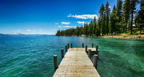 “Lake Tahoe, one of California’s – and the world’s – most dazzling natural features, attracts approximately 15 million visitors every year to its emerald waters, sandy beaches and stunning alpine terrain. Often referred to as the “Jewel of the Sierra,” the lake is not just a tourism hotspot but also a unique water resource and major freshwater research hub, with Lahontan Regional Water Quality Control Board scientists playing a key role in preserving the lake’s iconic water clarity and quality. Tahoe’s clarity is one of many reasons that make it iconic, but it’s also fragile. As the lake’s popularity has increased, its waters have become murkier. Clarity declined from a depth of 105 feet in 1967 to an all-time low at the time of only 64 feet in 1997, spurring concern in California and Nevada. …; ” Read more from the State Water Board’s Ebb and Flow.
Nevada County Supervisors adopt strategic framework for local climate resilience
“At their Tuesday meeting, Supervisors approved the County’s Resource Resiliency Roadmap, a long-term plan to help communities prepare for increasingly frequent extreme weather and improve access to future state and federal funding, including grant funding from the climate bond approved by California voters in November 2024. The Board’s action followed two years of community engagement, technical analysis, and collaboration with local organizations, Tribes and agencies. Hundreds of residents helped develop the plan through workshops, surveys, focus groups and public comments. Top community concerns included wildfire, power outages, extreme weather and the rising cost of living, all reflected throughout the Roadmap’s strategies. … ” Read more from YubaNet.
SACRAMENTO VALLEY
Oroville begins clearing overgrown vegetation at Bedrock Park
“Bedrock Park is receiving a makeover, with crews beginning work on clearing large amounts of vegetation in the park on the island in the Feather River. The city of Oroville began work on a large-scale clearing of vegetation Tuesday, focusing heavily on the island in the Feather River. City Administrator Brian Ring said the idea to clear the vegetation at the park was talked about with the city for months. He said the vegetation had gotten to a point where it was overgrown, but the city hadn’t had the resources to address it in the past. “Bedrock Park is, in my opinion, a jewel of this community,” Ring said. “If anyone hasn’t been out there, I mean, just walk out there. Even right now, when it’s not in its best shape, it’s still one of the most beautiful places in this town. By clearing off the vegetation on the island, it’s going to make it safer for folks to be able to go out there and enjoy the the beauty of the Feather River.” … ” Read more from the Chico Enterprise-Record.
From the river: A different view of Sacramento’s erosion protection
“From the Sacramento River, the progression of work to strengthen one of the city’s most important lines of flood defense can be seen in a single boat trip. At some locations, barges and heavy equipment are placing rock along the shoreline. A short distance away, completed sites show what that construction is designed to become as native vegetation takes hold along the rebuilt riverbank. Project team members traveled the river Sept. 30 to view active and completed portions of the Sacramento River erosion protection work, part of the American River Common Features 2016 project. The trip included active construction at Sites 7 and 8 along the east bank of the river in Sacramento’s Pocket and Greenhaven area. The group also viewed completed erosion-protection work from earlier contracts near Pocket-Greenhaven and Little Pocket to see how the riverbank and vegetation are developing after construction. For Sacramento residents, the work addresses a problem that can be difficult to see from streets, trails and neighborhoods behind the levee: erosion occurring along the river side of the flood control system. … ” Read more from Dredge Wire.
Regional Water Authority celebrates 25 years of partnership and progress
“The Regional Water Authority celebrated its 25th anniversary on October 1, bringing together approximately 120 water leaders, elected officials, and partners to recognize a quarter-century of partnership that has strengthened water supply reliability and supported communities and the environment in the greater Sacramento region. Held in downtown Sacramento, the celebration highlighted the relationships behind the region’s progress and the work ahead as water suppliers prepare for a changing climate, address pressures on affordability, and navigate increasingly complex regulations. “Water is the ultimate team sport,” said RWA Executive Director Jim Peifer. “Nothing gets done by an individual in this business. It’s the work of many people, and the RWA really helps to accomplish that.” … ” Read more from the Regional Water Authority.
NAPA/SONOMA
Sonoma County officials declare emergency ahead of possible wet winter
“Sonoma County officials are stepping up preparations for a potentially wet winter, declaring an emergency Tuesday as forecasters warn that a strong El Niño could bring unusually heavy rain. The Board of Supervisors proclaimed the emergency as the county prepares for a season that could bring flooding, mudslides and other storm-related problems. The action comes two weeks after Gov. Gavin Newsom issued a statewide emergency proclamation, saying the anticipated impacts could require resources from multiple jurisdictions and mutual aid regions. Forecasters put the chance of El Niño reaching historic levels this winter at 75%, according to the county. “The best time to prepare for a flood is before a storm,” Supervisor Rebecca Hermosillo, chair of the Board of Supervisors, said in a statement released by the county. … ” Read more from Local News Matters.
BAY AREA
S.F. Bay high tides will be at flood levels this weekend; El Niño-fueled wave of water may have reached city
 “El Niño-warmed seas are pushing tides unusually high in California, prompting the National Weather Service to issue a coastal flood advisory for San Francisco Bay and Monterey Bay. The advisory is in effect from 9 a.m. Friday to 3 p.m. Tuesday. “High tides will result in flooding along coastal trails, cut off access to some low- lying beaches and coastal areas, and bring water and waves farther up the beach than typical,” the weather service said. Low-lying parking lots, parks, and roads could experience flooding. In San Francisco, tides are forecast to peak at 1.2 feet above the average highest daily tide on Friday to Sunday, in the late morning and early afternoon. … ” Read more from the San Francisco Chronicle. | Read via Yahoo News.
Press release: Sierra Club sues San Francisco Public Utilities Commission over inflated water demand forecast
“For years, San Francisco’s water utility has pulled more water out of the rivers than its customers need, has planned on major infrastructure builds that exceed future demand, and has put its ratepayers on the hook for current and future rate increases. Last week, the Sierra Club filed a petition in court that challenges the heart of the San Francisco Public Utility Commission’s (SFPUC) mismanagement of our natural resources and of the public purse. The petition in San Francisco Superior Court alleges the agency is not properly informing the public on the important issue of future water demand. This follows a pattern of inflated demand projections by agencies throughout the state. We are asking the courts to finally set the SFPUC straight and, in so doing, protect our environment. State law requires every five years that urban water suppliers publish a public accounting of how much water its customers will need. That document is not a formality: it is the factual basis for how much water agencies divert from rivers and the Bay-Delta, and for the programs ratepayers finance. The SFPUC has, over the years, had a pattern of inflated demand projections, overstating demand by 40-50%. That means they leave less water in the rivers and fewer dollars in the pockets of the public. The environment and ratepayers both pay. … ” Read more from the Sierra Club.
SEE ALSO: Lawsuit Filed By Sierra Club In Connection To Hetch Hetchy Reservoir, Demand Forecasts, from My Mother Lode
Markham Elementary sixth graders explore Suisun Marsh
“A hot day usually calls for a trip to the beach or a dip in the pool. But for Markham Elementary sixth graders, Wednesday was a day to explore the Suisun Marsh at Rush Ranch, where they learned about the area’s ecological diversity and why protecting it is important to the health of the region’s waterways. “Our goal at RCD is to bring kids outside and get them in tune with nature,” said Rebecka Velarde, a program educator with the Solano County Resource Conservation District. “We take sixth graders from all around Solano County, and we teach them about their marsh health, the delta, and how the delta flows into the marsh.” The Solano RCD is hosting the annual field trips for the 17th year. By the end of the winter, over 1,500 students from 14 different schools in Solano County will have experienced the Suisun Marsh. … ” Read more from the Vacaville Reporter.
SAN JOAQUIN VALLEY
San Joaquin County halts new data center approvals amid water, power concerns
“San Joaquin County supervisors have temporarily halted approvals for new large-scale data centers, giving county officials time to study how the rapidly growing industry could affect electricity, groundwater, agriculture and surrounding communities. The Board of Supervisors voted 5-0 Tuesday to adopt an urgency ordinance establishing a 45-day moratorium on new land-use approvals for data centers in unincorporated San Joaquin County. The pause comes about a month after supervisors directed county staff to spend six months studying large-scale data centers and asked County Counsel Edward J. Kiernan to determine whether a temporary moratorium could legally be imposed. … ” Read more from Stocktonia.
Magsig looks into $100,000 relief for Shaver Springs water issues
“Fresno County Supervisor Nathan Magsig plans to spend $100,000 of his own district funding to help Shaver Springs deal with its water quality issues. The board unanimously approved Magsig’s proposal on Tuesday to study solutions for the water quality issues and to potentially use money set aside for district projects to fund them. The backstory: Shaver Springs residents have reported discolored water, with some of them publicly sparring over the issue with Magsig. State officials have told the county that the water is potable, but the county has issued water quality violation notices for high levels of gross alpha, uranium and manganese in the water. … ” Read more from the San Joaquin Valley Sun.
Justices delve into constitutional questions swirling in Kern River case
“California Supreme Court justices wasted no time Wednesday jumping into the deep end of several complex issues at the heart of an ongoing lawsuit over flows in the Kern River. Within a few minutes of Attorney Kevin Bundy’s opening address on behalf of plaintiffs Bring Back the Kern and Water Audit California, Chief Justice Patricia Guerrero interrupted to ask about one of the main issues in the case: Whether a particular water use must be found “reasonable” when compared to other, competing uses. Her question was aimed at the relationship between California Fish and Game Code Section 5937 – which requires dam owners to allow enough water downstream for fish – and Article X, Section 2 of the state constitution – which requires all water uses to be reasonable. … ” Read more from SJV Water.
SEE ALSO:
- Kern River goes before California Supreme Court: Is Bakersfield obligated to keep water in the river?, from KGET
- California Supreme Court probes ‘reasonable’ water use in Kern River, from the Courthouse News Service
SOUTHERN CALIFORNIA
Extreme heat, dangerous surf hit Southern California as Hurricane Rachel churns
“Southern California’s stubborn October heat wave continues Wednesday as another weather threat develops along the coast, where Hurricane Rachel is helping generate elevated surf, dangerous rip currents and possible flooding. An extreme heat warning remains in effect through 8 p.m. Thursday for parts of Los Angeles and Orange counties, while a coastal flood advisory went into effect Wednesday morning and is expected to remain in place through 1 p.m. Friday. The combination of unusually high tides and a southerly swell generated by Hurricane Rachel could bring some of the greatest coastal flooding impacts to areas including Long Beach, Catalina Island, Malibu and Zuma Beach, according to the National Weather Service. … ” Read more from KTLA.
SEE ALSO: Hurricane Rachel forecast to reach Southern California as strong waves begin battering coast, from CBS LA
Kelvin wave hitting Southern California: What to expect as El Niño threatens the coast again
“The Kelvin wave bearing down on Southern California this week is not the kind that draws surfers. You don’t see it crash on shore, and by itself, it’s probably not even noticeable. But it can have a profound effect, adding 6 to 12 inches to background sea levels, potentially for months. This is a major concern when combined with other sources of sea level rise, and could exacerbate the woes of California coastal cities and property owners. The “coastally trapped” aquatic pulse has been slithering up the coast for weeks, fascinating scientists and weather watchers as it marched across the equatorial Pacific before splitting upon hitting the coast of Peru. “It is arriving now,” UC Agriculture and Natural Resources climate scientist Daniel Swain said in an interview. … ” Read more from the LA Times.
Desalination project near Doheny State Beach gets changes approved, timeline pushed back
“Several changes to an ocean desalination project proposed near Doheny State Beach to help generate drinking water for South Orange County were discussed Wednesday, Oct. 7, by the California Coastal Commission, with the modifications given the green light. Approved changes will move the slant wells, which will source water from subsurface intake wells buried beneath the ocean floor, to the north day use area of the state beach, away from the campgrounds as previously proposed. The project aims to tap seawater to lessen the dependence on imported water, with the South County Water District estimating the ability to make up to 5 million gallons per day of drinking water supply using a first-of-its-kind system in the state. The desalination plant would sit at Pacific Coast Highway and Stonehill Drive, next to San Juan Creek, within 100 yards of existing regional water transmission lines. SCWD proposes to build the facility on property it owns, with much of the infrastructure already in place. … ” Read more from the OC Register.
Warm water, wild visitors: El Niño is reshaping Southern California’s marine neighborhood
“Southern California boaters and anglers are accustomed to watching water temperatures closely. A few degrees can change where bait gathers, where gamefish travel, and what anglers might find at the end of their line. But in 2026, the changes unfolding along the coast have gone well beyond the fishing grounds. Two olive ridley sea turtles have laid eggs on Orange County beaches in what officials say are the first known natural sea turtle nests recorded on the U.S. West Coast. Days earlier, a rare yellow-bellied sea snake, a tropical and highly venomous species seldom documented in California, washed ashore at Crystal Cove. Offshore, anglers have already been seeing another side of the same warm-water story. Dorado and yellowfin tuna arrived unusually early this year, while other warm-water species have expanded their ranges northward. Together, the sightings are turning Southern California’s coastline into a living example of what can happen when an already warm ocean meets a developing El Niño. … ” Read more from The Log.
Orange County residents blast emergency shoreline armoring
“Beachgoers and residents of Orange County, California, demanded answers from the California Coastal Commission Wednesday over the continued emergency permitting of shoreline armoring in San Clemente that they say prioritizes an aging railroad track over beach access. Residents told commissioners that the armoring has been a Band-Aid solution that has only resulted in the loss of more shoreline as sandy beaches become inaccessible due to riprap — large angular stones that are used to prevent coastal erosion. They say what’s needed is sand, but the Orange County Transit Authority and Southern California Regional Rail Authority have failed to provide it. “Four years ago, they told us, ‘We are studying how to get sand down,’” Save Our Beaches San Clemente Chairman Gary Walsh told commissioners. “Now, in that length of time, SpaceX has managed to build a rocket and send astronauts around the moon.” … ” Read more from Courthouse News Service.
SEE ALSO:
- Popular San Clemente beach trail to fully reopen as crews finish protecting coastal rail, from the LAist
- SoCal’s famed coastal railroad may have to move to survive rising seas. How could it happen?, from the LA Times
IMPERIAL/COACHELLA VALLEYS
IVH2O initiates sustainability campaign; fights to protect local water rights
“The Imperial County Board of Supervisors approved a $65,000 Public Benefit Grant to the Imperial Valley Water (IVH2O) on Tuesday, October 6, to expand its policy education and public outreach efforts through the ongoing development of 2026 Colorado River operating guidelines. The grant application was submitted to the Public Advisory Committee on April 13, and updated in July. The grant was approved by the Committee on May 18, before moving forward for the County Board’s approval. IVH2O initiated a stakeholder advocacy and public relations campaign in 2015 to defend local interests against challenges to Imperial County’s water rights. In its grant application, IVH2O stated Imperial County agriculture is the target of criticism due to its substantial allocation of water on the Colorado River, which heightens concerns regarding the renegotiations of the 2007 Colorado River Interim Guidelines for lower Basin Shortages and the Coordinated Operations of Lake Powell and Lake Mead, expiring at the end of 2026. … ” Read more from the Imperial Valley Press.
Newsom data center laws could reshape Rucci project
“Two new California laws signed by Gov. Gavin Newsom could significantly change the regulatory landscape for Sebastian Rucci’s proposed nearly one-million-square-foot artificial intelligence data center near the City of Imperial, although the two measures affect the project in different ways. Newsom signed Senate Bills 886 and 887 on Sept. 21 as part of a seven-bill package aimed at regulating the rapidly expanding data center industry. The new laws address electricity costs, environmental review, water use, and the potential for data centers to shift infrastructure costs onto existing utility customers. For Rucci’s Imperial Valley Computer Manufacturing LLC project, SB 887 may be the more consequential of the two measures. The legislation eliminates the ability of qualifying data center projects to rely on categorical exemptions from the California Environmental Quality Act, commonly known as CEQA. It also creates a new pathway for data centers that meet stringent environmental and energy requirements to receive “Environmental Leadership Development Project” certification, which provides an expedited judicial review process. The law takes effect Jan. 1, 2027. … ” Read more from the Desert Review.
Along the Colorado River …
Where does Arizona’s water actually go? A look inside the numbers
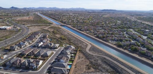 “Lake Mead and Lake Powell are hovering at record low levels, and the instinct is to point fingers at growth, golf courses, and data centers. But a closer look at the data tells a more complicated story. The single biggest consumer of water in Arizona is agriculture — accounting for nearly three-quarters of the state’s total use, or about 5 million acre-feet annually. Within that, a single crop dominates: alfalfa, which alone accounts for 1 million acre-feet, or 20% of all water used in Arizona. Cotton is next at 7%. Every other crop comes in at 3% or lower. Arizona cities used 1.5 million acre-feet in 2024 — and while that number is growing alongside the population, the growth is increasingly efficient. Today, Arizona cities use just under 200 gallons per person, per day. The peak was 279 gallons per person, per day — back in 1989. … ” Read more from KTAR.
Arizona exploring long-term water importation options
“Arizona is studying five projects that could eventually bring hundreds of thousands of acre-feet of new water to the state, but the projects face a major hurdle: The state lacks long-term funding sources to pay for them. The Water Infrastructure Finance Authority of Arizona’s Board of Directors approved two projects for appraisal studies on Monday, bringing the number of projects in the appraisal phase to five. Early estimates suggest they could produce nearly 1 million acre-feet of water each year, though more conservative estimates put their combined yield at about 361,000 acre-feet. The state’s expected reduction in its Colorado River supply is about 760,000 acre-feet annually, underscoring the scale of the challenge facing state water officials. State lawmakers have given WIFA about $386 million to pursue long-term water augmentation projects. Appraising the five projects will cost about $27 million. One proposed project — a Mexico-based desalination plant — could cost billions of dollars. … ” Read more from the Arizona Capitol Times.
Colorado should buy part of San Luis Valley ranch at the center of a long-running land battle, report says
“The state should “acquire” 10,000 acres of an 83,000-acre San Luis Valley ranch long fought over by the ranch owner and the heirs of a land grant signed before Colorado was a state, a new report ordered by Gov. Jared Polis says. The governor appointed former U.S. Sen. Ken Salazar, a native of the valley in southern Colorado, as a “special envoy” to help come up with a solution to one of the state’s longest-running land battles. In the past month, Salazar and consultant Berrick Abramson have met with the landowner, walked the ranchland, and talked with land-grant heirs at the governor’s mansion. The two even asked William Harrison, the son of an oil baron who purchased the Cielo Vista Ranch in 2017 for $105 million, if the state could buy the whole property, according to the report released Wednesday. The answer was a definitive no. “He declined that approach and said he had no interest in it,” wrote Abramson, with consulting firm Confluence PSG. “He repeated that position in multiple subsequent discussions.” … ” Read more from the Colorado Sun.
In national water news today …
How the U.S. public lost its say on environmental policy
“Public participation is a hallmark of environmental regulation, embedded in every major environmental statute enacted over the past half-century. Yet the Trump administration has systematically sought to curtail public input into the government’s environmental decision-making by shirking decades of precedent and making strained interpretations of longstanding federal law. Looked at collectively, the pattern of public disenfranchisement is unmistakable. There are good reasons to speed up the process of writing regulations and issuing permits, but truncating public input has serious costs. It can result in flawed policy that is harder to implement, full of avoidable error, and more vulnerable to being struck down by courts. Input from industry, public interest groups, academics, states, and other agencies gives regulators critical feedback on the potential impact of their proposed rules, helping them to anticipate and avoid unforeseen problems. Stakeholders possess information, experience, and expertise the government lacks, and they can suggest alternatives to make rules more effective or less costly. By testing agency assumptions and pushing officials to explain their rationale, public comments perform a crucial vetting function. The process also helps to make government more accountable by alerting Congress to potential pitfalls and building a record in the event of judicial review. … ” Read more from Yale e360.