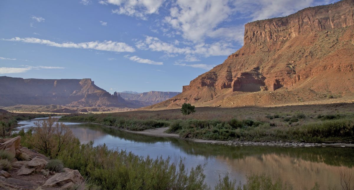
Using satellite technology, Virginia Tech geoscientists estimated groundwater depletion across the Colorado River Basin, finding recent losses greater in the historically resilient Upper Basin.
By Kelly Izlar, Virginia Tech
Declining Colorado River flows and falling water levels at Lake Powell and Lake Mead are highly visible signs of the Southwestern megadrought.
Unseen below ground, groundwater reserves in the Colorado River Basin are disappearing just as fast — and in an unexpected new pattern, according to research from Virginia Tech.
Historically, groundwater has declined more in the Lower Basin. But the system has hit a turning point: The Upper Basin is now experiencing rapid groundwater losses, with surface-water shortages increasingly affecting groundwater as well.
To isolate changes in groundwater stocks across both basins, Virginia Tech’s Susanna Werth and a team of geoscientists combined measurements from NASA’s Gravity Recovery and Climate Experiment satellite mission with estimates of surface water, soil moisture, and snow-water storage from 2004 to 2023. Their findings were published in Water Resources Research.
Results point to an acceleration in groundwater depletion after 2019. During the severe drought from 2020 to 2022, the Upper Basin lost about 4.6 trillion gallons of groundwater. This was nearly double the loss in the Lower Basin, which was estimated at 2.5 trillion gallons.
“We generally think of the Upper Basin as more resilient because of its snowmelt-driven recharge,” said lead author Esther Oyedele, a geosciences graduate student at Virginia Tech. “I did not expect to see so much groundwater loss there during the recent drought. What surprised me even more was that groundwater did not track surface-water shortages in the same way in the Upper and Lower Basins.”
A thinning buffer
The Colorado River Basin provides water for roughly 40 million people and extensive agricultural operations. As rivers and lakes dry up, groundwater can become a critical buffer against shortages — but that buffer is not unlimited.
“Continued groundwater depletion, especially in the Upper Basin, could further reduce groundwater contributions to rivers and intensify the feedback between groundwater loss and surface-water shortages,” said Werth, an assistant professor of hydrology and remote sensing.
The study sends a clear signal, Werth said: Looking at surface water alone is no longer enough. Protecting the Colorado River Basin requires managing the water above and below ground.
RESEARCH: Contrasting Groundwater Response to Surface Water Shortages in the Upper and Lower Colorado River Basins
By E. O. Oyedele, S. Werth, G. Carlson
 ABSTRACT: Groundwater plays a critical role in sustaining the water supply in the Colorado River Basin (CRB), a region experiencing persistent drought, population growth, and increasing water demand. Using GRACE/GRACE-FO satellite observations combined with hydrological data sets, we analyze basin-scale variations and long-term trends in terrestrial and groundwater storage across the CRB from water year 2004–2023. We further apply a joint framework integrating copula-based statistical modeling with statistical inference to quantify probabilistic relationships among storage-based drought indicators and to characterize groundwater–surface water interactions.
Results reveal sustained basin-wide groundwater depletion over the past two decades, with accelerated losses since 2019 and during the water year 2020–2022 drought. Notably, during this recent drought period, groundwater losses were larger in the typically more resilient Upper CRB (17.5 ± 3.5 km3) than in the Lower CRB (9.4 ± 6.5 km3), indicating increasing vulnerability across both subbasins. Copula-based analysis shows strong coupling between surface-water deficits and groundwater drought probability in the Upper CRB, whereas parts of the Lower CRB exhibit weaker statistical dependence, consistent with groundwater extraction operating partly independently of surface water availability under chronically limited supply conditions.
These findings provide a basin-wide observational synthesis of groundwater–surface water dynamics and demonstrate the value of satellite-based monitoring for diagnosing hydroclimatic stress in large managed river basins. The results highlight emerging shifts in groundwater vulnerability across the CRB and underscore the need for integrated water-management strategies that jointly consider climatic pressures and sustained anthropogenic demand.
PLAIN LANGUATE SUMMARY: Groundwater is a vital resource in the Colorado River Basin (CRB), one of the most water-stressed regions in the United States. However, groundwater levels have been steadily declining due to overuse, prolonged dryness, and population growth. Our study uses data from satellite gravimetry and hydrological models to analyze changes in groundwater storage in the CRB between water year 2004 and 2023. A key innovation in our work is the application of advanced statistical methods to deepen understanding of how extreme dryness affects water resources across the basin. We find that during the recent extreme dry period from water year 2020–2022, groundwater storage has declined much more in the Upper CRB than in the Lower CRB. In the Upper CRB, groundwater storage loss closely tracks surface water shortages, suggesting a strong connection between the two systems. In contrast, in the dryer Lower CRB, groundwater storage declines even before surface water levels decline, indicating that human-driven water use may be the dominant stressor. These basin-scale insights provide a regional perspective on the challenges and limitations of current drought response and water management strategies.